Pinal County, Arizona
Top Spots in and near Pinal County
-
Picacho, Arizona
Photograph the Wildflowers at Picacho Peak State Park
4.0If Arizona is lucky enough to have a rainy winter, we will most certainly have a beautiful bloom come spring. One of the best places to see the beautiful golden blooms is on a hike in Picacho Peak State Park. Blooming season typically begins in mid/late February. Length depends on temperature –...Read more -
Campground Loop B, Arizona
Camp at Picacho Peak State Park
3.1 mi / 800 ft gainDrive about 30 minutes west on I-10 from Tucson, AZ to the Picacho Peak Rd. Exit and follow the signs south to the park entrance. The campgrounds are about a half mile inside the main gate to the right.You can either make a reservation at Pichacho Peak State Park or arrive the day of and pay. Eve...Read more -
Picacho, Arizona
Picacho Peak's Hunter Trail
5.02.82 mi / 1841 ft gainIf you've ever done the drive on highway10 from Phoenix to Tucson, you've definitely noticed an intriguing looking mountain peak about an hour into the drive. It broadly rises from the earth and tapers off into a point at the top, appearing like an illustration straight out of a Dr. Seuss boo...Read more -
Coolidge, Arizona
Explore Casa Grande Ruins National Monument
4.00.25 mi / 10 ft gainNo one really knows why the people from the Sonoran Desert built this mud skyscraper. Some scientists believe it was built as a astronomical observatory. What ever the reason, the Casa Grande Ruins National Monument is a engineering marvel that was built in the 1300's. People have been so puzzled...Read more -
Superior, Arizona
Hike Picketpost Mountain
4.74.4 mi / 2200 ft gainFrom the parking lot you will start out on the Arizona Trail until you reach the turn off to begin your accent up the mountain. This part of the trail isn't well maintained, and is a scramble, so be ready to use those hands. The trail is marked with cairns though and there is enough traffic tha...Read more -
Queen Creek, Arizona
Hike the Dynamite and Goldmine Loop
5.04.7 mi / 773 ft gainThis trail is a moderately-rated hike. It is used for a variety of activities including hiking, mountain biking, running, and walking. To access the trail, it is important to note that there is a $7 cash parking fee, so be prepared! The beginning of the trail is the most challenging part as it ...Read more -
Tucson, Arizona
Canyon Loop Trail in Catalina State Park
2.26 mi / 180 ft gainThe Canyon Loop trail is an easy hike through the foothills that begins and ends at the Trailhead parking lot. (End of the road when you enter Catalina State Park from Oracle Rd - entrance fee required) The loop is relatively flat, although starts with a short uphill burst before leveling off. ...Read more -
Tucson, Arizona
Romero Pools via Romero Canyon
4.85.52 mi / 1155 ft gainTo enter the Catalina State Park costs $7 per vehicle with up to four adults. You then drive to the trailhead parking lot. There will be a restroom and a very small shop there. From the trailhead, you almost immediately crosse Sutherland Wash, which flows seasonally. The first 1.1 miles is relati...Read more -
Tucson, Arizona
Hike Signal Hill Trail
0.6 mi / 46 ft gainA popular trail in the Tucson Mountain District of Saguaro National Park, Signal Hill is a highlight of the park with a small summit to a boulder field with many petroglyphs and views for several miles. The petroglyphs date to the 13th and 14th centuries and were created by the Hohokam people. ...Read more -
Pinal County, Arizona
Photograph Elephant Arch
4.00.4 mi / 250 ft gain...For this very short stroll to Elephant Arch, I'd like to clarify that it's more of a sightseeing and/or photo opportunity trip than a hiking trip. It's so close that it can be seen from the side of the road. So just forewarning! Nonetheless, if you love natural wonders then it's a landmark you...Read more -
Tucson, Arizona
Hike the Valley View Overlook Trail in Saguaro National Park
5.00.8 miThe Valley View Overlook Trail is located in the Tucson Mountain District (which west of Tucson) of Saguaro National Park. The access to this trail is about 3 miles north from the Red Hills Visitor Center. From the visitor center travel 1.5 miles north on N. Kinney Road, then take a right on Hoh...Read more -
Tucson, Arizona
Hike the Hugh Norris Trail, Saguaro National Park
4.09.5 mi / 2000 ft gainNamed for a Native American police chief, the Hugh Norris trail takes you from lush (by desert standards) Saguaro and cholla forests to the top of rugged Wasson Peak. On top of the peak, you'll have sweeping views of the city of Tucson, as well as the surrounding mountain ranges. Depending on y...Read more -
Tucson, Arizona
Mountain Bike the Desperado Loop
3.6 mi / 231 ft gainThe Desperado Loop in the Sweetwater Preserve is a great introductory mountain biking loop that is perfect for beginners, yet the Loop can also be tied into the larger Sweetwater Trail System for more advanced riders. Beginning from the parking lot, the Desperado Trail loop quickly rises to a rid...Read more -
Gold Canyon, Arizona
Wave Cave Trail
4.73 mi / 948 ft gainFrom the trail-head you will follow the old and wide dirt road for a while until you reach the wilderness fence line. It's easy to get lost. When you reach the fence there's an area to go through. It's difficult to see. Make sure you look closely. DO NOT follow the signs that say "trail". Once yo...Read more -
Gold Canyon, Arizona
Superstition Peak 5057 via Carney Springs
5.07.71 mi / 2831 ft gainThis is the true beast hike of the Superstitions. If you think Flatiron is a toughy, give this a whirl! You will be poked, prodded, slapped, smacked, jolted, tripped and stabbed the entire way, but rewarded with arguably the finest sights the valley of the sun has to offer: the entire Superstitio...Read more -
Gold Canyon, Arizona
Catch a Sunset at Three Sisters
5.0Three Sisters is a huge rock formation in the southern area of the Superstition Mountains. This spot is only about an hour outside of Phoenix and it's a great spot to do photography in the evening or morning.This is accessed from the Wave Cave parking lot on the way to the nearby Peralta Trailhe...Read more
Top Activities
Camping and Lodging in Pinal County

Picacho, Arizona
Picacho / Tucson NW KOA Journey
Tall shade trees and gorgeous cactus landscaping welcome you to this inviting KOA with easy access from I-10. Roomy sites up to 140 feet ...
Marana, Arizona
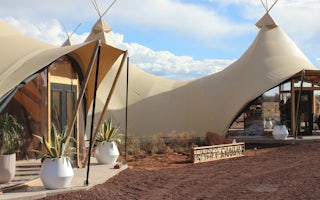
Under Canvas Grand Canyon
A quick 25-minute drive to the South Rim entrance of Grand Canyon National Park, the safari-inspired resort offers the perfect luxury cam...
From $189 / night
Oracle, Arizona
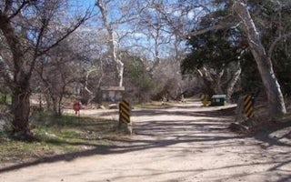
Peppersauce
Overview
With its picturesque vegetation and dramatic setting at the foot of 9,157' Mt. Lemmon in southeastern Arizona, Peppersauce Campg...
Mount Lemmon, Arizona
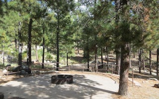
Whitetail Campground
Overview
Whitetail Campground offers group campsites in the foothills of the Catalina Mountains of southeastern Arizona, 5 miles south of...

Apache Junction, Arizona
Mesa / Apache Junction KOA Journey
Teddy Roosevelt called the Superstition Mountains "the most beautiful panorama nature has created." You'll see why not far from the Mesa/...
Mount Lemmon, Arizona
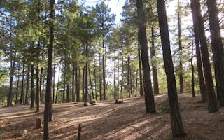
Showers Point Group Site
Overview
The cool shade of tall ponderosa pines and an overlook of Palisade Canyon from the campgrounds edge make Showers Point Group Sit...


