Coolidge, Arizona
Top Spots in and near Coolidge
-
Coolidge, Arizona
Explore Casa Grande Ruins National Monument
4.00.25 mi / 10 ft gainNo one really knows why the people from the Sonoran Desert built this mud skyscraper. Some scientists believe it was built as a astronomical observatory. What ever the reason, the Casa Grande Ruins National Monument is a engineering marvel that was built in the 1300's. People have been so puzzled...Read more -
Queen Creek, Arizona
Hike the Dynamite and Goldmine Loop
5.04.7 mi / 773 ft gainThis trail is a moderately-rated hike. It is used for a variety of activities including hiking, mountain biking, running, and walking. To access the trail, it is important to note that there is a $7 cash parking fee, so be prepared! The beginning of the trail is the most challenging part as it ...Read more -
Campground Loop B, Arizona
Camp at Picacho Peak State Park
3.1 mi / 800 ft gainDrive about 30 minutes west on I-10 from Tucson, AZ to the Picacho Peak Rd. Exit and follow the signs south to the park entrance. The campgrounds are about a half mile inside the main gate to the right.You can either make a reservation at Pichacho Peak State Park or arrive the day of and pay. Eve...Read more -
Picacho, Arizona
Photograph the Wildflowers at Picacho Peak State Park
4.0If Arizona is lucky enough to have a rainy winter, we will most certainly have a beautiful bloom come spring. One of the best places to see the beautiful golden blooms is on a hike in Picacho Peak State Park. Blooming season typically begins in mid/late February. Length depends on temperature –...Read more -
Picacho, Arizona
Picacho Peak's Hunter Trail
5.02.82 mi / 1841 ft gainIf you've ever done the drive on highway10 from Phoenix to Tucson, you've definitely noticed an intriguing looking mountain peak about an hour into the drive. It broadly rises from the earth and tapers off into a point at the top, appearing like an illustration straight out of a Dr. Seuss boo...Read more -
Superior, Arizona
Hike Picketpost Mountain
4.74.4 mi / 2200 ft gainFrom the parking lot you will start out on the Arizona Trail until you reach the turn off to begin your accent up the mountain. This part of the trail isn't well maintained, and is a scramble, so be ready to use those hands. The trail is marked with cairns though and there is enough traffic tha...Read more -
Gold Canyon, Arizona
Peak 5057 via Hieroglyphic Trail
5.07.45 mi / 3045 ft gainTo get to the trailhead from US60, turn north onto Kings Ranch Road where you will begin the winding path through the neighborhoods. From Kings Ranch Road, turn east on Baseline Ave, north on Mohican Road, west on Valley View Drive, north on Whitetail Road, and east on Cloudview Ave until it com...Read more -
Gold Canyon, Arizona
Hieroglyphic Trail
5.02.9 mi / 614 ft gainThis hike is a great beginner hike for those who want to experience the beauty of the Superstitions. I suggest going early in the morning because this trail gets very crowded later in the day (especially on weekends). To get to the trailhead from US60, turn north onto Kings Ranch Road where you ...Read more -
Gold Canyon, Arizona
Wave Cave Trail
4.73 mi / 948 ft gainFrom the trail-head you will follow the old and wide dirt road for a while until you reach the wilderness fence line. It's easy to get lost. When you reach the fence there's an area to go through. It's difficult to see. Make sure you look closely. DO NOT follow the signs that say "trail". Once yo...Read more -
Gold Canyon, Arizona
Superstition Peak 5057 via Carney Springs
5.07.71 mi / 2831 ft gainThis is the true beast hike of the Superstitions. If you think Flatiron is a toughy, give this a whirl! You will be poked, prodded, slapped, smacked, jolted, tripped and stabbed the entire way, but rewarded with arguably the finest sights the valley of the sun has to offer: the entire Superstitio...Read more -
Gold Canyon, Arizona
Catch a Sunset at Three Sisters
5.0Three Sisters is a huge rock formation in the southern area of the Superstition Mountains. This spot is only about an hour outside of Phoenix and it's a great spot to do photography in the evening or morning.This is accessed from the Wave Cave parking lot on the way to the nearby Peralta Trailhe...Read more -
Apache Junction, Arizona
Monument Canyon and Broadway Cave
3.63.69 mi / 866 ft gain...Who doesn't enjoy a short adventure to an scenic location?! If I were to guess, I'd say a good majority of us. This four mile, low trafficked hike to the Broadway Cave will lead you to one of the best spots to hang out or watch the sunset. The Broadway trailhead is located by taking Highway 60...Read more -
Gold Canyon, Arizona
Weavers Needle
8.02 mi / 2602 ft gainLace up your boots, stock up your gear, bid farewell to civilization and head out to the wild. This adventure is not one for the faint of heart. It will scrape, snag, trip and stumble you. It will scare, taunt and tantalize you. You will need to earn this one, and it is more than worth the effort...Read more -
Gold Canyon, Arizona
Fremont Saddle via Peralta Canyon Trail
4.74.53 mi / 1378 ft gainAfter taking Peralta Road all the way to the end, park your car in the parking lot and you'll see the sign for the trail head. Sign in at the register and then begin our hike on Peralta Trail. This trail winds through the canyon and then takes you up switch backs until you reach the saddle. The ...Read more -
Gold Canyon, Arizona
Weavers Needle Loop
5.012.37 mi / 2608 ft gainThis is a difficult hike! Plan on a lot of time and an early start. I did this hike in a clockwise direction (Peralta Trail) which really doesn't matter much but I recommend the direction to get the steepest part of the hike done first. Most people just do an out and back hike to Freemont Saddle ...Read more -
Gold Canyon, Arizona
Bluff Springs Loop
4.014.55 mi / 2523 ft gainFrom the Peralta Trailhead, start hiking on Bluff Springs Trail. This trail will wind over a few hills past incredible views, and then take you down into a wash. In the wash you will intersect with the Terrapin Trail. Turn left onto the Terrapin Trail, and it will take you out of the wash and pa...Read more
Top Activities
Camping and Lodging in Coolidge
Picacho, Arizona
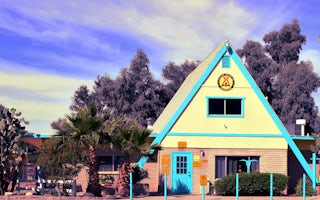
Picacho / Tucson NW KOA Journey
Tall shade trees and gorgeous cactus landscaping welcome you to this inviting KOA with easy access from I-10. Roomy sites up to 140 feet ...
Apache Junction, Arizona
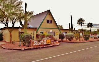
Mesa / Apache Junction KOA Journey
Teddy Roosevelt called the Superstition Mountains "the most beautiful panorama nature has created." You'll see why not far from the Mesa/...
Marana, Arizona
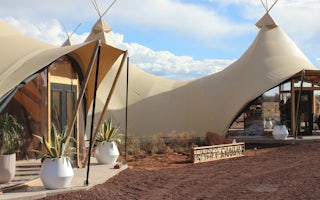
Under Canvas Grand Canyon
A quick 25-minute drive to the South Rim entrance of Grand Canyon National Park, the safari-inspired resort offers the perfect luxury cam...
From $189 / night
Globe, Arizona
Kellner Group Campground
Overview
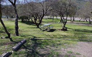
Kellner Group Site is nestled at the base of the beautiful Pinal Mountains south of Globe, Arizona. Several picnic areas are sep...
Roosevelt, Arizona
Burnt Corral Campground
Overview
Burnt Corral Campground and Recreation Area (elevation 1914') is about 5.8 miles south of Roosevelt Dam along the Apache Trail (...


