San Juan County, Utah
Top Spots in and near San Juan County
-
Monticello, Utah
Explore Looking Glass Arch
4.0Getting there:From Moab, follow Highway 191 south for about 23 miles until you get to Looking Glass Road/Co. Rd. 131. Take a right and follow the road for about 2 miles and then turn left into the parking lot.It is only about 0.10 miles from the parking lot to the arch itself, but there is a ~150...Read more -
Moab, Utah
Climb Wilson Arch
Wilson Arch is a common stop for people visiting the local national parks and Moab, but with some general climbing knowledge and gear you can make this into a longer outing. If coming from Moab, the arch is obvious on your left about 25 miles south. There is ample parking on both sides of the r...Read more -
Moab, Utah
Hiking to Wilson Arch
4.3To get to Wilson Arch, drive south of Moab on US-191 S for about 25 miles. The arch is right off US-191S and there is parking on either side of the highway. Keep an eye out after you pass the LaSal Junction - the arch is visible from the road.From the parking lot there is a a very short (~0.5 mil...Read more -
Moab, Utah
Climb Mount Tukuhnikivatz
6 mi / 2200 ft gainFrom the parking area at La Sal Pass, follow a well defined but unmapped trail though meadow, brief forest, and then switchbacks up the prominent ridge just east of the summit ridge of Mt Tuk. Once on the ridge bear west (climbers left) along the ridge as it narrows. Depending on conditions the r...Read more -
Moab, Utah
Climb Mount Peale
5.05 mi / 2721 ft gainFrom the parking area at La Sal Creek, just east of Medicine Lake examine the mountain and identify the prominent gully which feeds into La Sal Creek. Follow the old road bed north until its end and then travel cross country. Ascend the gully the the summit ridge between the northwest peak and th...Read more -
Moab, Utah
Camp at Kens Lake Campground
4.0Ken's Lake is an excellent location for peace and quiet. It is operated by the Bureau of Land Management and you can register on site or the reservation system at Recreation.gov. There are three group sites and 30 tent sites so relatively small. Faux Waterfall is within walking distance and a nic...Read more -
Moab, Utah
Explore Faux Falls
1 mi / 200 ft gainFaux Falls is located near the Ken's Lake campground off Route 191, 20 minutes south of Moab. When I was there it was during several days of thunderstorms. The waterfall was really gushing. Not sure how much water is running when there hasn't been rain in a while. The falls can be seen from the ...Read more -
Monticello, Utah
Rock Climbing in Indian Creek
5.0Just outside the Needles District of Canyonlands National Park and 40 miles south of Moab lies one of the greatest crack climbing destinations in the world. Indian Creek is home to world famous routes such as "Supercrack of the Desert" 5.10 "Way Rambo" 5.12- and "Incredible Hand Crack" 5.10c.This...Read more -
Moab, Utah
Camp at Hamburger Rock
Hamburger Rock is a small BLM campground with 10 sites based around an interesting rock outcropping. Each site can accommodate around 6 campers, 2 tents, and 2 cars. The bathrooms here are very basic, open-top pits, and no other services are offered. Camping fees are only $6/night.Read more -
Monticello, Utah
Explore Needles Overlook
About 1.5 hours from Moab on BLM land, Needles Overlook sits on a peninsula of rock 1600 ft. above southern Canyonlands NP. The views from here are just as commanding as Island in the Sky in Canyonlands, but with a lot fewer people due to its isolated location; there's a good chance you'll have ...Read more -
Monticello, Utah
Camp at the Ledges Camping Area off of Kane Creek Road
5.0The turn off for Kane Creek Rd. is directly before the McDonald's on the right side of the road. A right turn takes you through small residential area and then places you on a dirt road continuing into the canyon. The road narrows a bit, switch backs, and becomes slightly rougher. Follow Kane Cr...Read more -
Moab, Utah
Ride the Whole Enchilada Mountain Bike Trail
5.026.8 mi / 2300 ft gainThe Whole Enchilada trail covers a massive expanse of terrain and varying climates. The trail passes through a variety of terrains in very remote locations. Be sure to pack as much food and water as possible and be prepared to service your own mechanical issues on the trail. This is a very popula...Read more -
Monticello, Utah
Climbing in Indian Creek
Come November most climbers are missing rock season. It's too cold. There's snow on the ground. There are lots of reasons why you can't climb in my native state, Montana, come November. So when some friends want to head to Moab to go climb in the colder months, I'm in.Indian Creek is a extremely ...Read more -
Moab, Utah
Camp in Hunters Canyon
5.02 miMoab has become an increasingly popular adventure destination over the last few years. Its proximity to Arches and Canyonlands National Parks make it a popular spot for beginning day hikers as well as seasoned canyoneers, bikers, and climbers. It comes as no surprise that it can be a hassle to fi...Read more -
Moab, Utah
Hike Hunters Canyon
5.03 mi / 164 ft gainThe hike into Hunters Canyon is extremely easy going. You can do the hike year round, but the further into summer you are, the hotter the canyon will be. This is a great beginner hike as it has very little elevation gain. It's also perfect for dogs, thanks to the stream that allows for frequent ...Read more -
Moab, Utah
View the Petroglyphs at Birthing Rock
5.00.1 mi / 0 ft gainThis roadside boulder is just a short ride down a dirt road from Moab. From the McDonalds in Moab, head west down Kane Creek Drive. You will pass a few BLM and private campgrounds as well as various trailheads. The road will eventually become graded dirt. Follow the road until you see an obvi...Read more
Top Activities
Camping and Lodging in San Juan County
Monticello, Utah
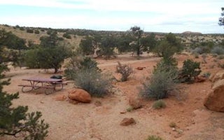
Windwhistle Group Site
Overview
The Windwhistle Group Site is ideal for small gatherings looking for a quiet retreat. The parking is limited and you must walk...
Monticello, Utah
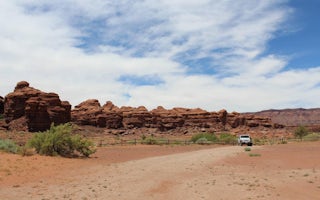
Indian Creek Falls Group Site
Overview
The Indian Creek Falls Group Site is ideal for groups wishing to recreate in the Indian Creek Corridor or to be close to Canyonl...
Moab, Utah
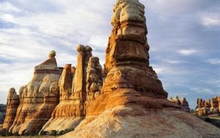
Canyonlands National Park Needles District Campground
Overview
The Needles Campground and group sites are located deep within the southern portion of Canyonlands National Park in southeastern...
Moab, Utah
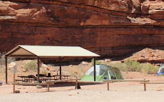
Creek Pasture Group Site
Overview
The Creek Pasture Group Site at Creek Pasture Campground is ideal for large groups wishing to recreate in the Indian Creek area,...
Moab, Utah
Kens Lake Group Sites
Overview
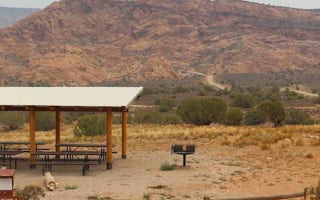
The Ken's Lake Group Sites are ideal for those wishing to be close to Moab, but away from the local highways. The lake offers s...
Moab, Utah
Moab KOA Holiday
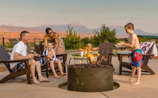
Check out this campground as the upgrades and improvements continue. This is the KOA closest to Arches and Canyonlands national parks as ...


