Paradox, Colorado
Top Spots in and near Paradox
-
Moab, Utah
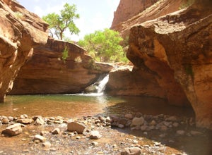
Power Dam
3.32.19 mi / 505 ft gainThis is a great little swimming hole spot in Moab. A lot of locals will call it The Power Dam. It's just a short easy 1.5-mile hike up the canyon to a natural swimming pool where you can swim and hang out. This is a perfect little spot to check out in Moab while visiting the great national parks....Read more -
Moab, Utah
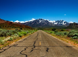
Drive through Scenic Castle Valley
5.0Going west on Highway 128 towards Moab, take a left onto La Sal Loop Road. And you're there! To get back to Highway 128, simply turn back on the same road. You can also take a right onto Porcupine Ranch Road, meeting at La Sal Loop Road again, eventually reaching Highway 128.During this drive, yo...Read more -
Moab, Utah
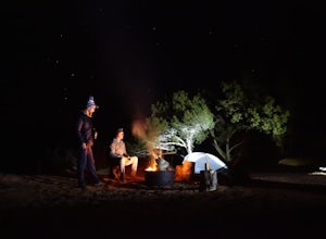
Camp at Sand Flats Recreation Area in Moab
3.0The rock domes and slickrock around the campsites provide fun for young and old to scramble on, or simply enjoy the sunrise or sunset. Located just outside of the town of Moab Utah is the Sand Flats Recreation Area. The area is managed jointly by the Bureau of Land Management and Grand County Uta...Read more -
Moab, Utah
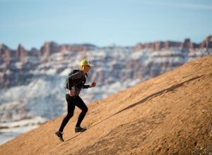
Trail Run Moab's Slickrock Trail
8.8 mi / 944 ft gainThe Slickrock Trail is well known in the mountain biking community and has put Moab on the map as one of the premier mountain biking destinations in the world. The good news for folks who don't mountain bike is that it's just as much fun to run or hike.It's a loop trail and very well marked with ...Read more -
Moab, Utah
Ride the Slick Rock Mountain Bike Trail
5.010.7 mi / 819 ft gainThe Slick Rock mountain bike trail is a great trail option for all skill levels looking to get a taste of what Moab has to offer. The trail is unique in that it is almost entirely on rock, with only a few patches of sand and mud scattered throughout the 10 mile loop. The trail is easy to follow d...Read more -
Moab, Utah
Camp at Oak Grove Campgrounds near Moab, UT
This a classic Moab area campground. Although you'll have neighbors nearby and a highway next to the site, it feels very secluded and quiet. You can sunbath on the sand and take a dip in the river to cool off/wash up everyday. It doesn't get much better than that. This is first-come, first-serve ...Read more -
Moab, Utah
Camp at Drinks Canyon
5.0Drinks Canyon Camping Area is located just 6 miles up the Colorado River on Hwy 191 from Moab. This BLM managed campsite has 17 sites that are all first-come, first served. Just a short drive from Arches National Park, Canyonlands National Park, Fisher Towers, and the surrounding BLM land, Drinks...Read more -
Moab, Utah
Mountain Bike the Pipe Dream Trail in Moab
6 mi / 730 ft gainThere are multiple trailheads to access the Pipe Dream trail in Moab. This time we chose to start at the Jackson Street parking area and rode the pipeline trail south for approximately 3-miles. This section of trail is a 2-track road that follows, you guessed it, the gas pipeline. It climbs aroun...Read more -
Moab, Utah
Camp at Big Bend Campground
5.0This campground has three different campsites. All the sites are made for larger groups, so there has to be a minimum number of people to reserve a site. Site A is the largest, with the maximum capacity of 40 people. Site B fits 20 people and site C fits about 30 people. All the sites are non-ele...Read more -
Moab, Utah
Grandstaff Canyon
4.34.34 mi / 1335 ft gainThe Grandstaff Canyon trail is 2.4 miles to Morning Glory Bridge and can take anywhere between 3-5 hours round trip. Grandstaff Canyon is nestled right along the Colorado River in Moab, UT. This easy hike takes you to the 6th longest natural bridge in the United States, Morning Glory Bridge. Brea...Read more -
Moab, Utah
Camping at Granstaff Campground
5.0Granstaff Campground has 17 campsites available, which are first come, first served. The sites are $15 a night per vehicle. The campground is a little limited and doesn't have running water, so bring your filter or head into town and pick up supplies.During the day, you can easily make your way t...Read more -
Monticello, Utah
Camp at the Ledges Camping Area off of Kane Creek Road
5.0The turn off for Kane Creek Rd. is directly before the McDonald's on the right side of the road. A right turn takes you through small residential area and then places you on a dirt road continuing into the canyon. The road narrows a bit, switch backs, and becomes slightly rougher. Follow Kane Cr...Read more -
Moab, Utah
Camp in Hunters Canyon
5.02 miMoab has become an increasingly popular adventure destination over the last few years. Its proximity to Arches and Canyonlands National Parks make it a popular spot for beginning day hikers as well as seasoned canyoneers, bikers, and climbers. It comes as no surprise that it can be a hassle to fi...Read more -
Moab, Utah
Hike Hunters Canyon
5.03 mi / 164 ft gainThe hike into Hunters Canyon is extremely easy going. You can do the hike year round, but the further into summer you are, the hotter the canyon will be. This is a great beginner hike as it has very little elevation gain. It's also perfect for dogs, thanks to the stream that allows for frequent ...Read more -
Cisco, Utah
Off Road to the Top of The World
13.2 mi / 2000 ft gainThe off road trail called Top of the World is a dirt road meant for *OFF ROAD VEHICLES ONLY*. All wheel drives jeeps and trucks are most common on this route but it is frequented by ATV and Dirt Bike users as well. If you elect to hike this route be mindful of their presence and give off-road veh...Read more -
Moab, Utah
Drive Chicken Corners
5.0From Moab, take Kane Creek Blvd out of town towards the beginning of the trailhead at the Kane Creek Recreation Parking Lot. From there, the trail is pretty much the only route available. The drive follows along a very smooth dirt road for the first six miles. Here, take a right to follow towards...Read more

