Paradox, Colorado
Top Spots in and near Paradox
-
Moab, Utah
Hike to Murphy Point
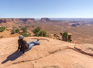
4.33.4 mi / 320 ft gainMurphy Point, found in the Island In The Sky district of Canyonlands NP, takes hikers on a mesa that ends at an overlook with sweeping vistas over Murphy Basin, the White Rim, and Green River. If you're looking to get away from the tourists, then head to this quiet and often overlooked trail.The ...Read more -
Moab, Utah
Night Photography at Mesa Arch
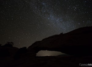
5.0From the parking lot, the hike is a .6 mile loop (20-30 min hike round trip). It took 10 minutes to get to the Arch. I arrived at 2am and hiked to the Arch to get some Milky Way shots, definitely arrive earlier to shoot the stars. I explored around when I got to the Arch and came up with a bunch ...Read more -
Moab, Utah
Mesa Arch
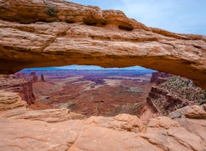
4.50.74 mi / 164 ft gainThis is an easy 0.6 mile loop. The hike takes you out to Mesa Arch, which is one of the most famous structures of Canyonlands National Park. If you're out with your camera, you can get amazing shots of the arch with the rugged canyon as your backdrop. Some of the best photos of the arch are at s...Read more -
Lone Mesa Group Gampground Road, Utah
Camp at Lone Mesa Campground
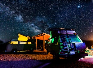
Lone Mesa Campground off Utah Highway 313, 8 miles from Highway 191, and 20 miles from Moab serves as an excellent basecamp for accessing the fantastic Navajo Rocks mountain bike trail system, Dead Horse State Park, and Canyonlands National Park. In fact, the Big Mesa trail goes right through the...Read more -
Moab, Utah
Hike to the Klondike Bluff Dinosaur Track
3.03 miI think these tracks are the best in Moab. Take route 191 north out of Moab for about 13 miles (mile post 142). Klondike Bluff road is on the right. If you pass the airport, you went too far. This road is easily accessed with two wheel drive cars. The parking area is at the end where you will see...Read more -
Moab, Utah
Hike the Aztec Butte Trail
4.52 mi / 500 ft gainThe Aztec Butte Trail is a two pronged out and back trail for a total of two miles. The trail is single track and easy to follow. After a third of a mile the trail splits. To the left, a trail takes you to the top of a small mesa. There is an informative sign marking the way. On the other side of...Read more -
Monticello, Utah
Backpack Salt Creek
33 mi / 1000 ft gainThe Needles District of Canyonlands receives 6 times as many backpackers as its more popular neighbor across the Colorado River, Island in the Sky. The Needles has an excellent trail network that is incredibly diverse, featuring amazing rock features as well as grassy meadows and savannahs. Whil...Read more -
Monticello, Utah
Hike Chesler Park and Joint Trails, Canyonlands NP
4.510 mi / 1755 ft gainThis world class hiking route circumnavigates Chesler Park by way of open meadows, slots, subterranean alcoves, stairways and slick rock.Begin at the Elephant Hill Trailhead and head south following signage for the Joint Trail / Chesler Park along the way. Once you arrive at Chesler Park turn lef...Read more -
Monticello, Utah
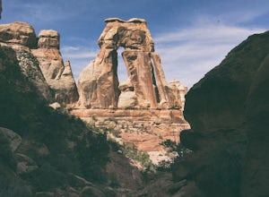
Hiking Druid Arch
5.010.28 mi / 1594 ft gainImportant Note: Druid Arch is located on the eastern side of Canyonlands National Park in the Needles District. It is not located at the main entrance to the park. Stop by the Needles Visitor Center and pick up a map. Your starting point, Elephant Hill Trailhead is then located 6.3 miles west of ...Read more

