Napa, California
Napa, California is the perfect destination for outdoor adventurers. With its stunning vistas, lush vineyards, and rolling hills, there are plenty of top attractions and activities to explore. Must-visit spots include the Silverado Trail, a scenic byway that winds through the valley, and the Robert Louis Stevenson State Park, which offers stunning views of the surrounding countryside. For those looking for a more active experience, the Napa Valley Wine Train offers a unique and leisurely way to explore the area, while the Bothe-Napa Valley State Park is great for hiking and biking. For a truly unique experience, visitors can take a hot air balloon ride over the valley and enjoy spectacular views of the countryside. For those looking for a more adventurous outdoor activity, there are plenty of trails to explore, including the Oat Hill Mine Trail, which offers stunning views of the valley. No matter what type of outdoor activity you’re looking for, Napa has something for everyone. With its breath-taking scenery, unique attractions, and outdoor adventures, Napa is the perfect destination for adventurers of all kinds.
Top Spots in and near Napa
-
Mill Valley, California
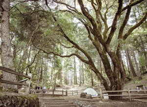
Camp at Mt. Tam's Pantoll Campground
5.0Need an escape from SF, but can't seem to find an available campground, then head to Pantoll Campground in Mount Tamalpais State Park. If you get there early on friday (or even better Thursday afternoon), you should be able to lock down one of these first-come, first-serve campgrounds. Each of th...Read more -
Mill Valley, California
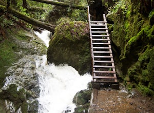
Steep Ravine Trail via Pantoll Station
5.03.96 mi / 1079 ft gainThe trailhead Pantoll Station is easy to find on GPS and there are friendly rangers there as well to answer questions.Maps: Paper map are available at the trailhead Pantoll Station in Marin, CA. For a moderate hike, I suggest going the one and a half miles down the trail to the ladder and retu...Read more -
Walnut Creek, California
Run the Mt. Diablo Foothill Loop
5.06.2 mi / 875 ft gainContinue by car down Castle Rock Road until it dead ends at the beginning of the trail. Parking is usually easy to find. If full, there is another overflow lot about 500 ft back the way you came in.You'll walk a good half mile down the trail before getting the main gate. As you're walking, you'll...Read more -
Mill Valley, California
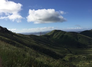
Oakwood Trail, Marin Headlands
5.02.56 mi / 538 ft gainLooking to escape the hustle of San Francisco, but don't want to commit to an entire day on the trail? When setting out for this morning hike, be prepared for about 1.5 hour hiking adventure (longer if you stop for extra photos) and a 20 minute commute from San Francisco. This hike is recomend...Read more -
Clayton, California
Hike the Waterfalls of Mount Diablo Loop Trail
5.06 mi / 1627 ft gainWinter and spring rains create scenic waterfalls in this hike at Mount Diablo, the East Bay's signature peak. Be careful hiking immediately post-rain, watch for slippery sections of mud. The trail is moderately difficult and is used by hikers, walking groups, trail runners, and for nature trips. ...Read more -
Mill Valley, California
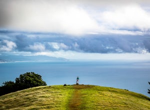
Trojan Point
4.50.25 mi / 75 ft gainThe endlessly scenic Trojan Point can be reached by taking the Panoramic Highway to Pantoll road from Stinson Beach to the west, or Mill Valley / Highway 1 to the east. It can also be reached by taking West Ridgecrest Boulevard from the north from the Fairfax-Bolinas road. Park at the large par...Read more -
Oakland, California
East & West Ridge Loop
4.53.47 mi / 833 ft gainTucked away in the hills of Oakland, you will find one of the homes of California's Coastal Redwoods. Created by a unique geographical circumstance, this forest breathes winds funneled through the Golden Gate across the bay, which created environment opportune for Redwood growth. These Redwoods a...Read more -
Antioch, California
Hike the Old Homestead Loop
5.06.5 miThis is a fun day hike that takes you through the beautiful hills of the Black Diamond Mines Regional Preserve and a bit of the Contra Loma Recreational Area as well. You can hike here year round, but I suggest going in the spring time when the hills are covered in soft, green grass and the wild ...Read more -
Sausalito, California
Catch the Sunset at Swedes Beach
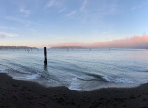
This is a small tucked away beach in Sausalito, CA. Being in the bay, it has very calm waters and is easy to swim in, though the water will be very cold. There are pilings in the water that are remnants of the old piers. It is a great beach to watch the sunset at. There is very limited street...Read more -
Mill Valley, California
Coyote Ridge Loop
5.06.15 mi / 1001 ft gainStarting just before the Tennessee Valley parking lot, head out from the Miwok Trailhead. This Mill Valley hike offers incredible views of the San Francisco Bay, the Pacific Ocean (fog permitting of course!), and on occasion, wildlife. Unfortunately, this trail is not dog-friendly. Keep in mind...Read more -
Mill Valley, California
Tennessee Beach via Tennessee Valley Trail
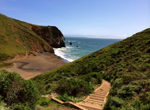
4.63.64 miThe Tennessee Valley trail is leisurely 3.6 mile roundtrip hike that turns around at Tennessee Valley Cove. Along the way, you’ll hike past shrublands, wetlands, and a lake before you get to a cool little secluded beach that many people picnic at. This is probably the easiest to access, and most...Read more -
Point Reyes Station, California
Bear Valley to Coast Camp Loop
5.016.18 mi / 2818 ft gainPermit and Trail Camp Info To stay overnight in Point Reyes, you must stay at one of the Trail Camps. Camping anywhere else in the park is not allowed. Permits for the Trail Camps can be booked up to 6 months in advance. If you are looking to go on a weekend, then you'll want to start loo...Read more -
Stinson Beach, California
Matt Davis-Steep Ravine Loop
4.76.62 mi / 1726 ft gainThis loop is made up of three of the most popular Marin trails and for good reason. These trails offer not only expansive ocean views, but a variety of topography and environments. This 6+ mile loop offers up waterfalls, dense forests, redwoods, and open grasslands overlooking the pacific. Starti...Read more -
Stinson Beach, California
Matt Davis-Coastal Trail Loop
4.76 mi / 2231 ft gainThis hike is an alternative to the famous Matt Davis to Steep Ravine Loop. The hike starts at Stinson Beach, just behind the fire Station. I recommend parking at the Beach parking lot. The Matt Davis trail is one of the best constructed trails I have ever seen. After 2.2 miles, turn left on the ...Read more -
Stinson Beach, California
Dipsea Trail to Steep Ravine Trail Loop from Stinson
5.05.99 mi / 1568 ft gainDipsea Trail to Steep Ravine Trail Loop from Stinson is a loop trail that takes you by a waterfall located near Stinson Beach, California.Read more -
Inverness, California
Explore the S.S. Point Reyes Shipwreck
3.9Explore the shipwreck of the S.S. Point Reyes, perched on a sand bar off the shoreline of Tomales Bay. It is located in the small town of Inverness, just behind the grocery store. If you are driving North on Sir Francis Drake Blvd it will be on your right side. Parking is easy and you will see a ...Read more

