Chester, California
Chester, California is a top outdoor getaway for outdoor adventurers. From scenic trails to must-visit attractions, there are plenty of top activities to explore in and near the area. Hike the Pacific Crest Trail for a stunning view of the surrounding mountains and valleys, or take a kayak trip down the Feather River to enjoy the abundant wildlife. For a more leisurely activity, you can enjoy a picnic at the beautiful Bidwell Mansion State Historic Park. For those looking for a thrill, there's the Skydive Lodi Parachute Center, where you can take a tandem jump and experience the rush of freefall. There are also several golf courses, fishing spots, and other activities to explore in and near Chester, California.
Top Spots in and near Chester
-
Chester, California
Lassen Volcanic National Park Scenic Drive
4.062.7 mi / 5387 ft gainLassen Volcanic National Park Scenic Drive is a point-to-point trail that takes you by a lake located near Chester, California.Read more -
Plumas County, California
Camp at Last Chance Creek Campground on Lake Almanor
This PG&E campsite is located on the northern most inlet of Lake Almanor and is slightly more remote than the other sites around Lake Almanor. The campground offers spectacular views and easy access to great fishing. To get there, head east out of the town of Chester on Highway 36. After cros...Read more -
Pacific Crest Trail, California
Devils Kitchen Trail
5.05.06 mi / 525 ft gainYour hike to Devils Kitchen will start from Warner Valley Campground. The hike starts out thorough the valley and eventually winds through the forest and ends at the top of the Devils Kitchen site. You'll then hike down the hill a bit and get to explore the area! There are pretty specific walkin...Read more -
Pacific Crest Trail, California
Camp at Warner Valley
Warner Valley Campground is at the end of Warner Valley Road. It's 16 dollars a night at a first come first serve basis. As far as the campground it self, there are a few bathrooms and each site has a fire ring and a picnic table. There are 17 sites which isn't a ton but since it's a fairly unuse...Read more -
Plumas County, California
Boiling Springs Lake Loop
2.38 mi / 449 ft gainThe hike to Boiling Springs Lake starts at the Warner Valley Trailhead and is only a 3 mile roundtrip hike. It's a fairly easy hike that starts through the valley and then winds up through the forest and eventually opens up to the lake. First thing you'll notice as you approach the lake is the ...Read more -
Plumas County, California
Drake Lake Trail
4.6 mi / 840 ft gainThe hike starts at the Warner Valley Trailhead and winds up the mountain until you reach the lake. The first 2 miles or so are very pleasant walk through the woods until you reach the last portion which is essentially straight up the mountain side. This portion of the trail can be very slippery...Read more -
Lassen County, California
Backpack the Caribou Wilderness Lakes Loop
12 miThe caribou lakes loop is very laid back, making it a great start for first time backpackers and kids. Word of caution: in the summer the mosquitos are plenty, I'd recommend this loop for the fall. From the parking lot there is a visible sign pointing you in the direction of the trailhead near Ca...Read more -
Shasta County, California
Kings Creek Falls Trail
4.02.49 mi / 495 ft gainKings Creek Falls Trail is an out-and-back trail that takes you by a waterfall located near Old Station, California.Read more -
Shasta County, California
Seven Lake Loop in Lassen Volcanic NP
11.54 mi / 1545 ft gainThis hike is one of my favorites for when I only have a weekend to get my nature fix. To start off, visit either the Loomis Museum, Loomis Ranger Station, Butte Lake Ranger Station, Kohm Yah-mah-nee Visitor Center, Warner Valley Ranger Station, or Juniper Lake Ranger Station and pick up a wildern...Read more -
Tehama County, California
Explore Deer Creek Falls
5.00.5 miThis extremely short hike starts just off of Highway 32. From Chester, head southwest on 32 for roughly 21 miles. There is a turnout and a sign where the trail starts. This waterfall is best viewed in the spring when there is still a large amount of snow melt off. This waterfall is definitely not...Read more -
Old Station, California
Bumpas Hell to Cold Boiling Lake
4.05.32 mi / 1007 ft gainBumpas Hell to Cold Boiling Lake Trail is an out-and-back trail that takes you by a lake located near Old Station, California.Read more -
Tehama County, California
Brokeoff Mountain Trail
4.06.93 mi / 2474 ft gainPeaking above the volcanic valley at 9235 ft, Brokeoff Mountain is only second in height to Mt. Lassen in the national park they share. Brokeoff was once a part of a larger volcano called Mt. Tehama that erupted, eventually leading to its collapse. The event left a rugged volcanic rim, now con...Read more -
Old Station, California
Hike to Cinder Cone
5.04 mi / 846 ft gainCinder Cone Trail For 1.2 miles, the trail gently slopes up through a forest. The Fantastic Lava Beds form a wall to your left. The Fantastic Lava Beds were formed by several eruptions of lava from Cinder Cone. The trail is mostly cinder erupted from Cinder Cone. Walking on cinder is similar to w...Read more -
Old Station, California
Hike to Snag Lake via the Cinder Cone
12.5 mi / 2000 ft gainStart from the Butte Lake trailhead, off Highway 44 at the north end of Lassen Volcanic National Park. From the parking lot walk past the little boat launch and the trailhead is obvious in front of you. Be mentally prepared to be walking in loose sand for most of this trip (and bring ankle or kn...Read more -
Shasta County, California
Lassen Peak
4.44.66 mi / 1936 ft gainOne of my personal favorites and a hidden gem of California that keeps circling my mind is the Lassen Peak Trail. Don't let the trail map (2.5 miles one way) deceive you and make you think this is a short trail. The elevation gain is is 2000 feet from the parking lot to the end of the peak. The a...Read more -
Shasta County, California
Bumpass Hell Trail
4.72.71 mi / 502 ft gainDue to hazardous snow and ice, Bumpass Hell Trail closes during the spring and may not open until July. From the Bumpass Hell Parking Area, the trail traverses the rocky slopes of Bumpass Mountain. The trail slowly ascends 200 feet with views of the valley to the west and Lassen Peak to the nort...Read more
Top Activities
Camping and Lodging in Chester
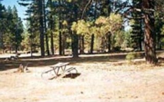
Almanor
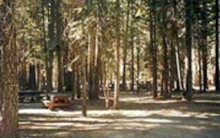
Gurnsey Creek
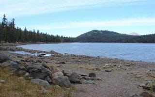
Juniper Lake Stock Corral
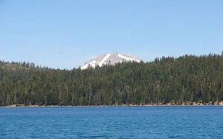
Juniper Lake Group
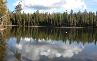
Summit Lake South
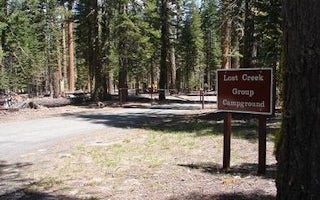
Lost Creek Group


