Juniper Lake Group
Book this listing through our partner Recreation Gov
About Juniper Lake Group
Overview
Juniper Lake Group Campground (elevation 6,800 feet) is a remote, rustic facility in the southeastern part of Lassen Volcanic National Park. It is on the eastern shore of Juniper Lake, a popular swimming spot, and offers a fantastic view of Lassen Peak, the largest volcano in the park, towering at 10,457 feet.Recreation
The main trailheads for Horseshoe Lake, Snag Lake and the interior of the park are within the facility. The Mount Harkness Trail ascends to a historic fire tower that is still in use. Juniper Lake is popular for canoeing, kayaking and swimming; Motorized boating is not permitted.Facilities
This is a tent-only facility with two group sites. Drinking water is not available. It is connected to the rest of Juniper Lake Campground, which is all first-come, first-served. Access is via a 13-mile road (seven miles gravel, six miles roughly paved). For more information visit Campgrounds of Lassen Volcanic.Natural Features
The national park is known for its volcanic history, as well as its diversity of plants and animals. It contains 300 active volcanic domes and many hydrothermal features, such as mud pots and steam vents, some of which are close to the campground. Lassen Peak is the southernmost active volcano in the Cascades, and the second-most recent volcano to erupt in the lower 48 of the United States before Mount Saint Helens in 1980.Lassen National Park boasts over 700 species of flowering plants and 250 species of vertebrates, including birds, mammals, reptiles and fish. The park is at the junction of the Cascade Mountains, the Sierra Nevada Mountains and the Great Basin, thus providing many unique habitats.
Juniper Lake Group Reviews
Have you stayed here? Be the first to leave a review!
Top Spots in or near Chester
Camp at Warner Valley
Pacific Crest Trail, CaliforniaWarner Valley Campground is at the end of Warner Valley Road. It's 16 dollars a night at a first come first serve basis. As far as the campground it self, there are a few bathrooms and each site has a fire ring and a picnic table. There are 17 sites which isn't a ton but since it's a fairly unused area so you should have no problem getting a spot.There are so many things to do and see in the ar...
Devils Kitchen Trail
Pacific Crest Trail, California
5.0
5.06 mi
/ 525 ft gain
Your hike to Devils Kitchen will start from Warner Valley Campground. The hike starts out thorough the valley and eventually winds through the forest and ends at the top of the Devils Kitchen site. You'll then hike down the hill a bit and get to explore the area!
There are pretty specific walking paths for you to stick to as people have fallen through the soft ground into the thermal mud and b...
Boiling Springs Lake Loop
Plumas County, California
2.38 mi
/ 449 ft gain
The hike to Boiling Springs Lake starts at the Warner Valley Trailhead and is only a 3 mile roundtrip hike. It's a fairly easy hike that starts through the valley and then winds up through the forest and eventually opens up to the lake.
First thing you'll notice as you approach the lake is the sulfur smell followed by the turquoise, green/brown water. The lake itself is more of a pond but the...
Drake Lake Trail
Plumas County, California
4.6 mi
/ 840 ft gain
The hike starts at the Warner Valley Trailhead and winds up the mountain until you reach the lake. The first 2 miles or so are very pleasant walk through the woods until you reach the last portion which is essentially straight up the mountain side.
This portion of the trail can be very slippery because of the steep nature of the trail and the loose rock. Though this part of the hike is pretty...
Seven Lake Loop in Lassen Volcanic NP
Shasta County, California
11.54 mi
/ 1545 ft gain
This hike is one of my favorites for when I only have a weekend to get my nature fix. To start off, visit either the Loomis Museum, Loomis Ranger Station, Butte Lake Ranger Station, Kohm Yah-mah-nee Visitor Center, Warner Valley Ranger Station, or Juniper Lake Ranger Station and pick up a wilderness camping permit (free of charge). Also be sure to have your bear canister to store your food in,...
Hike to Snag Lake via the Cinder Cone
Old Station, California
12.5 mi
/ 2000 ft gain
Start from the Butte Lake trailhead, off Highway 44 at the north end of Lassen Volcanic National Park. From the parking lot walk past the little boat launch and the trailhead is obvious in front of you. Be mentally prepared to be walking in loose sand for most of this trip (and bring ankle or knee braces if you have a weak joint). You'll walk along the edge of the intimidating black "fantastic...
Camping and Lodging in Chester
Chester Juniper Lake Road
Juniper Lake Stock Corral
Overview
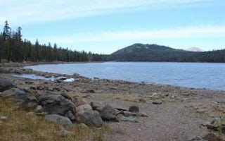
Juniper Lake Stock Corral (elevation 6,800 ft.) is a remote and rustic facility in the southeastern part of Lassen Volcanic Nat...
Old Station, California
Butte Lake Group
Overview
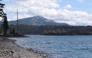
Butte Lake Group Campground (elevation 6,100 feet) is located in the northeastern section of Lassen Volcanic National Park in no...
Old Station, California
Butte Lake
Overview
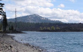
Butte Lake Campground (elevation 6,100 feet) is located in the northeastern section of Lassen Volcanic National Park in northern...
Volcanic Legacy Scenic Byway
Lost Creek Group
Overview
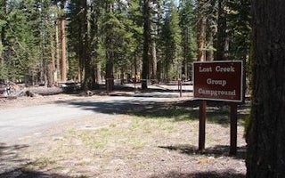
Lost Creek Group Campground (elevation 5,700 ft.) is approximately five miles south of Manzanita Lake, and close to the Lost Cr...
Volcanic Legacy Scenic Byway
Summit Lake South
Overview
Summit Lake South Campground (elevation 6,700 ft.) is conveniently located on the main road of Lassen Volcanic National Park. Th...
Volcanic Legacy Scenic Byway
Summit Lake North
Overview
Summit Lake North Campground (elevation 6,700 ft.) is conveniently located on the main road of Lassen Volcanic National Park. Th...
Unfortunately, we don't have up-to date pricing data for this listing, but you can check pricing through Recreation Gov.
Book NowAdd your business today to reach The Outbound's audience of adventurous travelers.
Community
© 2024 The Outbound Collective - Terms of Use - Privacy Policy


