Glendale, Arizona
Top Spots in and near Glendale
-
Phoenix, Arizona
Hike the West Park Loop Trail in Papago Park
4.44 miThis trail begins from the parking lot on the west side of Galvin Parkway. To the east of the parking lot is a single track, dirt trail that heads north towards the big buttes. It continues counterclockwise around the big butte and heads south around the smaller butte. It continues west around th...Read more -
Phoenix, Arizona
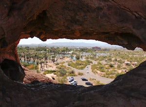
Hole in the Rock
3.60.27 mi / 200 ft gainPapago Park is located right next to the Phoenix Zoo. The park is known for its rock formations and short hiking / running trails. The main attraction, the Hole in the Rock, at the top of the short trail, is a great place to take pictures as it is one of the highest points in the area and it off...Read more -
Goodyear, Arizona
Hike Estrella Mountain's Baseline Trail
4.02.4 mi / 259 ft gainBaseline Trail is a 2.4 mile moderately trafficked loop trail. This trail features lovely wild flowers and is rated as intermediate. You can use this trail not just for hiking but you can also use the trail for running as well as mountain biking. On the trail you are allowed to bring your furry f...Read more -
Phoenix, Arizona
Hike Holbert Trail to Dobbins Lookout
4.04.1 mi / 1135 ft gainDobbins lookout is a popular high point in South Mountain Park that offers views of the entire Phoenix area. It's accessible by road or by trail with no entry fee. Consider going in the evening for the best views.If you plan to hike to the top, the shortest route is the Holbert trail. Take a l...Read more -
Phoenix, Arizona
Hidden Valley via the Mormon Loop Trail
4.03.63 mi / 873 ft gainThis is a great spot for an afternoon hike near Phoenix. There are some beautiful rock formations, nice trails, and pretty stunning views of the city and desert beyond. It's open year round and is dog friendly so if you've got a pup, definitely bring it along. It gets super hot in the summer and ...Read more -
Phoenix, Arizona
Hidden Valley Trail Via Mormon Trail
3.63 mi / 863 ft gainHidden Valley Trail Via Mormon Trail is a loop trail that takes you by a river located near Phoenix, Arizona.Read more -
Phoenix, Arizona
Acer Summit Via Mormon Trail
2.46 mi / 758 ft gainAcer Summit Via Mormon Trail is an out-and-back trail where you may see wildflowers located near Phoenix, Arizona.Read more -
Tempe, Arizona
Catch a Sunset from Tempe Town Lake and the Mill Avenue Bridge
4.5Last year I went to Phoenix for a few days for work. I googled lots of places to shoot pictures around Phoenix, but the majority of them were in neighboring areas, and I only had an hour or two after work and couldn't drive an hour to a better photography spot. One place that kept coming up was...Read more -
Waddell, Arizona
Hike Goat Camp Trail
16 miThis is one of the less traveled trails in White Tank Mountain Regional Park. If you're looking for a solid day hike in the west valley, try this one. It isn't a loop, but it ultimately connects with some of the other long trails so if you're up for a long hike, you have options. This starts f...Read more -
Waddell, Arizona
Hike to Waterfall Canyon
4.02 mi / 200 ft gainSo to fully enjoy the theme of this hike, make sure to try and go right after a rain. But also know that since this is a pretty easy hike, you will won't be the only one there. This is also a great hike/ waterfall to do with someone that is new to desert hiking, since it is relatively easy and th...Read more -
Waddell, Arizona
Hike Mesquite Canyon Trail
13 mi / 1394 ft gainThis is a great place to begin your hike in the White Tank Mountains. From the Ramada Way area, the trail begins to lead steadily into a small canyon. As you get further up, the trail will begin get more steep. After a short time it leads up to the first saddle and wraps around a ridge and bec...Read more -
Phoenix, Arizona
Hike Marcos de Niza Ridgeline / National Loop
5.02.8 mi / 640 ft gainThis is somewhat of a hidden gem in South Mountain Park, the largest municipal park in the United States, even though it's right there for all to see. The best way to take advantage of this trail is to attack the ridgeline with an intense hiking pace or trail run, connecting it to the National Tr...Read more -
Phoenix, Arizona
Lost Ranch Ruins Trail to Lost Ranch Mines Trail Loop
5.04.97 mi / 1184 ft gainLost Ranch Ruins Trail to Lost Ranch Mines Trail Loop is a loop trail where you may see wildflowers located near Phoenix, Arizona.Read more -
Scottsdale, Arizona
Hike Bell's Pass
7.3 mi / 1700 ft gainStarting at 1800 ft elevation, the trail begins at Gateway Loop. This part of the trail will start off pretty flat and be more crowded than Bell's Pass depending on the day and time you are hiking. If you enjoy running this would be the time to do it before you reach Bell's Pass and the incline i...Read more -
Scottsdale, Arizona
Gateway Loop
4.54.32 mi / 764 ft gainThe Gateway Trailhead is one access point into the McDowell Sonoran Conservancy in Scottsdale and is my favorite “Gateway” into the treasure trove of great trails and vistas in the McDowell Mountains. The Gateway Trailhead provides great accessibility for a quick hike or trail run at the end of t...Read more -
Morristown, Arizona
Hike the Wild Burro Trail
4 mi / 112 ft gainHike along the shoreline of beautiful Lake Pleasant. This 4.0 mile out-and-back trail is worth its weight in beautiful views. The path is well maintained and perfect for beginner hikers who enjoy leisurely hikes while looking for wild burros. The Wild Burro trail starts with a small descent from ...Read more

