
Bike along the San Francisco Peaks on Waterline Road
Flagstaff, Arizona
Details
Distance
20 miles
Elevation Gain
3000 ft
Route Type
Out-and-Back
Description
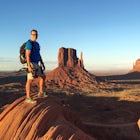
Added by Matt Bloomfield
Mountain bike, hike or run through aspen groves, charred ponderosa pines and basalt formations on this well maintained, private road along the eastern slopes of the beautiful San Francisco Peaks of Flagstaff, AZ.
Waterline Road is a closed service road that follows along the southern and eastern slopes of the San Francisco Peaks of Flagstaff, AZ. You will pass through several miles of charred ponderosa pine as well as expansive groves of aspen trees as you make your way to the Inner Basin.
The road follows a very gradual increase in elevation, gaining about 3,000 feet over 10 miles from start to finish making this a great workout for a beginning mountain biker or the seasoned endurance runner. You'll enjoy unobstructed views of Doney Park and the cinder hills of east Flagstaff and Sunset Crater.
Getting there: From Hw 180 (Fort Valley Road) turn onto Schultz Pass Road and hang a left at the Y in the road. Continue down this gravel and dirt road until you reach the trailhead parking area for the Weatherford Trail. Continue past this point until you see the junction of Schultz Pass Road and FR 146. Make a left here and continue until you reach a locked gate blocking further access to the road. This is the start of Waterline Road. Find a place to park on the shoulder and continue past the gate on bike or foot until you reach the Inner Basin. When you reach the Inner Basin, turn and go back the way you came.
Be sure to enjoy the ride back to your vehicle! The constant decline in elevation makes for an effortless ride as you coast along at high speed!
Download the Outbound mobile app
Find adventures and camping on the go, share photos, use GPX tracks, and download maps for offline use.
Get the appFeatures
Bike along the San Francisco Peaks on Waterline Road Reviews
First part is all burned from the Schultz Fire; allows for some amazing views to the east and north! The last part is gorgeous in the aspens, pines, and fir trees. The last half mile before the Inner Basin gets quite steep. Once you get to the Inner Basin, the prime mountain biking paths are done...the trail continues, but most ideal for hiking (up to Agassiz and Humphreys).
4.0
Leave No Trace
Always practice Leave No Trace ethics on your adventures and follow local regulations. Please explore responsibly!
Nearby

Humphreys Peak Summit

Hike Fatman's Loop

Trail Run in Lockett Meadow

Hike Inner Basin Trail #29

Frisbee Golf at McPherson's

Hike the Aspen Nature Loop at Humphrey's Peak
Community
Mobile Apps

© 2024 The Outbound Collective - Terms of Use - Privacy Policy