Moab, Utah
Top Spots in and near Moab
-
Monticello, Utah
Hike the Confluence Overlook
4.010.4 mi / 220 ft gainThe Green River starts in Wyoming and flows 730 miles before joining the Colorado River in Utah. Confluence Overlook Trail is located in the northern parts of the Needles district of Canyonlands National Park. At the southwest edge of the parking area, you will see where the trail starts. The tra...Read more -
Monticello, Utah
Hike Needle's Slickrock Foot Trail
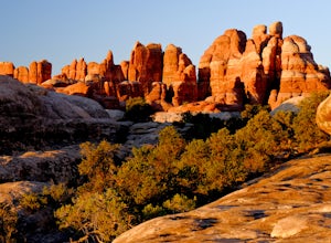
2.4 mi / 200 ft gainThe trail weaves away from the highway following cairns. I did the loop counter-clockwise to hit all the viewpoints first. The first part of the trail offers stellar views of the Needles behind you.All the viewpoints are well marked by trail signs. The first viewpoint veers off to the right and t...Read more -
Thompson, Utah
Photograph Sego Canyon Indian Rock Art
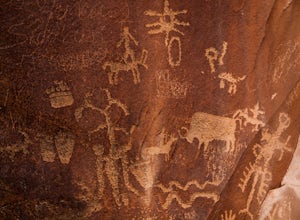
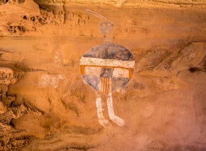
0.3 mi / 0 ft gainLocated north of Moab, off U.S. Route 70 is Sego Canyon. There is a dirt road that travels north up into the canyon to an interesting and unique area of Indian rock art. There are three different sections covering three different time periods and Indian groups. The petroglyph panel to the left ...Read more -
Monticello, Utah
Camp at Squaw Flat Campground
3.0Squaw Flat campground is an easily-accessed area full of picturesque campsites in Canyonlands National Park, Utah. It is located in the Needles District, which is well known for its colorful spires of Cedar Mesa Sandstone that cover the region. Campsite reservations must be made in advance at rec...Read more -
Monticello, Utah
Backpack to Chesler Park, Canyonlands NP
5.013 mi / 600 ft gainThe first draw of this adventure is the roadtrip to the trailhead itself. Set out pre-dawn from Moab, UT and head 77 miles south and west to the Needles District Visitors Centre on Utah 211. En route you'll pass Newspaper Rock, a treasured collection of pictographs well worth the detour if you're...Read more -
Monticello, Utah
Hike Peekaboo Trail to Salt Creek Canyon
10 mi / -60 ft gainTrail Description This adventure starts at Squaw Flat Trailhead A in the Needles District of the Canyonlands. Get there early to claim a parking spot, as there are several trails in the area, and you will want to see the colors change in the rock formations as the sun rises in front of you on you...Read more -
Monticello, Utah
Joint Trail in the Canyonlands Needles District
5.019.06 mi / 3028 ft gainA large part of the grandeur of Canyonlands National Park is the vast barren vista at Island in the Sky, but no visit to Canyonlands would be complete without the intimate and immersive desert experience that the Needles District offers. Drive two hours southwest of Moab away from cell phone rece...Read more -
Green River, Utah
Float the Green River through Labyrinth Canyon
5.0This trip goes 45 miles between Ruby Ranch and Mineral Bottom on the Green River in Utah north of Canyonlands National Park. Labyrinth Canyon is known for it's massive beautiful walls and oasis landscape surrounding the river. This entire section of water is flat water and can be done with no te...Read more -
Monticello, Utah
Hike Chesler Park and Joint Trails, Canyonlands NP
4.510 mi / 1755 ft gainThis world class hiking route circumnavigates Chesler Park by way of open meadows, slots, subterranean alcoves, stairways and slick rock.Begin at the Elephant Hill Trailhead and head south following signage for the Joint Trail / Chesler Park along the way. Once you arrive at Chesler Park turn lef...Read more -
Monticello, Utah
Hiking Druid Arch
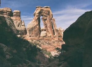
5.010.28 mi / 1594 ft gainImportant Note: Druid Arch is located on the eastern side of Canyonlands National Park in the Needles District. It is not located at the main entrance to the park. Stop by the Needles Visitor Center and pick up a map. Your starting point, Elephant Hill Trailhead is then located 6.3 miles west of ...Read more -
Wayne County, Utah
Canyoneering High Spur Canyon
5 miFrom Moab, the drive to the canyon is approximately 4 hours long and much of it is on sandy or rocky dirt roads so it’s best to drive a 4x4 vehicle with good clearance. Drive past Hans Flat Ranger Station on the west side of Canyonlands National Park and make your way to the trailhead on Deadman’...Read more -
Monticello, Utah
Climbing in Indian Creek
Come November most climbers are missing rock season. It's too cold. There's snow on the ground. There are lots of reasons why you can't climb in my native state, Montana, come November. So when some friends want to head to Moab to go climb in the colder months, I'm in.Indian Creek is a extremely ...Read more -
Monticello, Utah
Explore the Newspaper Rock Ancient Petroglyphs
4.7After leaving Moab, turn off Highway 191 on to 211. The drive will wind over the mesa tops and down into red rock canyon country. Enjoy the changing seasons whether the red cliffs are covered in snow or spring desert flowers are blooming.Watch for cattle as this is open range country. Also watch ...Read more -
Green River, Utah
Explore a Manmade Geyser in Utah
3.0Four and a half miles from the town of Green River, Utah, Crystal Geyser is one of the few manmade geysers as a result of the area's historical mining industry. This cold-water geyser usually erupts every eight to 20 hours. Getting There Getting to the geyser is easy and the site can be accessed ...Read more -
Monticello, Utah
Backpack Salt Creek
33 mi / 1000 ft gainThe Needles District of Canyonlands receives 6 times as many backpackers as its more popular neighbor across the Colorado River, Island in the Sky. The Needles has an excellent trail network that is incredibly diverse, featuring amazing rock features as well as grassy meadows and savannahs. Whil...Read more -
Mack, Colorado
Mountain Bike in the Rabbit Valley Area
13 mi / 1200 ft gainThis area is one of my favorites. Rabbit Valley is a great place with all kinds of activities available. Mainly we mountain bike here, but we have hiked and explored the canyons as well. There are traces of Native Americans that lived in the area hundreds of years ago, even a small arch too.From ...Read more

