United States
Looking for the best running in United States? We've got you covered with the top trails, trips, hiking, backpacking, camping and more around United States. The detailed guides, photos, and reviews are all submitted by the Outbound community.
Top Running Spots in and near United States
-
Silver Plume, Colorado
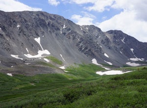
Grays and Torreys Peaks
4.37.97 mi / 3458 ft gainAt about an hour's drive from Denver, Grays Peak (14,270 ft./4338m) and its sister mountain, Torreys Peak (14,267 ft./4337m), are two of the most popular 14ers in the state. Because of this, a wealth of information is available on the internet. Rather than go into all the details of the technical...Read more -
Auburn, California
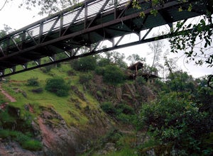
Hike around Coon Creek to Hidden Falls
4.58.4 mi / 968 ft gain--Important: 7-day a week parking reservations required until further notice during the COVID-19 crisis. Follow park social distancing measures. Learn more online, https://www.placer.ca.gov/6106/Hidden-Falls-Regional-Park -- Not far from California's capital is Hidden Falls Regional Park. The na...Read more -
Bend, Oregon
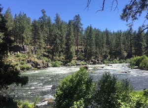
Deschutes River Trail Loop
4.73.18 mi / 203 ft gainThere are quite a few urban trails along the Deschutes River, but my favorite runs just South of the Old Mill District near the Farewell Bend Park. Here you will find a gravel loop trail that is private and relaxing, but also very convenient to other amenities such as restrooms, shops, and resta...Read more -
Winters, California
Homestead & Blue Ridge Loop
5.04.46 mi / 1299 ft gainAt the bend in the road on Highway 128, you will pass two silver gates. The gate with the UC Davis logo is the entrance to the trailhead. Past the entrance there is a large dirt pullout off the road with plenty of parking. Starting at the trailhead, go left in the fork to start the loop trail. T...Read more -
San Francisco, California
Fort Funston Trail
4.71.81 mi / 253 ft gainFort Funston is an SF gem I discovered when looking for a dog friendly hike near the city. Located west of Lake Merced, you'll find a gorgeous Northern California beach oasis where you and your dog can run wild and free :). Parking is located at the top of the park where you'll descend a steep se...Read more -
Redwood City, California
Hike or Bike the Old Growth Redwood Loop at El Corte de Madera
4.48.8 mi / 1900 ft gainThis hike starts at the middle parking lot of the El Corte de Madera Open Space Preserve. The middle lot is located roughly a mile south on Skyline Boulevard from the Skeggs Point Vista. From the parking lot, take the Methuselah Trail for 0.3 miles until you reach the Timberview Trail. Take this ...Read more -
Seattle, Washington
Lighthouse and Discovery Park Loop
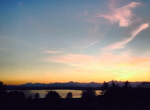
5.04.27 mi / 384 ft gainThis Beautiful park in Seattle offers up gorgeous views of Puget Sound. The park has an easy to follow loop, which is about 4.5 miles. There are easy offshoots of the loop if you're looking to get a little extra distance. Keep an eye out for Hidden Valley Trail and North Beach Trail if you're up ...Read more -
Califon, New Jersey
Explore the Ken Lockwood Gorge
4.3One of New Jerseys best kept secrets has to be the Ken Lockwood Gorge. If you are looking for a relaxing, beautiful, and nature packs place then this area is perfect for you. You can access the gorge from two different points, either by driving down Raritan River Rd. and parking right before you ...Read more -
North Bend, Washington
Bandera Mountain
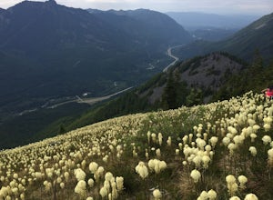
4.47.8 mi / 3176 ft gainThis hike has unreal views of Mount Rainier. On a great clear spring day, the mountain is out. It's right in your face. It's incredible. If you tackle this hike in the spring the bear grass and wildflowers are alive and blooming towards the top and it makes for some fantastic picture-taking. Once...Read more -
Morrison, Colorado
Explore Red Rocks Park in Winter
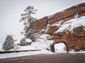
4.3Red Rocks is a bustling park in the summer when its famous amphitheater is filled with concerts. In winter though, the park dies down and becomes even more quiet when snow is falling. Grab your camera and head to the park during a winter storm to truly enjoy the beautiful red sandstone formations...Read more -
Phoenix, Arizona
Quartz Ridge Trail
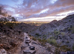
4.52.29 mi / 509 ft gainQuartz Ridge in the Phoenix Mountain Preserve (also known as Trail 8A) is a great escape getaway trail that can be done as a single track or combined with many intersecting trails. It is a very popular trail for hikers, trail runners, pet walkers, sky gawkers and more! The trailhead sits in a sm...Read more -
Flagstaff, Arizona
SP Crater
1.96 mi / 341 ft gainOff of the 89, just north of Flagstaff AZ, there is an unmarked dirt road just before a gas station. It leads out to privately owned land that's open to the public. Some friends and I went out there to get away from our day jobs. As we headed down the road, the land opened up in vast expanses of ...Read more -
Peninsula, Ohio
Ledges Trail
4.82.34 mi / 210 ft gainDrive and park in the area shown on the map. If you are in the parking lot near a big open field, you made it to the right place. There are two ways to take the trail from here, south or north. I suggest that you go North first (towards the shelter area). Follow this trail into the woods and ...Read more -
Pacifica, California
Mori Point Loop
4.82.54 mi / 276 ft gainStart at the parking lots close to the pier, where bathrooms are also available. Walk along the pier to watch the sunset as it begins. Next, walk along Sharp Park Beach to discover the plethora of wild flowers and friendly locals always ready to guide you on your walk. Take the stairs up to the...Read more -
Richmond, California
Explore Point Pinole Shoreline
5.0Point Pinole Regional Shoreline is a 2,315-acre parkland that juts out into the San Pablo Bay. Only a brief car ride from San Francisco, this is a great spot for a Sunday stroll, picnic or simply to find a quiet space.There are several short trails to choose from that wind through eucalyptus grov...Read more -
Claremont, California
Claremont Wilderness Loop
4.85.03 mi / 1020 ft gainDrive to the top of Mills Ave in Claremont. There is a main parking area to the left and overflow parking a block south on the right. It costs $3 to park for 4hrs. As the name implies, the Wilderness Loop is a loop that connects to other trails in the Claremont Hills Wilderness. You can choose t...Read more

