Somerset, Pennsylvania
Top Spots in and near Somerset
-
Somerset, Pennsylvania
Hike to Wolf Rocks
3.35 miYou'll find the trailhead for Wolf Rocks at top of Linn Run Rd off Laurel Summit Rd. Off the left-hand side you will find what is referred to as parking lot D - the route to Wolf Rocks begins there.The hike is nothing to write home about, though with only a 5 mile total for the out-and-back it's ...Read more -
Boswell, Pennsylvania
Cross-Country Ski on Laurel Mountain
5.0Start at the Loop trail, directly across from the warming hut. This groomed trail rolls smoothly along through native rhododendron, hemlocks and large rocks. From there you can connect to a number of trails: try linking from Albert trail to Picnic trail, then continuing on to Wolf's Rocks, where ...Read more -
Markleton, Pennsylvania
Cross-Country Ski at Laurel Ridge State Park
Laurel Ridge Cross-Country Ski Center is a great place to try cross-country skiing! The ski center maintains and grooms 30 kilometers of cross-country ski trails through Laurel Ridge State Park. You can rent skis from the rental center onsite. As of January 2021, they do not take reservations f...Read more -
Stahlstown, Pennsylvania
Adams Falls Trail
1.26 mi / 210 ft gainLinn Run State Park is one of my favorite adventure spots. From the moment you enter the park you are surrounded by tall hemlocks and rhododendrons. Most of the hiking trails run along a stream accompanied by beautiful cottages - a perfect scene for awesome photos. When entering the park you wil...Read more -
Salisbury, Pennsylvania
Primitive Camp along Wolf Rocks Trail
3.01.5 mi / 50 ft gainThis is a GREAT location for beginning backpackers with minimal backpacking rules, short trails and cell service. Although all trails (with a few exceptions found in this brochure -labeled as "Areas Closed to Camping") in the Forbes State forest allow primitive backpack camping (primitive backpac...Read more -
Mill Run, Pennsylvania
Hike the Bear Run Nature Reserve Loop
4.08 miBear Run Nature Reserve features a number of trail loops that range from 1.7 miles in length to 11.9 miles. By hiking overlapping trails, you can complete an 8 mile hike that passes by Paradise Overlook, which provides great views of the Youghiogheny River Gorge. Start at the trailhead, which i...Read more -
Mill Run, Pennsylvania
Explore Fallingwater
4.8"Fallingwater is the name of a house built over a waterfall in southwest Pennsylvania. Frank Lloyd Wright, America’s most famous architect, designed the house for his clients, the Kaufmann family. Fallingwater was built between 1936 and 1939. It instantly became famous, and today it is a Natio...Read more -
Dunbar, Pennsylvania
Hike the Sugar Run Trail
1.6 miThis trail connects Old Mitchell Trail to Johnathan Run Trail. It is a short but fun hike down to the falls. We parked by the helicopter landing field and the trail head was right by the entrance to the parking lot.The hike down to the falls was nice and easy, but coming back up was tough. The tr...Read more -
Ohiopyle, Pennsylvania
White Water Raft the Youghiogheny River in Ohiopyle
Enjoy the thrill of rafting on Class III rapids on the Youghiogheny River in Ohiopyle! The Youghiogheny River has exciting whitewater boating for all experience levels. Only sturdily constructed rafts, kayaks, and closed-deck canoes intended for whitewater use may be used in the river. River leve...Read more -
Ohiopyle, Pennsylvania
Meadow Run Natural Water Slide
Ohiopyle State Park, located in Fayette County, Pennsylvania, is full of adventure along the Youghiogheny River. During your visit, make sure you stop by the Meadow Run natural waterslide for some serious fun. You can park for free at the Meadow Run parking lot, and then take a short walk down ...Read more -
Ohiopyle, Pennsylvania
Explore Cucumber Falls
4.30.25 mi / 30 ft gainJust off Kentuck Road, at the southern end of Ohiopyle State Park, you arrive at Cucumber Falls' marked parking lot. Access to this lot is limited (about 20 cars). Most of the time you will be able to find a spot, but when not, parking on the side of the road is perfectly acceptable.Walking down ...Read more -
Swanton, Maryland
Hike the Big Savage Mountain Trail (Southern Terminus to High Rock)
11 mi / 1500 ft gainThis is not a casual hike; it is one which should be taken taken seriously. However, it will be an enjoyable experience for anyone with the resolve to face the early 1,500 ft. climb in elevation, as well the ascent of a slightly dodgy (but still structurally sound) mid-20th century fire tower. ...Read more -
Oakland, Maryland
Hike the Swallow Falls Loop
4.71.1 mi / 125 ft gainThis park has plenty to do—forest hiking, swimming at Herrington Manor, and camping—but the main attraction, unsurprisingly, is Swallow Falls. The Swallow Falls Canyon Trail (1.1 miles) follows Muddy Creek and features a number of other falls, including Muddy Creek Falls (53 ft).Read more -
Oakland, Maryland
Hike the Herrington Manor/Swallow Falls Trail
5.011 mi / 25 ft gainI began my adventure at the trailhead in Herrington Manor State Park. The parking lot was empty and the trail was very easy to access. From start to finish this trail varies in the width of its path. For the first mile I had a lot of foot room, but as I went deeper into the forest, the trail turn...Read more -
Morgantown, West Virginia
Hike to the Henry Clay Furnace
3.01.8 mi / 70 ft gainAcross the road from the McCollum camping area entrance of Coopers Rock sits the entry point of the Clay Run Trail. With a hiking distance of 1.8 miles (1 hour and 10 minute walking time), this adventure will lead you to a jaw-dropping landmark, the Henry Clay Furnace.Built between 1834 and 1836,...Read more -
Oldtown, Maryland
Hike to Paw Paw Tunnel
3.82.4 miThis hike is short and sweet, with it only being 2.4 miles to the other side of the tunnel and back. It's easily accessible, located right off the highway at the Paw Paw Tunnel Campground on the Potamac River at the border of Maryland and West Virgina. The town of Paw Paw is on the West Virgina s...Read more
Top Activities
Camping and Lodging in Somerset
Confluence, Pennsylvania
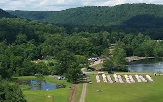
Outflow Camping
Overview
The Outflow Camping Area is located on Youghiogheny River Lake in the heart of the Laurel Highlands. The lake spans the Mason-Di...

Ruffs Dale, Pennsylvania
Madison / Pittsburgh S.E. KOA Journey
This KOA is an easy off/easy on to the PA Turnpike (I-76) and I-70 with lots of Pull-Thru RV Sites. Camp here and you're just 45 minutes ...
Clarksburg, Pennsylvania
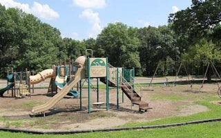
Conemaugh Lake Pavilions
Overview
Tucked away amidst rolling hills, Conemaugh River Lake complements the tranquil rural countryside of southern Indiana County. On...
Keyser, West Virginia
Robert W Craig
Overview
The Robert W. Craig Campground is located off West Virginia State Highway Route 46, five miles from Elk Garden, West Virginia. T...
Elk Garden, West Virginia
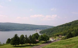
Howell Run Picnic Area
Overview
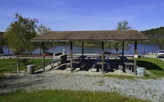
The Howell Run Picnic Area is a day use facility overlooking Jennings Randolph Lake, providing a beautiful backdrop for picnicki...
Duncansville, Pennsylvania
Loyalhanna Lake Pavilions
Overview
Loyalhanna Lake is located in the Laurel Highlands. This location provides picturesque views of the lake as well as opportunitie...


