Marion, Montana
Top Spots in and near Marion
-
Libby, Montana
Hike to Kenelty Mountain Lookout
10.1 mi / 3502 ft gainStarting from Kalispell, take Hwy 2 west towards Libby. Follow the highway for 62.5 miles until mile marker 57 and turn right in 0.3 miles on to a cut across road for 0.3 miles. Take a left on to Road 763 and follow this road for 3.4 miles and take a right on to an unnamed road for 1.8 miles and ...Read more -
Kalispell, Montana
Notch Trail, Overlook Trail, and Plum Creek Road Loop
3.85 mi / 801 ft gainNotch Trail, Overlook Trail, and Plum Creek Road Loop is a loop trail where you may see local wildlife located near Kalispell, Montana.Read more -
Kalispell, Montana
Western Larch and Cliff Trail Loop
2.77 mi / 656 ft gainWestern Larch and Cliff Trail Loop is a loop trail that takes you through a nice forest located near Kalispell, Montana.Read more -
Somers, Montana
Kayak to Pig Island
Drive to the North Flathead Launch in Somers, MT (15 miles south of Kalispell). Launch the kayaks and head south towards the yacht club. Once past the yacht club, paddle eastward, you should come upon a wooden shack, a number of wooden poles, and an island. Continue eastward past these various fe...Read more -
Somers, Montana
Paddle North Flathead Lake
5.0Flathead Lake is huge, and gorgeous. It's the biggest lake in Montana and certainly one worth spending some time on. The water is surprisingly warm, and the views are amazing. If you are passing through the area, find a place to rent some paddleboards and hit the water around golden hour in the e...Read more -
Libby, Montana
Leigh Lake Trail #132
5.02.66 mi / 1339 ft gainLeigh Lake Trail #132 is a short, but difficult hike. With the elevation gain greater than 1300 feet, you'll get quite the workout -- keep this in mind if thinking about brining small kids or pets. In fact, there are sections where you may be climbing up on all fours. Along the route, you'll pass...Read more -
Dayton, Montana
Kayak to Wild Horse Island
5.0There are many boat ramps to access Flathead Lake, but the closest location to Wild Horse Island is Dayton, MT. Dayton offers easy access with only about a 1-hour paddle to the island for the novice kayakers. Unfortunately, the boat ramp in Dayton does not have room for parking, thus it is only a...Read more -
Noxon, Montana
Saint Paul Lake Trail
4.06.8 mi / 1998 ft gainSaint Paul Lake Trail is an out-and-back trail that takes you by a lake located near Noxon, Montana.Read more -
Libby, Montana
Granite Lake
5.011.06 mi / 1673 ft gainGranite Lake is an out-and-back trail that takes you by a waterfall located near Libby, Montana.Read more -
Whitefish, Montana
Lion Mountain Trail
2.92 mi / 453 ft gainLion Mountain Trail is a loop trail that takes you by a lake located near Whitefish, Montana.Read more -
Whitefish, Montana
Hike Whitefish Mountain via the Danny On Trail
5.07.6 mi / 2250 ft gainThe Danny On Trail starts from the base area of Whitefish Mountain Ski Resort and zig zags its way up to the summit. The trailhead is near the Chalet building/Hellroaring Saloon upper parking lot (there's a big sign). The trail passes through Douglas fir, western larch, spruce and fir trees. The ...Read more -
Bigfork, Montana
Aneas Loop
3.02.77 mi / 207 ft gainAneas Loop is a loop trail where you may see beautiful wildflowers located near Bigfork, Montana.Read more -
Flathead County, Montana
Hike to Blaine Mountain
7.3 mi / 2350 ft gainTo reach the trailhead for this hike, it is about an hour's drive from nearby Kalispell. You will drive around Hungry Horse Reservoir on the West Side Road, and turn off onto Doris Creek Road. Be sure NOT to get this mistaken with the nearby Doris Ridge Road. Once turning onto Doris Creek Road, i...Read more -
Heron, Montana
Ross Creek Cedars Loop
5.00.87 mi / 151 ft gainThe Ross Creek Cedar area is a really cool area in Northwest Montana that houses some monstrous Western Red Cedar Trees (some of which have a diameter of over 12 feet and over 500 years old!). The grove is one of the few in the area that still has some really beautiful old-growth forest. Due to i...Read more -
Troy, Montana
Kootenai Falls and Swinging Bridge
5.01.59 mi / 200 ft gainKootenai Falls is accessed via short dirt trail from the parking lot on Highway Two between Troy and Libby. In the summer the parking lot is often full and even has some vendors selling objects and food. The trail is easy to follow and winds through the forest before descending towards the rive...Read more -
Kalispell, Montana
Flathead Lookout
5.02.4 mi / 666 ft gainFlathead Lookout is an out-and-back trail that takes you through a nice forest located near Kalispell, Montana.Read more
Top Activities
Camping and Lodging in Marion
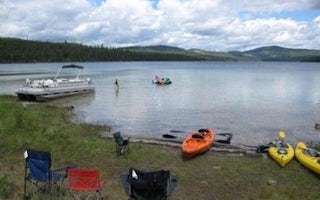
Marion, Montana
Mcgregor Lake Campground
Overview
McGregor Lake Campground is located approximately 53 miles southeast of Libby, Montana, on Highway 2 at the west end of McGregor...
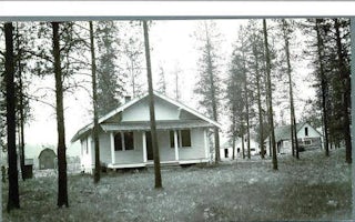
Marion, Montana
Bend Guard Station
Overview
The Bend Guard Station is located in a historic site within the Lolo National Forest of northwestern Montana. It is equipped wit...
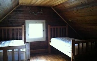
Libby, Montana
Fairview Ranger Station
Overview
This remote cabin was built in 1908 and served as an administration building for the Wolf Creek District of the Blackfeet Nation...
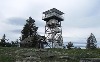
Libby, Montana
Big Creek Baldy. Lookout Rental
Overview
Big Creek Baldy Lookout sits atop its namesake mountain at an elevation of 5,780 feet in the Kootenai National Forest. The looko...
Whitefish, Montana
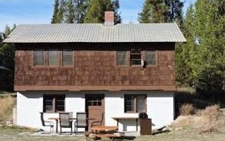
Star Meadows Guard Station
Overview
This two-room historic Forest Service Guard Station is located 23 miles from Whitefish, Montana, and is accessed by a paved road...
Thompson Falls, Montana
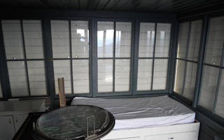
Cougar Peak Lookout
Overview
The Cougar Peak Lookout offers guests an opportunity to experience an old-time Forest Service lookout. The tower commands an imp...


