Mcgregor Lake Campground
Book this listing through our partner Recreation Gov
About Mcgregor Lake Campground
Overview
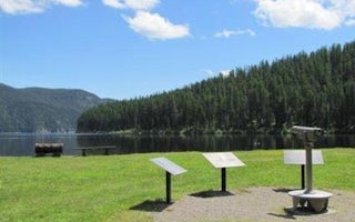
McGregor Lake Campground is located approximately 53 miles southeast of Libby, Montana, on Highway 2 at the west end of McGregor Lake in the Kootenai National Forest. This area is about halfway between Libby and Kalispell in the heart of the Thompson Chain of Lakes, a premier fishing and hunting area.Recreation
McGregor Lake is host to a prime mackinaw trout population and offers excellent opportunities for a trophy-size catch. There is a boat ramp on-site for access to the lake. Swimming and water skiing are also popular activities. Hikers can walk the 2.9-mile McGregor Lake Shoreline Trail.Facilities
The campground has 27 sites, including one host site, all with tables and fire rings. Most sites offer an average length of 32 feet. Vault toilets, garbage service and drinking water are available during the peak season. The campground campsites are not currently on the reservation system. The reservable group site is available for large groups, this site is a 120' x 140' gravel parking area. Tables and fire ring are located within the site. Reservations can be made at Recreation.gov Day use picnic sites with tables and fire rings are located near the beach.Natural Features
At an elevation of 3,900 feet, the campground is nestled among young pines at the west end of McGregor Lake in the Fisher River Area. The lake spans 1,240 acres, making it the largest lake in the Kootenai National Forest. The Fisher River Area is the watershed formed by the four forks (West, East, Silver Butte, Pleasant Valley) of the Fisher River and Wolf Creek. Within it is the Thompson Chain of Lakes, which consists of more than 20 lakes.Mcgregor Lake Campground Reviews
Have you stayed here? Be the first to leave a review!
Top Spots in or near Marion
Hike to Kenelty Mountain Lookout
Libby, Montana
10.1 mi
/ 3502 ft gain
Starting from Kalispell, take Hwy 2 west towards Libby. Follow the highway for 62.5 miles until mile marker 57 and turn right in 0.3 miles on to a cut across road for 0.3 miles. Take a left on to Road 763 and follow this road for 3.4 miles and take a right on to an unnamed road for 1.8 miles and take a right for 0.2 miles to the trailhead. From the trailhead, the road continues for about a mile...
Notch Trail, Overlook Trail, and Plum Creek Road Loop
Kalispell, Montana
3.85 mi
/ 801 ft gain
Notch Trail, Overlook Trail, and Plum Creek Road Loop is a loop trail where you may see local wildlife located near Kalispell, Montana.
Western Larch and Cliff Trail Loop
Kalispell, Montana
2.77 mi
/ 656 ft gain
Western Larch and Cliff Trail Loop is a loop trail that takes you through a nice forest located near Kalispell, Montana.
Kayak to Pig Island
Somers, MontanaDrive to the North Flathead Launch in Somers, MT (15 miles south of Kalispell). Launch the kayaks and head south towards the yacht club. Once past the yacht club, paddle eastward, you should come upon a wooden shack, a number of wooden poles, and an island. Continue eastward past these various features and Pig Island will be visible in the distance. In total, the paddle should take no longer th...
Paddle North Flathead Lake
Somers, Montana
5.0
Flathead Lake is huge, and gorgeous. It's the biggest lake in Montana and certainly one worth spending some time on. The water is surprisingly warm, and the views are amazing. If you are passing through the area, find a place to rent some paddleboards and hit the water around golden hour in the evening.
A great place to explore on the lake is the northern part. It's the closest area to Kalispe...
Kayak to Wild Horse Island
Dayton, Montana
5.0
There are many boat ramps to access Flathead Lake, but the closest location to Wild Horse Island is Dayton, MT. Dayton offers easy access with only about a 1-hour paddle to the island for the novice kayakers. Unfortunately, the boat ramp in Dayton does not have room for parking, thus it is only a temporary loading and unloading zone. A Public Reserve is located in Dayton 2 blocks North and 2 Bl...
Camping and Lodging in Marion
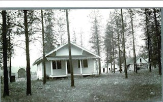
Marion, Montana
Bend Guard Station
Overview
The Bend Guard Station is located in a historic site within the Lolo National Forest of northwestern Montana. It is equipped wit...
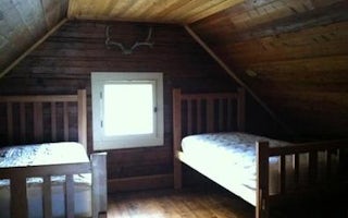
Libby, Montana
Fairview Ranger Station
Overview
This remote cabin was built in 1908 and served as an administration building for the Wolf Creek District of the Blackfeet Nation...
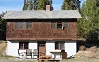
Whitefish, Montana
Star Meadows Guard Station
Overview
This two-room historic Forest Service Guard Station is located 23 miles from Whitefish, Montana, and is accessed by a paved road...
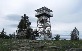
Libby, Montana
Big Creek Baldy. Lookout Rental
Overview
Big Creek Baldy Lookout sits atop its namesake mountain at an elevation of 5,780 feet in the Kootenai National Forest. The looko...
Tally Lake Road
Tally Lake Campground
Overview
Tally Lake Campground is located on the northern shores of its namesake lake, west of Whitefish, Montana. The campground is popu...
Thompson Falls, Montana
Cougar Peak Lookout
Overview
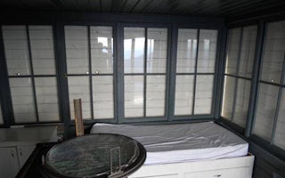
The Cougar Peak Lookout offers guests an opportunity to experience an old-time Forest Service lookout. The tower commands an imp...
Unfortunately, we don't have up-to date pricing data for this listing, but you can check pricing through Recreation Gov.
Book NowAdd your business today to reach The Outbound's audience of adventurous travelers.
Community
© 2024 The Outbound Collective - Terms of Use - Privacy Policy


