Ontonagon, Michigan
Top Spots in and near Ontonagon
-
Headquarters Road, Michigan
Snowshoe to the Lost Creek Yurt in the Porkies
13.6 mi / 610 ft gainThe Porcupine Mountains offer a lot of fantastic winter options including cabin and yurt rentals for winter excursions. The most remote trek available in the park is towards the Lost Creek Yurt, a 6.8 miles route that is 2.8 miles on cross country ski trail, and 4 miles on a flagged route into th...Read more -
Ontonagon, Michigan
Backpack the Union Spring and Lost Lake Trails in the Porkies
8.1 mi / 600 ft gainThe hike begins at the Union Spring trailhead, roughly two miles south of the Park Headquarters on Boundary Road. This area of the park is also the winter cross country and snowshoeing section of the park, so many of the trails are marked for winter travel. To make sure you stay on the summer rou...Read more -
Bruce Crossing, Michigan
Hike to O Kun de Kun Falls
2.6 mi / -100 ft gainLocated roughly 8 miles north of Bruce Crossing on Highway 45, the O Kun de Kun Trailhead is a small turnoff located on the right side of the highway. The trailhead offers limited parking, but the trail is rarely busy. At the beginning the trail, hikers can see the blue blazes of the North Countr...Read more -
Ontonagon, Michigan
Escarpment Trail
4.08.39 mi / 1007 ft gainEnjoy scenic views of Lake of the Clouds and Big Carp River Valley. This hike on Michigan's upper peninsula is a great place for fall colors in late September or early October. Upon arriving at Porcupine Mountains State Park (from Highway 107) in Ontonagon, Michigan, follow signs to the Lake of ...Read more -
Ontonagon, Michigan
Backpack the Big Carp River and Lake Superior Trails in the Porkies
18.2 miWe started our hiking in the afternoon at the Lake of the Clouds parking lot. Our original plan for the hike was to thru hike the Lake Superior Trail, however, due to muddy conditions and recent rain, we chose the Big Carp River Trail as a dryer route to get to our mid-camp point near the Big Car...Read more -
Ontonagon, Michigan
Lake of the Clouds in the Porcupine Mountains
5.01.23 mi / 364 ft gainHiking in the porcupine mountains could be a day trip or a week trip. From a short rim hike overlooking Lake of the Clouds to a three day back country camping excursion, there are endless amounts of options for planning a getaway to the Porcupine Mountains. Located in the far northwest of Michi...Read more -
Ontonagon, Michigan
Mirror Lake Cabins Loop
6.24 mi / 584 ft gainThe trip to Mirror Lake begins at the Summit Peak Scenic Area. To extend your hike, start at the Lily Pond trail-head farther south on Summit Peak Road (5.3 miles to cabin). The initial trail towards the lake is the Beaver Creek trail (1.2 miles). The trail climbs down the peak slope into some lo...Read more -
Ontonagon, Michigan
Summit Peak Observation Tower
0.9 mi / 190 ft gainSummit Peak Observation Tower is an out-and-back trail that takes you by a lake located near Ontonagon, Michigan.Read more -
Ontonagon, Michigan
Backpack the Little Carp River Trail in the Porkies
4.015.3 mi / -720 ft gainThe Little Carp River Trailhead is located in the center of the Porcupine Mountain State Park, about 16 miles west of the park headquarters on S. Boundary Road. At the start of the trailhead, hikers can see Overlooked Falls. About a mile in one the trail, Greenstone Falls can be seen past both th...Read more -
Trout Creek, Michigan
Hike to the Base of Agate Falls
1 mi / -200 ft gainOutside of Agate, MI, this spot is a couple of miles west of the town on MI-28. With parking on the side of the road, follow the main path under the bridge to reach the wooden walkway to the overlook. If you'd like to see the falls from above, before the walkway, there is a path up the hill that ...Read more -
Bruce Crossing, Michigan
Bond Falls Loop
0.82 mi / 112 ft gainBond Falls Loop is a loop trail that takes you by a waterfall located near Bruce Crossing, Michigan.Read more -
Bruce Crossing, Michigan
Explore Bond Falls
4.00 miVery short hiking trail (walk) along the river to view the falls from various parking lots. There is a boardwalk with viewing platforms from the lower parking area or a gravel path from the roadside parking area that lead to stairs down to the board walk. Along the boardwalk there are multiple pl...Read more -
Ironwood, Michigan
Presque Isle River Waterfall Loop
5.02.47 mi / 335 ft gainThis hike combines the East and West River Trails for a scenic hike along the Presque Isle River, which runs through the Porcupine Mountains State Park. The river has strong currents and sections of rapids, as well as three main waterfalls, Nawadaha Falls, Manido Falls, and Manabezho Falls, which...Read more -
Pelkie, Michigan
Hike to Sturgeon Falls
4.01.5 miThe Sturgeon River Gorge Wilderness is a remote and scenic section of the Ottawa National Forest. This trail descends steeply into Sturgeon Gorge to reach the falls – prepare to tackle the same elevation on your way out! There is also camping near the falls.Read more -
Marenisco, Michigan
Hike to Yondota Falls
5.00.5 miOutside of Marenisco, MI, take Cty Rd 523 north of town. The trailhead is just north of the bridge over Presque Isle River, hidden away in the trees. We missed it our first pass over the bridge. Once at the trailhead, hike down roughly 0.25 to 0.5 miles to see the waterfalls to your left. There a...Read more -
Ironwood, Michigan
Photograph the Potawatomi and Gorge Waterfalls
5.0Potawatomi and Gorge falls are two of the most scenic waterfalls on the black river. These two waterfalls are an easy stop for anyone and both waterfalls are accessible for wheelchairs. The Black River Scenic Byway starts north of US 2 near Bessemer. There are signs on the highway. The falls ar...Read more
Top Activities
Camping and Lodging in Ontonagon
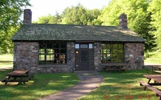
Ironwood, Michigan
Black River Harbor Pavilion
Overview
The Black River Harbor Pavilion is located within the Black Harbor Recreation Area on Lake Superior in Michigans Upper Peninsula...
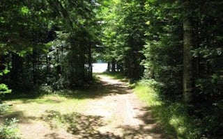
Watersmeet, Michigan
Marion Lake Group Site
Overview
The sparkling Marion Lake offers breathtaking and exciting camping for your next family trip. Live it up on the water with your ...
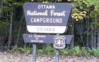
Watersmeet, Michigan
Sylvania (Clark Lake) Campground
Overview
Sylvania (Clark Lake) Campground is located seven miles southwest of Watersmeet, Michigan, adjacent to the 18,327 acre Sylvania ...
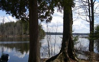
Watersmeet, Michigan
Sylvania Wilderness Backcountry Camping
Overview
The Sylvania Wilderness encompasses 18,327 acres of primitive lands and is part of the National Wilderness Preservation System. ...
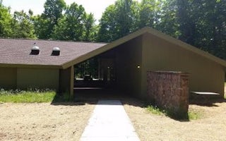
Watersmeet, Michigan
Clark Lake Pavilion
Overview
The Clark Lake Pavilion, located within the Clark Lake day use area, sits in a beautiful north woods setting; at the north end o...


