Westhampton, Massachusetts
Top Spots in and near Westhampton
-
Holyoke, Massachusetts
Whiting Street Reservoir Loop
3.74 mi / 138 ft gainWhiting Street Reservoir Loop is a loop trail that takes you by a lake located near Holyoke, Massachusetts.Read more -
Deerfield, Massachusetts
South Sugarloaf Trail
1.48 mi / 404 ft gainSouth Sugarloaf Trail is a loop trail that takes you by a river located near South Deerfield, Massachusetts.Read more -
Hampden, Massachusetts
Goat Rock Trail
2.67 mi / 659 ft gainGoat Rock Trail is an out-and-back trail where you may see beautiful wildflowers located near Hampden, Massachusetts.Read more -
Granby, Connecticut
Hiking Enders Falls
4.0Enders State Forest sprawls over approximately 2000 acres, and is found within the towns of Granby and Barkhamsted in Connecticut. Enders has a good sized parking lot directly on Route 219. From the junction of Route 219 and Route 20, visitors will proceed west on Route 219 for 1.2 miles and tu...Read more -
Savoy, Massachusetts
Tannery Falls Loop
0.54 mi / 135 ft gainThe hike to Tannery Falls may be a little confusing, I'll clear it up for you before you even go there! To get to The falls you will travel down a dirt road that isn't very well maintained during the winter. As you keep driving down the dirt road you will notice a pond , which means you are almos...Read more -
Erving, Massachusetts
Rattlesnake Loop to Red Trail
1.97 mi / 676 ft gainRattlesnake Loop to Red Trail is a loop trail that provides a good opportunity to view wildlife located near Erving, Massachusetts.Read more -
Stockbridge, Massachusetts
Laura's Tower and Ice Glen
5.02.4 mi / 676 ft gainYou will park at the end of Park Street in Stockbridge, Massachusetts. From the parking are you will cross a beautiful bridge over the Housatonic River. The trail crosses railroad tracks and immediately begins to climb into the woods. You will reach a split in the trail, a left will take you...Read more -
Adams, Massachusetts
Explore Bellevue Falls
5.0When you reach the falls, you can cliff jump into a large swimming hole at the base. The best time to visit the falls is from April to November. Please note that dogs are not permitted here. Parking is at a cemetery, and the gates are open from 8am to 9pm. Use common sense before cliff jumping - ...Read more -
Great Barrington, Massachusetts
Mt. Wilcox and Beartown Mountain Trail Loop
5.09.29 mi / 981 ft gainMt. Wilcox and Beartown Mountain Trail Loop is a loop trail that takes you by the lake located near Great Barrington, Massachusetts.Read more -
Great Barrington, Massachusetts
Hike Monument Mountain
4.02 mi / 720 ft gainAt 1642 feet (with a total elevation gain of 720 feet), Squaw Peak is a great spot to see both Mt Greylock along the Vermont border, and the Catskills in New York. There are several trail options here to get to the summit, but no matter which combination you choose, you can keep your trip under ...Read more -
Norfolk, Connecticut
Hike to Campbell Falls
4.01.4 mi / 187 ft gainCampbell Falls, one of the most beautiful parks in CT. Don't let the size of the park fool you, that's what adds to the beauty. With it's strong pine and fresh flower scented woods you slowly forget that you're even in Connecticut. The trails aren't labeled the greatest but still can be made out....Read more -
Williamstown, Massachusetts
Hike the March Cataract Falls Trail
4.02.2 mi / 511 ft gainPark at the Junction of Sperry Rd and Rockwell Rd. To get to the trailhead, hike along Sperry Road for about 30 minutes. (Not to the end of the road, see map below.) Then hike along the March Cataract Trail, an out-and-back. You can bring dogs on leash. The trail is short but steep in some parts ...Read more -
Simsbury, Connecticut
Hike to the Heublein Tower on Talcott Mountain
4.32.54 mi / 404 ft gainThe Heublien Tower Trail, located just inside the Talcott Mountain State Park entrance off of Route 185 in Simsbury CT, is a short 1.25 miles. While the hike isn't long, the first 1/3 of a mile is a steep incline that will get your heart pumping. The trail itself it very well kept, and although ...Read more -
Williamstown, Massachusetts
Hike Mt. Greylock via Money Brook Trail
9.7 mi / 3034 ft gainPark in the parking lot on Hopper Rd. Walk to the end of the road where you will find the Hopper Trailhead. Take the right fork. The Money Brook trail will take you to a waterfall, the Mt. Greylock summit, and back to the end of Hopper Rd. The trail is long but worth the hike, exploring parts of ...Read more -
Sheffield, Massachusetts
Hike to Race Brook Falls
4.03.4 mi / 1174 ft gainHiking along the Appalachian trail I made a detour in Mt Everett State reservation. About a 2.5 mile detour lead me down to a beautiful 100ft waterfall called Race Brook falls. The waterfall felt made me feel like i was in the tropical jungle in Hawaii. Adding to the beauty of the waterfall were ...Read more -
Manchester, Connecticut
Explore Wickham Park
5.0Wickham Park Is open the first weekend in April and closes the last weekend in October. Entrances fees are $5 Monday-Friday and $7 Saturday-Sunday. The park is known for its 250 acres of open fields, wildflowers, gardens, ponds and nature center. There is no where else can you go have a picnic w...Read more
Camping and Lodging in Westhampton
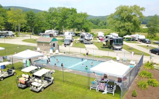
Westhampton, Massachusetts
Northampton / Springfield KOA Holiday
With fantastic attractions, arts and entertainment, outdoor recreation and shopping, the Greater Springfield, Northampton and Pioneer Val...
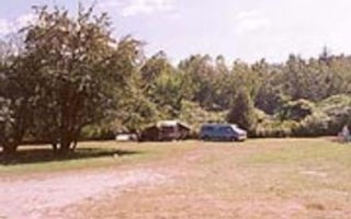
Chesterfield, Massachusetts
Indian Hollow
Overview
With abundant wildlife, lush scenery and waterfront views, Indian Hollow Group Campground, located at the Knightville Dam and Re...
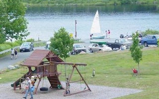
Athol, Massachusetts
Tully Lake Recreation Area (Ma)
Overview
The U.S. Army Corps of Engineers invites you to come relax at Tully Lake. There are a variety of outdoor recreation activities ...
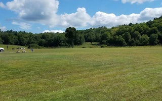
Sturbridge, Massachusetts
Westville Recreation Area
Overview
Westville Lake is situated on the Quinebaug River in the towns of Southbridge and Sturbridge, Massachusetts. Westville offers a ...

Putney, Vermont
Brattleboro North KOA Journey
This award-winning KOA is located 3 miles north of the most direct and toll-free road from Niagara Falls to coastal Maine. It's also 3 mi...
Thomaston, Connecticut
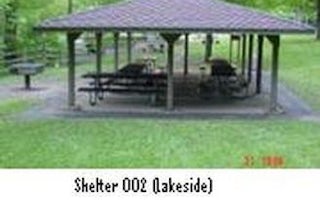
Northfield Brook Lake Group Shelters
Overview
Northfield Brook Lake Group Shelters are located along a small scenic lake in the Naugatuck Valley of west-central Connecticut.N...


