Athol, Massachusetts
Top Spots in and near Athol
-
Erving, Massachusetts
Rattlesnake Loop to Red Trail
1.97 mi / 676 ft gainRattlesnake Loop to Red Trail is a loop trail that provides a good opportunity to view wildlife located near Erving, Massachusetts.Read more -
Jaffrey, New Hampshire
Hike MT Monadnock via White Arrow Trail
4.3 mi / 1485 ft gainArriving at the Old Toll Road/Halfway House Trail head you will have $5 entrance fee. Starting on the Old Toll road you'll find yourself walking on a gradual incline into the beautiful New Hampshire wilderness. Everything you see and smell is fresh and vibrant. Following the road for 1.1 miles yo...Read more -
Ashburnham, Massachusetts
Summit Mount Watatic via the Wapack Trail
5.03 mi / 800 ft gainEntering Mount Watatic in your GPS will take you to Rindge State Road (119), continue about two minutes down the road past where the GPS tells you. on the Right hand side you will will see a sign for Mount Watatic Parking area or just enter in coordinates: 42.696796, -71.904521 You will begin the...Read more -
Westminster, Massachusetts
Summit Mt. Wachusett via the West Side Trail
5.01.2 mi / 750 ft gainSet your GPS to Wachusett Mountain ski area. Coming from Rt. 2 turn onto Mile Hill Rd and look for your first right to take Bolton Rd. Take this road all the way until it intersects with West Princeton Rd. Turn left. and drive down W Princeton Rd for 1.2 miles and there should be a small parkin...Read more -
Jaffrey, New Hampshire
Mount Monadnock via White Dot & White Cross Loop
4.53.7 mi / 1686 ft gainThe White Dot Trail is the shortest, steepest ascent to the summit, while White Cross has a slightly easier grade down with very little difference in distance. Therefore, per the park's rangers, the best way to conquer this loop is White Dot up, White Cross down.The White Dot Trail begins at Mon...Read more -
Jaffrey, New Hampshire
Mount Monadnock via White Dot Trail
4.43.46 mi / 1699 ft gainMonadnock State Park is located in and around the 3,165-ft. Mount Monadnock. Mount Monadnock is crisscrossed by many miles of well-maintained hiking trails. The popular White Dot Trail (2.2 miles) is the shortest but steepest ascent to the summit, accessible from the Monadnock State Park headquar...Read more -
Jaffrey, New Hampshire
Summit Mt. Monadnock via Marlboro Trail
5.04 mi / 2300 ft gainStart at the Marlboro Trailhead (you can enter this in Google maps) off Shaker Road. There's parking and porta-potty bathrooms. The trail is well-marked with white dashes/M marks all the way up. Once on trail, the initial 800 ft climb is through forested terrain with a few brooks and streams alon...Read more -
Deerfield, Massachusetts
South Sugarloaf Trail
1.48 mi / 404 ft gainSouth Sugarloaf Trail is a loop trail that takes you by a river located near South Deerfield, Massachusetts.Read more -
Temple, New Hampshire
Hike the North & South Peaks of Pack Monadnock
5.08.3 mi / 2290 ft gainThis route will take you to both peaks and on most of the trails in this section of the park! Take the Wapack Trail (1.4 miles, rocky, challenging) to the summit of South Pack (2290') and climb the fire tower for some incredible views! On a clear day, you can see the Boston skyline. Then continue...Read more -
Temple, New Hampshire
Hiking Pack Monadnock at Miller State Park
4.02.8 miMiller State Park is the oldest State park in New Hampshire and offers the perfect spring, summer or fall hike. From the parking area, visitors can choose from one of three trails: The Marion Davis Trail (1.4 miles to peak), The Wapack Trail (1.4 miles to peak) or the Auto-road (~ 1.0 miles to pe...Read more -
Clinton, Massachusetts
Wachusett Reservoir
4.7Wachusett Reservoir is located in central Massachusetts, northeast of Worcester. Easy location and parking, you can go anytime of the day and you won't be disappointed. The Reservoir is the second largest body of water in the State of Massachusetts, taking place in 5 cities around the area, West ...Read more -
Harvard, Massachusetts
Hike along the Nashua River and the Oxbow National Wildlife Refuge
9.5 mi / 0 ft gainPark in the lot on Tank Road to access the Nashua River Trail. Keep your eyes peeled for turtles, chipmunks, birds, and other wildlife! This trail is open from April to October. The trail can become flooded and muddy after a rain/ snow, so for a shorter alternative to the 9.5 miles, you can take...Read more -
Bolton, Massachusetts
Take a Stroll at Fyfeshire Conservation Area
1.0Fyfeshire is located in Bolton Massachusetts off "Wattaquadock Hill Road", near the "Fotini's Restaurant and Bar". The trailhead begins at a small parking area with a stone gate that says Fyfeshire Conservation area on a wood plank. Once you are in the conservation area you will see an opening in...Read more -
Holyoke, Massachusetts
Whiting Street Reservoir Loop
3.74 mi / 138 ft gainWhiting Street Reservoir Loop is a loop trail that takes you by a lake located near Holyoke, Massachusetts.Read more -
Milford, New Hampshire
Granite Town Rail Trail
13.24 mi / 761 ft gainGranite Town Rail Trail is an out-and-back trail that takes you by a lake located near Milford, New Hampshire.Read more -
Groton, Massachusetts
Catch a Sunset at Gilbert Hill
5.01 miFrom Rt. I-495 Exit 31, Gibbert Hill has one of the greatest sunsets around Groton, MA area. You will see a lot of cows and even a castle. This is a very easy hike and a not so easy place to park, you have to leave you car on the side of the road, which is totally fine, I guess, it is easy.The wa...Read more
Camping and Lodging in Athol
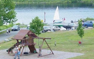
Athol, Massachusetts
Tully Lake Recreation Area (Ma)
Overview
The U.S. Army Corps of Engineers invites you to come relax at Tully Lake. There are a variety of outdoor recreation activities ...
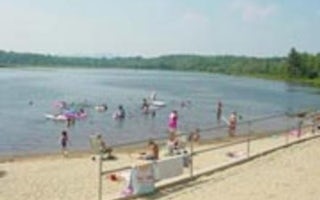
Peterborough, New Hampshire
Edward Mac Dowell Lake Day Use Facilities
Overview
Edward MacDowell Lake is situated in a quiet corner of the Monadnock Region of New Hampshire. This day-use area lies just off St...
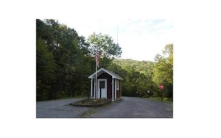
Keene, New Hampshire
Otter Brook Lake Beach
Overview
Otter Brook Lake Beach is a U.S. Army Corps of Engineers day use facility offering many outdoor recreation opportunities everyon...

Putney, Vermont
Brattleboro North KOA Journey
This award-winning KOA is located 3 miles north of the most direct and toll-free road from Niagara Falls to coastal Maine. It's also 3 mi...
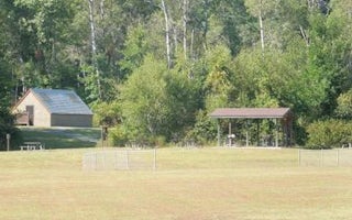
Surry, New Hampshire
Surry Mountain Lake Beach
Overview
Surry Mountain Lake Beach is a U.S. Army Corps of Engineers day use facility located on the Ashuelot River in Surry, New Hampshi...
Westhampton, Massachusetts
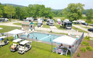
Northampton / Springfield KOA Holiday
With fantastic attractions, arts and entertainment, outdoor recreation and shopping, the Greater Springfield, Northampton and Pioneer Val...


