Ririe, Idaho
Top Spots in and near Ririe
-
Menan, Idaho
"R" Mountain
3.43.29 mi / 1020 ft gainThe North Menan Butte, or "R" Mountain is a well-known landmark in southeast Idaho for its size and uniqueness. The mountain is known as “R” Mountain by locals because of the large “R” painted on its side for Rexburg, Idaho. "R" Mountain, however, is not actually a mountain but rather an extinct ...Read more -
Idaho Falls, Idaho
Fly Around the Grand Teton
5.0Flying around the Grand Teton in Grand Teton National Park is a once-in-a-lifetime experience, especially at sunrise or sunset. Viewing the Tetons from ground level at Grand Teton National Park is a spectacular view, but seeing the Tetons from the air is unreal.Finding a Plane and Pilot: There ar...Read more -
Tetonia, Idaho
Packsaddle Lake
4.80.74 mi / 259 ft gainDirections to the lake:To get here, head North on Highway 20 as if you’re heading to St. Anthony. Then, take exit 339 towards Driggs on ID-33 E. Turn right onto 9th N for .5 miles. Then follow ID-33 E for 24.4 miles until you reach the dirt road Hoopes Rd. Drive. Drive on this road for 5.9 miles ...Read more -
Swan Valley, Idaho
Camp at Fall Creek Falls
4.8Just an hour outside of Jackson Hole, this waterfall is very easy to access. This is also a great spot to camp overnight if you are heading to the Grand Tetons National Park from the West Coast. Look for a sign at the turn out that says “Fall Creek Falls.” If you find yourself on the bridge over ...Read more -
Irwin, Idaho
Hike along Palisades Creek
5.02 mi / 1827 ft gainThe Palisades Creek Nature Trail is a fun little hike with many photographic opportunities. You can make the hike as short or long as you want, so once you're done taking photos, turn back around and head to your vehicle. The trail does eventually lead to Lower and Upper Palisades Lake, but this ...Read more -
Irwin, Idaho
Scenic Autumn Drive around Palisades Reservoir
5.0If you're heading to Grand Teton National Park from Idaho Falls and are looking to take the most scenic route, make sure to take US 26 E through Palisades Reservoir. The fall colors light up the mountain sides for 20 miles as you drive along the windy road. There are multiple pull offs to capture...Read more -
Moose, Wyoming
Scenic Drive Up to Grand Targhee Ski Resort
5.0The scenic drive along Alta Ski Hill Road to Grand Targhee Ski Resort provides many amazing views of the Grand Teton, especially during autumn. The Grand Teton is one of the most spectacular mountain peaks in all of the U.S. People travel the world to come see this specific mountain. Most people,...Read more -
Moose, Wyoming
Explore Teton Creek along Sheep Bridge Trail
4.02 mi / 250 ft gainTrailhead: The trail is just outside of Driggs, Idaho in Alta, Wyoming on the way up to Grand Targhee Ski Resort. The hike is fairly easy, so you can enjoy the scenic views of the forest and creek, especially during the winter when the trees have a thick layer of snow on them. You also cross Teto...Read more -
Alta, Wyoming
Hike Coal Creek Trail
Imagine hiking through the expansive valleys of wildflowers and evergreen forests with grand views of the Tetons. That is exactly what this trail provides. The coal creek trail is an access trail to many other great trails throughout the Bridger-Teton National Forest. This gives the adventurer th...Read more -
Alta, Wyoming
Taylor Mountain via Cole Creek
8.76 mi / 3261 ft gainThe Coal Creek Trailhead is at 7,250 feet. Follow the trail as it goes up Coal Canyon and through Coal Creek Meadows. Taylor mountain is the peak on the left side of the canyon as you climb. When you come to a fork at 2.5 miles (just after the meadow), take the left fork (toward the west) to begi...Read more -
Alta, Wyoming
Hike Darby Canyon to the Wind Cave
4.9The best time to hike Darby Canyon is May through September, since the snow stays late in spring and comes earlier in fall.Hiking up Darby Canyon to the Wind Caves provides spectacular views of the Jedediah Smith Wilderness and is a fun, yet challenging hike. It is a popular day hike, and many fa...Read more -
Wilson, Wyoming
Hike Mt. Glory
5.02 mi / 1650 ft gainDepending on how old your vehicle is, this hike could be as difficult for your rig as it is for you. At the top of the Pass, there is a generously-sized parking area. The unmarked trail for Mt. Glory is on the opposite side of the road, and you can't miss it if you look for the yellow speed limit...Read more -
Wilson, Wyoming
Hike to Ski Lake
4.34.4 mi / 455 ft gainThis is a great hike that is just a few minutes from Wilson, WY. This trail is used more by locals than visitors to the area, but is a great one to check out if you are nearby. The views are incredible and the lake at the top is pretty cool, too.There is easy access from Teton Village and Jackson...Read more -
Alta, Wyoming
Summit Table Mountain
4.811 mi / 4000 ft gainTo climb Table Mountain you begin at the Teton Canyon Trailhead near Driggs, Idaho. The trailhead sits at about 6,800 feet elevation and from there you have two options to reach the 11,106 ft. peak -neither of which are technical, and both of which are dog-friendly.The first option, named Huckleb...Read more -
Ashton, Idaho
Upper and Lower Mesa Falls Loop
4.82.6 mi / 358 ft gainWhen two waterfalls have their own scenic byway, you know it is worth the additional stop. Lower Mesa Falls and Upper Mesa Falls are spectacular waterfalls along the Henrys Fork River, deep in the Grand Targhee Forest. The winding scenic byway yields some spectacular views of the Grand Targhee Fo...Read more -
Ashton, Idaho
Mesa Nature Trail
5.02.44 mi / 236 ft gainThe Mesa Nature Trail begins on the dirt road to the Upper Mesa Falls overflow parking lot. The first mile of the trail is wide and smooth. Pause a half mile in to admire the Henry's Fork from the top of a lava field. The trail terminates at a flat bluff overlooking the top of Upper Mesa Falls. ...Read more
Top Activities
Camping and Lodging in Ririe
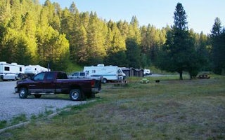
Ririe, Idaho
Table Rock
Overview
Table Rock Campground is located in a small but scenic canyon near Kelly Canyon Ski Resort, approximately 30 miles from Idaho Fa...
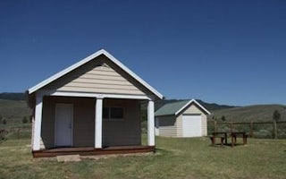
Bonneville County, Idaho
Stump Creek Guard Station
Overview
Stump Creek Guard Station is located along what was once the Lander Cutoff for the Oregon Trail. Visitors can trace the path tha...
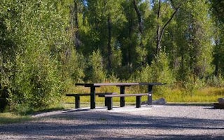
Swan Valley, Idaho
Falls Campground
Overview
Falls Campground is located next to the Snake River in beautiful Swan Valley at an elevation of 5,100 feet. Idaho Falls, Idaho i...
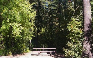
Irwin, Idaho
Calamity
Overview
Calamity Campground is located along the Snake River drainage at the north end of beautiful Palisades Reservoir at an elevation ...
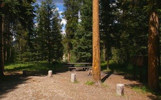
Victor, Idaho
Mike Harris
Overview
Mike Harris Campground is located along scenic Teton Pass, just 5 miles from Victor, Idaho at an elevation of 6,200 feet. Visito...
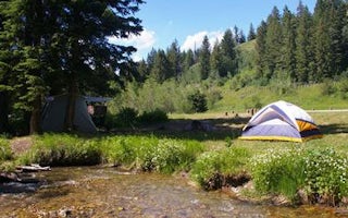
Alta, Wyoming
Trail Creek
Overview
Trail Creek Campground is located along Trail Creek on scenic Teton Pass, just 7 miles from Victor, Idaho at an elevation of 6,6...


