Red Bluff, California
Top Spots in and near Red Bluff
-
Redding, California
Arboretum Loop Trail
3.52.07 mi / 43 ft gainArboretum Loop Trail is a loop trail that takes you by a river located near Redding, California.Read more -
Redding, California
Hilltop Trail Head to Sundial Bridge
4.02.27 mi / 167 ft gainHilltop Trail Head to Sundial Bridge is an out-and-back trail where you may see wildflowers located near Redding, California.Read more -
Shasta County, California
Hike Kanaka Peak
4.53.5 mi / 1100 ft gainHead to the Peltier Bridge Campground after entering Whiskeytown National Recreation Area and then go 1.1 miles along the road through the campground until you reach the trailhead for Kanaka Peak. The road from the campground is open from late spring to late fall, otherwise hikers will need to pa...Read more -
Shasta County, California
Hike to the top of South Fork Mountain
5 mi / 4181 ft gainStarting from the Kanaka Peak Trailhead, follow the Kanaka Peak Trail all the way, continuing on past the Peltier Trail Junction and the Kanaka Cutoff Trail Junction until the trail begins to head east (about 2-2.5 miles from the trailhead) and there is a gently sloping hill on your right that is...Read more -
Igo, California
Hike to Brandy Creek Falls in Whiskeytown National Recreation Area
5.03 mi / 500 ft gainMy favorite hike in Whiskeytown National Recreation Area. From the visitor center you will take Kennedy Memorial Drive towards the dam, make a left at Brandy Creek Road. At a junction for Sheep camp/Shasta Bally make a left. You will arrive at the trailhead. This hike follows a beautiful stream t...Read more -
Redding, California
Flanagan and Chamise Peak Trail
5.04.64 mi / 906 ft gainThe Flanagan Trail to Chamise Peak is a family-friendly hike with moderate slopes and excellent views. The trail winds through shaded woodland, offering glimpses of Shasta Dam, Lassen, and the Sacramento River. Though long, it’s manageable for all ages, with a bench halfway up and a picnic tabl...Read more -
Chico, California
Monkey Face Loop
1.27 mi / 279 ft gainMonkey Face Loop is a loop trail that takes you by a lake located near Chico, California.Read more -
Chico, California
Hike the Yahi Trail in Upper Bidwell Park
7.9 mi / 836 ft gainTo start this hike, find parking at Bidwell Park Parking Area E, near the Chico Rod and Gun Club. From there walk a short ways down Upper Park Road. You will see the sign for the Yahi Trail trailhead on the right. From here, simply follow the trail along the river. A reminder to those with dogs, ...Read more -
Chico, California
Yahi Trail
8.88 mi / 541 ft gainYahi Trail is an out-and-back trail where you may see wildflowers located near Chico, California.Read more -
Tehama County, California
Explore Deer Creek Falls
5.00.5 miThis extremely short hike starts just off of Highway 32. From Chester, head southwest on 32 for roughly 21 miles. There is a turnout and a sign where the trail starts. This waterfall is best viewed in the spring when there is still a large amount of snow melt off. This waterfall is definitely not...Read more -
Redding, California
Camp at Shasta Campground
Shasta Campground offers 27 tent/trailer campsites, picnic tables, paved loop road, vault toilets, OHV staging area, potable water, and fire rings. To get to the campground head along Keswick Reservoir, below Shasta Dam. Take I-5 north from Redding about 10 miles to Shasta Dam Blvd. Follow Shas...Read more -
French Gulch, California
Hike to Whiskeytown Falls in Whiskeytown National Recreation Area
2.8 mi / 787 ft gainComing from Redding pass the visitor center and heading down highway 299. Make a left turn on Crystal Creek Road. Drive about 3.75 miles and on your left will be the Mills Creek Trailhead. Start hiking. You will start headed downhill towards the creek. You will cross Crystal Creek on a footbridge...Read more -
French Gulch, California
Hike to Crystal Creek Falls in Whiskeytown National Recreation Area
0.6 miFrom Redding pass the visitor center on highway 299 and pass the lake. Make a left turn on to Crystal Creek Road. Follow this road for about 2 miles. There will be signs to make a left turn to Crystal Creek Falls. This is less of a hike and more of a walk. The trail is paved. It is less than a ha...Read more -
Redding, California
Houseboat Lake Shasta
1 mi / 1 ft gainLake Shasta sits at the foot of infamous Mt Shasta, past the major Northern California city of Redding. From the Bay Area you can count on at least a 3.5 hour drive to get to waters edge, but the drive goes by quickly just cruising on HWY 5. There are multiple Marinas on Shasta but the largest is...Read more -
Tehama County, California
Brokeoff Mountain Trail
4.06.93 mi / 2474 ft gainPeaking above the volcanic valley at 9235 ft, Brokeoff Mountain is only second in height to Mt. Lassen in the national park they share. Brokeoff was once a part of a larger volcano called Mt. Tehama that erupted, eventually leading to its collapse. The event left a rugged volcanic rim, now con...Read more -
Shasta County, California
Visit Sulphur Works at Lassen Volcanic NP
4.02 mi / 200 ft gainLassen Volcanic National Park is a wonderland of lush pine forests, arid rocky terrain, boiling lakes, snow-capped peaks, and extremely diverse wildlife. I recommend at least a week to explore this underrated national park, but if you are only driving through, you can still enjoy some of the won...Read more
Camping and Lodging in Red Bluff

40.182481,-122.229227, California
Red Bluff KOA Journey
Nestled on the Sacramento River, with beautiful views of the river that can be taken in from the campground. At Red Bluff KOA Journey, we...
Red Bluff, California
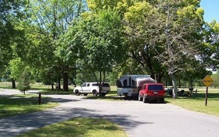
Sycamore Grove (Red Bluff) Campground
Overview
Sycamore Grove Campground sits along the banks of the sparkling Sacramento River at a 300-foot elevation, within the 488-acre Re...
Buckhorn Road
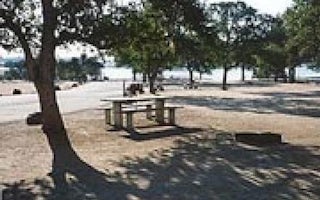
Buckhorn
Overview
Buckhorn Recreation Area is at Black Butte Lake, situated at the northern end of the Sacramento valley, 100 miles north of Sacra...
Tehama County, California
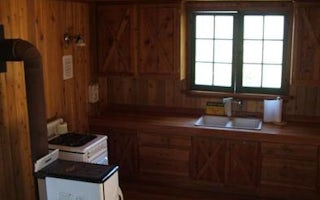
Mccarthy Point Lookout
Overview
McCarthy Point Lookout was constructed in 1936 by the Civilian Conservation Corps for use in spotting wildfires. During World Wa...
County Road 206
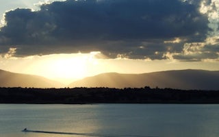
Orland Buttes
Overview
Orland Buttes Recreation Area is at Black Butte Lake, situated at the northern end of the Sacramento valley, 100 miles north of ...
Shingletown, California
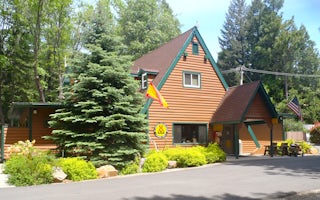
Mt. Lassen / Shingletown KOA Holiday
The natural landscape of this KOA reflects the beautiful geography of the area. This shaded, peaceful campground is nestled among cedars,...


