Mccarthy Point Lookout
Book this listing through our partner Recreation Gov
About Mccarthy Point Lookout
Overview
McCarthy Point Lookout was constructed in 1936 by the Civilian Conservation Corps for use in spotting wildfires. During World War II, the lookout served as part of an aircraft defense monitoring system that extended throughout California. The lookout is accessible by vehicle, but a high-clearance vehicle is recommended. Guests must walk approximately 1,000 feet along a paved trail to reach the lookout from the parking area. This is a high cliff area, so caution is advised. The cabin offers several creature comforts, but guests may need to bring some supplies and gear for their stay. The scenic views and remote location make McCarthy Point Lookout an ideal retreat.Recreation
The lookout is an excellent base for exploring the recreational opportunities of the Ishi Wilderness. Many hiking and equestrian trails crisscross the Wilderness.Special fishing regulations are in effect for Mill and Deer Creeks within the Wilderness. Please check the State of California’s Fishing Regulations before fishing. A valid California fishing license is required.
Facilities
McCarthy Point Lookout is a two-room cabin with a kitchen and a bedroom. The bedroom is surrounded on three sides by windows and has overhead propane lights, two single-sized sleeping platforms and six aluminum cots. The kitchen has overhead propane lights, a propane cook stove, wood stove, double sinks with running non-potable water (hot water is not available), a large picnic-style table with benches and a portable gas barbecue. Propane is provided. There is a broom and dust pan for tidying up the cabin. Wheeled carts are provided to transport gear to the lookout. An outhouse with a pit toilet is located at the parking area. The cabin does not have potable water or electricity. Guests need to provide their own drinking water. Garbage bags are needed to pack out trash. Items such as bedding, sleeping pads, cooking pots, utensils, dishes, dish soap, toilet paper, paper towels, matches and flashlights are not provided.Natural Features
The lookout is perched at an elevation of 3,600 feet on the southern end of Mill Creek rim overlooking scenic Mill Creek Canyon and the Ishi Wilderness. The cabin is tucked into a stand of mixed evergreens. McCarthy Point is located within a state game refuge that protects species like wild hog, mountain lion, black bear, coyote, bobcat, Tehama deer and rabbit. A variety of raptors nest on rock cliffs in the nearby Ishi Wilderness, including hawks, eagles, falcons and owls. Other common bird sightings include wild turkey, quail, canyon wrens, band-tailed pigeons and myriad songbirds.Nearby Attractions
Ishi WildernessMccarthy Point Lookout Reviews
Have you stayed here? Be the first to leave a review!
Top Spots in or near Tehama County
Explore Deer Creek Falls
Tehama County, California
5.0
0.5 mi
This extremely short hike starts just off of Highway 32. From Chester, head southwest on 32 for roughly 21 miles. There is a turnout and a sign where the trail starts. This waterfall is best viewed in the spring when there is still a large amount of snow melt off. This waterfall is definitely not a destination hike, but is a perfect way to break up a longer drive on a hot summer day.
Brokeoff Mountain Trail
Tehama County, California
4.0
6.93 mi
/ 2474 ft gain
Peaking above the volcanic valley at 9235 ft, Brokeoff Mountain is only second in height to Mt. Lassen in the national park they share. Brokeoff was once a part of a larger volcano called Mt. Tehama that erupted, eventually leading to its collapse. The event left a rugged volcanic rim, now considered smaller, individual mountains that help make up the Cascade Mountain Range. The summit of Br...
Visit Sulphur Works at Lassen Volcanic NP
Shasta County, California
4.0
2 mi
/ 200 ft gain
Lassen Volcanic National Park is a wonderland of lush pine forests, arid rocky terrain, boiling lakes, snow-capped peaks, and extremely diverse wildlife. I recommend at least a week to explore this underrated national park, but if you are only driving through, you can still enjoy some of the wonder!
There are several hydrothermal areas of the park, but if you are short on time, Sulphur Works i...
Bumpass Hell Trail
Shasta County, California
4.7
2.71 mi
/ 502 ft gain
Due to hazardous snow and ice, Bumpass Hell Trail closes during the spring and may not open until July.
From the Bumpass Hell Parking Area, the trail traverses the rocky slopes of Bumpass Mountain. The trail slowly ascends 200 feet with views of the valley to the west and Lassen Peak to the north. At 0.9 miles, you reach an overlook with a view of Bumpass Hell. Then, for 0.4 miles, the trail d...
Lake Helen in Lassen Volcanic NP
Shasta County, California
5.0
Lake Helen is a glacial lake in Lassen Volcanic NP. The park's winter season starts in October and runs through June. Lake Helen can be found thawing mid-June. The turquoise blue of the water comes from the minerals in it, and is mesmerizingly beautiful when thawing in pools over a snowy Lake Helen.
Once fully thawed, Lake Helen is a great lake for reflection photos as there is no surface o...
Bumpas Hell to Cold Boiling Lake
Old Station, California
4.0
5.32 mi
/ 1007 ft gain
Bumpas Hell to Cold Boiling Lake Trail is an out-and-back trail that takes you by a lake located near Old Station, California.
Camping and Lodging in Tehama County
Tehama County, California
Gurnsey Creek
Overview
Gurnsey Creek Campground is located in the mountains of northern California. It offers access to a variety of nearby recreationa...
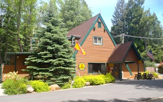
Shingletown, California
Mt. Lassen / Shingletown KOA Holiday
The natural landscape of this KOA reflects the beautiful geography of the area. This shaded, peaceful campground is nestled among cedars,...
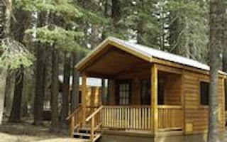
Unnamed Road
Manzanita Lake Camping Cabins
Overview
Manzanita Lake Camping Cabins offer convenience and comfort in a scenic setting of the Lassen Volcanic National Park. They are w...
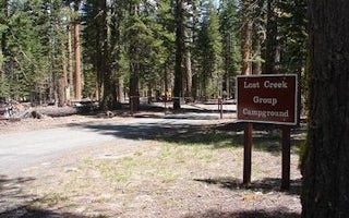
Volcanic Legacy Scenic Byway
Lost Creek Group
Overview
Lost Creek Group Campground (elevation 5,700 ft.) is approximately five miles south of Manzanita Lake, and close to the Lost Cr...
Volcanic Legacy Scenic Byway
Summit Lake North
Overview
Summit Lake North Campground (elevation 6,700 ft.) is conveniently located on the main road of Lassen Volcanic National Park. Th...
Volcanic Legacy Scenic Byway
Summit Lake South
Overview
Summit Lake South Campground (elevation 6,700 ft.) is conveniently located on the main road of Lassen Volcanic National Park. Th...
Unfortunately, we don't have up-to date pricing data for this listing, but you can check pricing through Recreation Gov.
Book NowAdd your business today to reach The Outbound's audience of adventurous travelers.
Community
© 2024 The Outbound Collective - Terms of Use - Privacy Policy


