Scottsdale, Arizona
Looking for the best hiking in Scottsdale? We've got you covered with the top trails, trips, hiking, backpacking, camping and more around Scottsdale. The detailed guides, photos, and reviews are all submitted by the Outbound community.
Top Hiking Spots in and near Scottsdale
-
Goodyear, Arizona
Hike Estrella Mountain's Baseline Trail
4.02.4 mi / 259 ft gainBaseline Trail is a 2.4 mile moderately trafficked loop trail. This trail features lovely wild flowers and is rated as intermediate. You can use this trail not just for hiking but you can also use the trail for running as well as mountain biking. On the trail you are allowed to bring your furry f...Read more -
Gold Canyon, Arizona
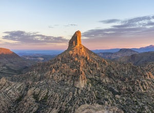
Weavers Needle
8.02 mi / 2602 ft gainLace up your boots, stock up your gear, bid farewell to civilization and head out to the wild. This adventure is not one for the faint of heart. It will scrape, snag, trip and stumble you. It will scare, taunt and tantalize you. You will need to earn this one, and it is more than worth the effort...Read more -
Gold Canyon, Arizona
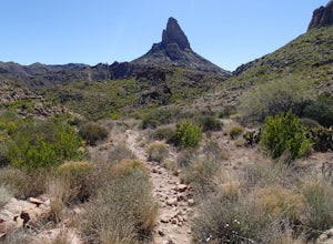
Fremont Saddle via Peralta Canyon Trail
4.74.53 mi / 1378 ft gainAfter taking Peralta Road all the way to the end, park your car in the parking lot and you'll see the sign for the trail head. Sign in at the register and then begin our hike on Peralta Trail. This trail winds through the canyon and then takes you up switch backs until you reach the saddle. The ...Read more -
Gold Canyon, Arizona
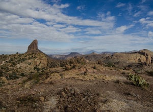
Weavers Needle Loop
5.012.37 mi / 2608 ft gainThis is a difficult hike! Plan on a lot of time and an early start. I did this hike in a clockwise direction (Peralta Trail) which really doesn't matter much but I recommend the direction to get the steepest part of the hike done first. Most people just do an out and back hike to Freemont Saddle ...Read more -
Gold Canyon, Arizona
Bluff Springs Loop
4.014.55 mi / 2523 ft gainFrom the Peralta Trailhead, start hiking on Bluff Springs Trail. This trail will wind over a few hills past incredible views, and then take you down into a wash. In the wash you will intersect with the Terrapin Trail. Turn left onto the Terrapin Trail, and it will take you out of the wash and pa...Read more -
Queen Creek, Arizona
Hike the Dynamite and Goldmine Loop
5.04.7 mi / 773 ft gainThis trail is a moderately-rated hike. It is used for a variety of activities including hiking, mountain biking, running, and walking. To access the trail, it is important to note that there is a $7 cash parking fee, so be prepared! The beginning of the trail is the most challenging part as it ...Read more -
Waddell, Arizona
Hike to Waterfall Canyon
4.02 mi / 200 ft gainSo to fully enjoy the theme of this hike, make sure to try and go right after a rain. But also know that since this is a pretty easy hike, you will won't be the only one there. This is also a great hike/ waterfall to do with someone that is new to desert hiking, since it is relatively easy and th...Read more -
Waddell, Arizona
Hike Mesquite Canyon Trail
13 mi / 1394 ft gainThis is a great place to begin your hike in the White Tank Mountains. From the Ramada Way area, the trail begins to lead steadily into a small canyon. As you get further up, the trail will begin get more steep. After a short time it leads up to the first saddle and wraps around a ridge and bec...Read more -
Waddell, Arizona
Hike Goat Camp Trail
16 miThis is one of the less traveled trails in White Tank Mountain Regional Park. If you're looking for a solid day hike in the west valley, try this one. It isn't a loop, but it ultimately connects with some of the other long trails so if you're up for a long hike, you have options. This starts f...Read more -
Payson, Arizona
Hike Barnhardt Trail
4.88 mi / 1912 ft gainTo get to the trailhead, use the turnoff of highway 87 labeled Barnhardt trail (has a marked sign coming from both Payson and Phoenix). Barnhardt road is just over 4 miles and is unpaved. The road can be driven on by lower clearance cars because the terrain is not too rocky. Once at the trailhead...Read more -
Black Canyon City, Arizona
Castle Creek Road to Cleator
4.010.59 mi / 1677 ft gainCastle Creek Road to Cleator is a point-to-point trail where you may see beautiful wildflowers located near Black Canyon City, Arizona.Read more -
Black Canyon City, Arizona
Richinbar Mine and Pueblo Trail
5.02.36 mi / 92 ft gainRichinbar Mine and Pueblo Trail is a loop trail where you may see beautiful wildflowers located near Crown King, Arizona.Read more -
Black Canyon City, Arizona
Zig Zag Trail
3.04.61 mi / 436 ft gainZig Zag Trail is a loop trail that takes you by a river located near Canyon City, Arizona.Read more -
Black Canyon City, Arizona
Government Springs Trail
5.011.04 mi / 741 ft gainGovernment Springs Trail is a loop trail that takes you by a river located near Mayer, Arizona.Read more -
Black Canyon City, Arizona
Badger Springs Wash Trail
5.01.48 mi / 98 ft gainBadger Springs Wash Trail is an out-and-back trail that takes you by a waterfall located near Cordes Junction, Arizona.Read more -
Black Canyon City, Arizona
Hike the Badger Spring Wash Trail
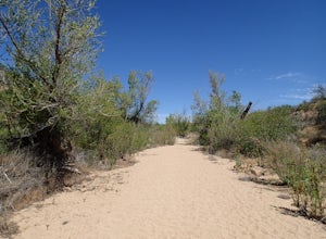
3.54 miBadger Spring Wash is a dry stream bed most of the year. This trail starts from the Badger Spring Trailhead just off Route 17 north from Phoenix. The trail follows the stream bed, sometimes in or along side for 1.5 miles. At about one mile, you reach the spring and a good amount of water which is...Read more

