Tamarack Cabin
Book this listing through our partner Recreation Gov
About Tamarack Cabin
Overview
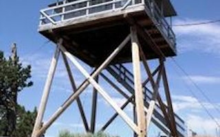
Tamarack Cabin offers outdoor enthusiasts a quaint cabin with epic views atop Tamarack Mountain. The cabin can accommodate four guests, and a short walk through the trees awards a unique opportunity to view miles of the Umatilla National Forest from sunup to sundown. The site was originally used as a fire detection lookout. The original structure was a platform built on a high tree in 1925. It was replaced with a 96-foot Aermotor tower in 1933, and a neighboring cabin was built to house Forest Service employees. A utility shed was also built. When the cabin burnt down in 1966, the shed was converted into housing. That same shed is where guests can stay today. The tower is also still standing, and when the tower is staffed, visitors are welcome to climb up and enjoy the view.Recreation
Over 26 miles of trails throughout the Heppner Ranger District can be accessed from the cabin for hiking or horseback riding. Plentiful fishing opportunities abound in nearby streams and Bull Prairie Lake. Many roads are open to off-road vehicles, and 28 miles of designated trails are available. Other activities include hunting, wildlife viewing and bird watching. This site is not open in the winter.Facilities
The cozy converted shed offers one room with amenities including propane lights, a heating stove and cook stove, cookware, silverware and dishes. Furnishings consist of two sets of twin bunkbeds, a cabinet for clothes, table with four chairs, and a rocking chair on the small front porch. There is a picnic table and fire ring outside, though fire danger may restrict campfires, so check for conditions with the Ranger District prior to arrival. There is also a nearby outhouse. No water is onsite, so visitors must bring plenty for drinking, cooking and washing. There is no refrigerator either, so come prepared with a cooler and ice. Guests must bring food, water, ice chest with ice, bedding, toiletries, a first aid kit, flashlights, matches and all other basic camping gear. Click here for more cabin details.Natural Features
At 4,979 feet above sea level, Tamarack Mountain overlooks the John Day River basin, between Spray and Kimberly. The lookout and the mountain it tops are named after the western larch, a tree that is particularly plentiful in the Blue and Wallowa Mountains. Western tanagers and dusty flycatchers frequent the area and purple-blue spikes of lupine, white and pink yarrow and yellow balsamroot add bursts of color to the landscape.Nearby Attractions
Heppner is the nearest town with a general store, which is about an hour's drive away. Off-road vehicle enthusiasts enjoy Morrow County OHV Park, located 14 miles southwest. There are some food options and ice for sale at this site.Tamarack Cabin Reviews
Have you stayed here? Be the first to leave a review!
Top Spots in or near Kimberly
Photograph the Painted Hills
Mitchell, Oregon
4.5
The Painted HIlls is the most dramatic of the three units that make up John Day Fossil Beds National Monument. Any trip to Eastern Oregon via Rt 26 requires a stop at the Painted HIlls to take in the unique landscape.John Day Fossil Beds are fee-free and as you enter you will see an area with bathrooms, picnic tables, and water fountains. This is the only place to find them, so stop there first...
Walk the Painted Cove Loop Trail
Mitchell, Oregon
4.0
0.2 mi
/ 40 ft gain
To get to the trailhead, use the US highway 26 which is the only way you can go to the Painted Hills Unit. Make a turn when arriving at Burnt Ranch Rd junction. Drive up and follow the sign around 6 miles. The trail junction is where you passed the Carroll Rim Trail and Painted Hill Overlook. Turn right at the junction then drive around 1 or 2 miles and you are there. If you need an exact coord...
Explore Shaniko's Ghost Town
Shaniko, OregonHeading south from Wasco, the scenery trades off between new farms and old abandoned homesteads. Most areas are fenced off along the road to keep in the roaming cattle, but now and then there is access to adventure off and visit the places that the settlers decided on in the 18-1900's.About 50 miles south of Wasco, you come over a rise to see an old crossroad surrounded by wooden storefronts an...
Hike Cottonwood Canyons Pinnacle Trail
Condon, Oregon
5.0
8.6 mi
/ 50 ft gain
Starting near the entrance to the fee-free Cottonwood Canyon State Park, which is one of Oregon's newest state Parks, find the large sign for the start of the Pinnacles Trail. This park was formerly a ranch, and this largely flat trail runs along an erstwhile ranch road that follows the John Day River. Undulating 4.3 miles into the canyon, you may catch glimpses of wildlife like elk, big horn ...
Hike the Elkhorn Crest Lollipop from Anthony Lakes
Baker City, Oregon
20 mi
/ 3829 ft gain
After unsuccessfully attempting to run 100 miles at IMTUF in Idaho, I had some time to kill before I had to be home and energy in my legs to burn. The Eastern part of Oregon has been on my list of places to run since I moved to the state a few years ago. One route popped into my mind and I had to do it.
The Elkhorn Crest is a point to point trail in the Blue Mountains just outside of Baker Ci...
Van Patten Lake
Baker City, Oregon
2.96 mi
/ 935 ft gain
Van Patten Lake is an out-and-back trail that takes you by a lake located near Haines, Oregon.
Camping and Lodging in Kimberly
Crook County, Oregon
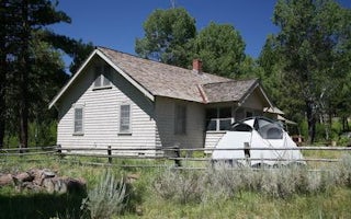
Cold Springs Cabin
Overview
Cold Springs Guard Station, constructed in 1934, is a historic site tucked into the Ochoco National Forest. It served a special ...
Prineville, Oregon
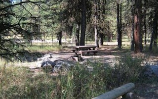
Ochoco Divide Group Site
Overview
The Ochoco Divide Group Site is a convenient place to camp while traveling across scenic State Highway 26 by bicycle or car. Res...
Prineville, Oregon
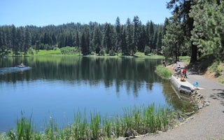
Walton Lake
Overview
Walton Lake Campground may be the best-known location in the Ochoco National Forest, offering a serene setting among old-growth ...
Mount Vernon, Oregon
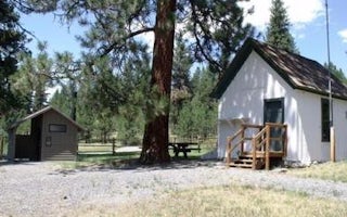
Murderers Creek Guard Station
Overview
Murderer's Creek Guard Station is in the heart of the Malheur National Forest, in central Oregon. It makes an excellent base cam...
Mount Vernon, Oregon
Fall Mountain Lookout Cabin
Overview
Fall Mountain Lookout Tower is situated about 20 miles from John Day, in central Oregon. It provides 360-degree views of the sur...

Grant County, Oregon
Sunshine Guard Station
Overview
Sunshine Guard Station is situated along John Day River in the Malheur National Forest at an elevation of 3,700 feet, about 43 m...
Unfortunately, we don't have up-to date pricing data for this listing, but you can check pricing through Recreation Gov.
Book NowAdd your business today to reach The Outbound's audience of adventurous travelers.
Community
© 2024 The Outbound Collective - Terms of Use - Privacy Policy


