Crook County, Oregon
Top Spots in and near Crook County
-
Mitchell, Oregon
Photograph the Painted Hills
4.5The Painted HIlls is the most dramatic of the three units that make up John Day Fossil Beds National Monument. Any trip to Eastern Oregon via Rt 26 requires a stop at the Painted HIlls to take in the unique landscape.John Day Fossil Beds are fee-free and as you enter you will see an area with bat...Read more -
Mitchell, Oregon
Walk the Painted Cove Loop Trail
4.00.2 mi / 40 ft gainTo get to the trailhead, use the US highway 26 which is the only way you can go to the Painted Hills Unit. Make a turn when arriving at Burnt Ranch Rd junction. Drive up and follow the sign around 6 miles. The trail junction is where you passed the Carroll Rim Trail and Painted Hill Overlook. Tur...Read more -
Prineville, Oregon
Fly Fish Crooked River
5.0Head East out of Bend, Oregon towards Prineville Reservoir State Park and Highway 27, which runs along the Crooked River. It is about an hour outside of Bend. Once you reach Highway 27 (Crooked River Highway), there are several campgrounds and pull-outs along the side of the road where you can st...Read more -
Shaniko, Oregon
Explore Shaniko's Ghost Town
Heading south from Wasco, the scenery trades off between new farms and old abandoned homesteads. Most areas are fenced off along the road to keep in the roaming cattle, but now and then there is access to adventure off and visit the places that the settlers decided on in the 18-1900's.About 50 mi...Read more -
Terrebonne, Oregon
North Point Loop
5.00.43 mi / 13 ft gainNorth Point Loop is a loop trail that takes you by a river located near Terrebonne, Oregon.Read more -
Terrebonne, Oregon
Canyon Trail and Homestead Trail
2.38 mi / 466 ft gainCanyon Trail and Homestead Trail is an out-and-back trail that takes you by a river located near Terrebonne, Oregon.Read more -
Terrebonne, Oregon
Misery Ridge Loop
5.02.57 mi / 774 ft gainThis hike takes you on a tour of the park, starting out with a steep climb up to the top of the formations and then back down past Monkey Face and to the canyon floor. It's a very popular place so if you're hoping for solitude start early -- the light on the rock walls will be worth rising earl...Read more -
Terrebonne, Oregon
Summit Trail Loop at Smith Rock
4.66.87 mi / 1506 ft gainSmith Rock State Park is an iconic PNW canyon that's become one of the rock climbing capitals of the country, and known worldwide for its sport climbing routes. And while climbing draws crowds year-round, adventurers also visit for its trail system boasting sweeping Central Oregon volcano views. ...Read more -
Terrebonne, Oregon
Snow Camp at Smith Rock
5.03 mi / 350 ft gainJust 140 miles southeast of Portland, and 27 miles north of Bend, lies a clustering of rocks more prominently referred to as Smith Rock.This intricate rock formation is a mecca for climbers during the warm summer months, however the landmark unveils a new face during the snowy season that few eve...Read more -
Terrebonne, Oregon
Misery Ridge Trail
5.02.58 mi / 919 ft gainMisery Ridge Trail is an out-and-back trail that takes you past scenic surroundings located near Terrebonne, Oregon.Read more -
Terrebonne, Oregon
Smith Rock State Park Canyon Trail
5.03.27 mi / 587 ft gainSmith Rock State Park Canyon Trail is an out-and-back trail that takes you past scenic surroundings located near Terrebonne, Oregon.Read more -
Terrebonne, Oregon
Smith Rock State Park Loop
4.95.55 mi / 1325 ft gainPark your vehicle in the bivouac parking area and hike 200 yards west to the tent campsites. Set up your home away from home at one of the undesignated cliff side campsites overlooking the park. Although it is famous for rock climbing, Smith Rock also boasts an extensive trail system. The best h...Read more -
Madras, Oregon
White Water Raft Down the Deschutes River
4.5For first time rafters and those just looking to get back into some fun white water, the Deschutes is a great run and an easily accessible one at that. Guiding companies operate trips spring through late summer starting out of the quiet town of Maupin, Oregon with both half day (just river raftin...Read more -
Terrebonne, Oregon
Steelhead Falls
4.81.98 mi / 148 ft gainFollowing along the Dechutes river for half a mile you will see where the river progressively gets more aggressive. On both sides of the trail you will see beautiful mountain inclines and jagged cliffs. If your lucky you might just see a bald eagle soaring high above! Along with Steel Head being ...Read more
Top Activities
Camping and Lodging in Crook County
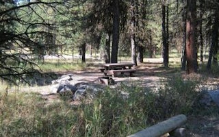
Prineville, Oregon
Ochoco Divide Group Site
Overview
The Ochoco Divide Group Site is a convenient place to camp while traveling across scenic State Highway 26 by bicycle or car. Res...
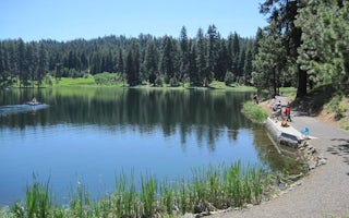
Prineville, Oregon
Walton Lake
Overview
Walton Lake Campground may be the best-known location in the Ochoco National Forest, offering a serene setting among old-growth ...

Prineville, Oregon
Ochoco Ranger Rental
Overview
Ochoco Ranger Station was established in 1906 as part of the Western Division of the Blue Mountain Forest Reserves. By 1911, Och...
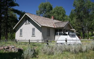
Crook County, Oregon
Cold Springs Cabin
Overview
Cold Springs Guard Station, constructed in 1934, is a historic site tucked into the Ochoco National Forest. It served a special ...
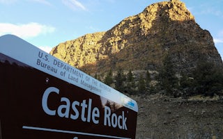
Prineville, Oregon
Castle Rock Campground
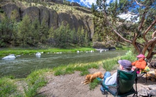
Located south of Prineville, Oregon, this six-site campground offers year-round camping and Crooked River access along the Lower Crooked ...
Prineville, Oregon
Chimney Rock Campground
Overview:Along the Chimney Rock segment of Central Oregon’s Crooked Wild and Scenic River, Chimney Rock campground offers a relaxing wood...


