Sunshine Guard Station
Book this listing through our partner Recreation Gov
About Sunshine Guard Station
Overview
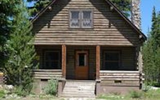
Sunshine Guard Station is situated along John Day River in the Malheur National Forest at an elevation of 3,700 feet, about 43 miles northeast of John Day, Oregon. The former guard station was built in 1936 and until the 1990s was used alternatively as a bunkhouse or a work station for fireguards.The guard station can be accessed by vehicle. Guests are responsible for their own travel arrangements and safety, and must bring several of their own amenities.
Recreation
Recreational options include fishing for steelhead and rainbow trout in the John Day River. Restrictions apply; visitors should refer to Oregon State regulations. There are hiking trails and back roads to the north of the guard station that lead into the nearby Vinegar Hill Forest/ Indian Rock Scenic Area. Wildlife viewing is popular, as is scenic driving.Facilities
This rustic four-room cabin sleeps up to six and has a kitchen, living room and two bedrooms. The living room is furnished with a futon, two chairs, a coffee table and an end table. The larger bedroom is furnished with a queen-sized bed and a closet, while the smaller bedroom offers a queen-sized bed and a chair. The kitchen is furnished with a table and four chairs, electric refrigerator and stove. Electric heat and lights are provided, and a vault toilet is located next to the cabin. There is no drinking water in the cabin. Guests must bring their own water for drinking, cooking and washing. Roads to the guard station are paved and maintained for summer and winter access.Natural Features
The guard station has a view of the Middle Fork of the John Day River. The Vinegar Hill Forest/Indian Rock Scenic Area is nearby. The 25,000-acre area includes a 10 mile ridgeline that comprises the summit of the Greenhorn Range in the Blue Mountains of eastern Oregon. Outcrops of serpentine, rhyolite, basalt, granite and shale can be seen. Agates can also be found on some of the rocky slopes. Wildlife includes elk and deer, songbirds and, in the river, steelhead and trout. Nearly every type of alpine wildflower found west of the Rockies can be blooming at different times in this area. Magone Lake is about 20 miles west of the guard station.Sunshine Guard Station Reviews
Have you stayed here? Be the first to leave a review!
Top Spots in or near Grant County
Hike the Elkhorn Crest Lollipop from Anthony Lakes
Baker City, Oregon
20 mi
/ 3829 ft gain
After unsuccessfully attempting to run 100 miles at IMTUF in Idaho, I had some time to kill before I had to be home and energy in my legs to burn. The Eastern part of Oregon has been on my list of places to run since I moved to the state a few years ago. One route popped into my mind and I had to do it.
The Elkhorn Crest is a point to point trail in the Blue Mountains just outside of Baker Ci...
Van Patten Lake
Baker City, Oregon
2.96 mi
/ 935 ft gain
Van Patten Lake is an out-and-back trail that takes you by a lake located near Haines, Oregon.
Hike the Elkhorn Crest Trail
Baker City, Oregon
5.0
30 mi
/ 1500 ft gain
The Elkhorn Crest Trail runs along the Elkhorn Ridge of the Blue Mountains in Eastern Oregon. From this ridge you can scramble of multiple peaks, including the highest in the ridge: Rock Creek Butte (9,106 ft) and Elkhorn Peak (8,931 ft). For the peakbaggers out there, the Elkhorns contain 13 of the Top 100 highest peaks in Oregon (minimum 500 feet prominence). The Elkhorns are just east of the...
Oregon Trail Interpretive Center Loop
Baker City, Oregon
5.0
2.15 mi
/ 420 ft gain
Oregon Trail Interpretive Center Loop is an out-and-back trail that takes you past scenic surroundings located near Baker City, Oregon.
Eagle Cap Wilderness Loop
Halfway, Oregon
5.0
40.13 mi
/ 10630 ft gain
The top trip in Oregon's Eagle Cap Wilderness takes you in a loop around Eagle Cap, Oregon's 13th tallest peak and through three high mountain passes. East Eagle trailhead has two main parking lots, the first one you come to is a trailer parking lot meant for horse trailers, but make sure you drive past that to the second parking lot for backpackers.
From East Eagle trailhead, follow Trail 19...
Hidden Lake via East Eagle Trailhead
Halfway, Oregon
5.0
18.52 mi
/ 3789 ft gain
The Wallowa Mountains are one of Oregon's best-kept secrets, and this overnight backpack into the Eagle Cap Wilderness will deliver you into the heart of the range. Following the East Eagle Creek through a valley filled with meadows and the occasional aspen, you will be surrounded by towering granite peaks on either side. The lake itself offers a tremendous vantage point of the valley and Jacks...
Camping and Lodging in Grant County
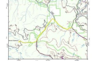
Sumpter, Oregon
Caretakers Cabin
Overview
Caretaker's Cabin allows guests to relax in the outdoors at the historic Fremont Powerhouse site. As one of four cabins loca...
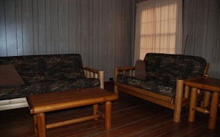
Sumpter, Oregon
Congo Gulch
Overview
Congo Gulch is an old Forest Service cabin that allows guests to relax in the outdoors and step back in time to when the cabin w...
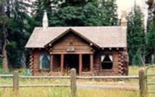
Baker City, Oregon
Peavy Cabin
Overview
Peavy Cabin was built in 1934 by Dr. George Wilcox Peavy, Dean of the School of Forestry at Oregon Agricultural College (later O...
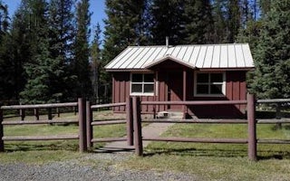
Prairie City, Oregon
Short Creek Guard Station
Overview
Short Creek Guard Station is a great place to stay to enjoy the nearby Monument Rock and Strawberry Mountain wilderness areas, a...
Baker County, Oregon
Anthony Lake Guard Station
Overview
Anthony Lake forms the source of Anthony Creek, named for William 'Doc' Anthony, an ambitious homesteader who came to Baker Coun...
Baker City, Oregon
Union Creek Campground
Overview
One of Eastern Oregon’s largest Forest Service campgrounds, Union Creek Campground is located 18 miles South of Baker City. Sitt...
Unfortunately, we don't have up-to date pricing data for this listing, but you can check pricing through Recreation Gov.
Book NowAdd your business today to reach The Outbound's audience of adventurous travelers.
Community
© 2024 The Outbound Collective - Terms of Use - Privacy Policy


