Sand Island Group Sites
Book this listing through our partner Recreation Gov
About Sand Island Group Sites
Overview
Sand Island Campground’s two group campsites are ideal for groups wishing to be close to the town of Bluff and the San Juan River. The area offers outdoor enthusiasts many options for river floating, scenic driving and rock art viewing.Recreation
Sand Island is the main put-in for the 102-mile section of the San Juan River between Montezuma Creek and Clay Hills Crossing that provides boaters with access to spectacular canyons rich in scenery, geology, archeology, history and wildlife. Within the campground there are numerous petroglyphs and pictographs on the ledges above and it is a popular destination for both sightseeing and bird watching.Facilities
Group Site A is located near the boat ramp and features picnic tables, a fire grate, a shade structure and has water nearby. The site may be reserved in advance for groups of 10 to 20 people for a maximum of fourteen days. Group Site B can accommodate group sizes from 15 to 40 people and is located in Loop B of the campground and features picnic tables, a large fire grate, a shade structure, water on site and a single vault toilet. The group sites do not have dump stations or electric hook ups. There are dumpsters located at the campground entrance.Natural Features
Sand Island Campground is beside the San Juan River.Nearby Attractions
Sand Island is close to Goosenecks State Park, Bears Ears National Monument (Shash Jaa Unit), and Cedar Mesa.Sand Island Group Sites Reviews
Have you stayed here? Be the first to leave a review!
Top Spots in or near Bluff
Raft the Upper San Juan
Bluff, UtahThe "Upper" San Juan is about 27 miles of river, and can be completed in a 2-4 day float. It is a permitted river, and trips launching between April 15 - July 15 obtain permits through a lottery draw negotiated on https://www.recreation.gov/. Applications for this lottery are accepted through the December and January preceding the trip.
The maximum number of people on one permit group is 25, an...
Camp in the Valley of the Gods
Mexican Hat, Utah
5.0
The dirt road loop is relatively smooth and can be driven on by just about any car, campervan, or RV. However, check the weather beforehand because some areas can become flooded after rain and will be a difficult mud crossing. It can be driven in either direction. One entrance is off Highway 163, 15 miles west of Bluff and 7 miles east of Mexican Hat, and the other entrance is off Highway 261, ...
Raft the Lower San Juan River
Mexican Hat, UtahThe put-in for the lower segment of the San Juan river is in the center of Mexican Hat. This is a permitted section of river run by a lottery, and you work to secure a permit through https://www.recreation.gov/permits/250986
Briefly after take off, the canyon walls begin to climb taller above the river, marking the entrance into Gooseneck State Park. Far from the rim, you're likely to see a num...
Goosenecks Viewpoint Trail
San Juan County, Utah
1.86 mi
/ 66 ft gain
For a small entrance fee of $5, you have the chance to photograph a beautiful canyon view without having to hike miles and days to get to it. Enjoy this rare luxury! There is a pavilion with a picnic table for dinner while you wait for the sunset, and there are also bathrooms if you need them.
There is a trail along the canyon rim that will allow you to explore multiple angles and find just...
Camp at Goosenecks State Park
San Juan County, Utah
4.3
Located near the southern border of the state, Goosenecks State Park is a small slice of Grand Canyon views in Utah. The park overlooks the meanders of the San Juan River, and canyons that have eroded over the millennia. This park is great for anyone hoping to learn about geology, get far away from civilization, or take in the natural desert beauty of Utah.This park has primitive, first come, f...
Hike the Honaker Trail
Mexican Hat, Utah
3.5
5 mi
/ 1010 ft gain
In the days of Utah's Wild West gold rush (circa 1890s), a man named Henry Honaker decided to build a supply route from the San Juan River to the cliffs tops, roughly 1200 feet, above. The roughly hewn trail that Henry built; aptly named the ‘Honaker Trail’ was to act as a supply route for the gold miners in the area. Sadly for Henry, the gold rush was short-lived (at least in this part of the ...
Camping and Lodging in Bluff
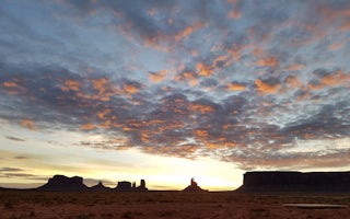
Oljato-Monument Valley, Utah
Monument Valley KOA Journey
Towering red pillars of sandstone give this valley its name and create the striking setting for this new KOA. It's a bold, broad landscap...
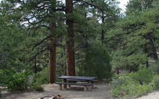
Monticello, Utah
Devils Canyon
Overview
Devils Canyon Campground sits in the Manti-LaSal National Forest of southeast Utah at the foot of the Abajo Mountains. Recreatio...
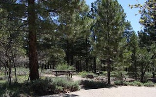
Blanding, Utah
Nizhoni
Overview
Nizhoni Campground sits in the Manti-LaSal National Forest in southeast Utah, at the foot of the Abajo Mountains.Recreation
Popu...
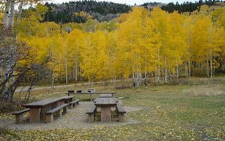
Monticello, Utah
Buckboard
Overview
Buckboard Campground sits in the Manti-LaSal National Forest in southeast Utah at the foot of the Abajo Mountains. Visitors enjo...
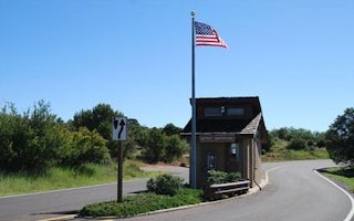
Dolores, Colorado
Mcphee Recreation Complex
Overview
McPhee Recreation Complex is located on the south shore of McPhee Reservoir near the town of Dolores in southwestern Colorado. V...
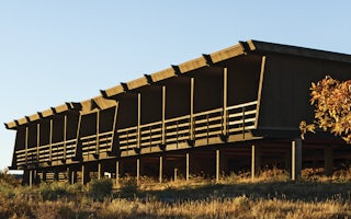
Mesa Verde National Park, Colorado
Far View Lodge
Peaceful and quiet lodge directly inside the park with incredible views. The Far View Lodge was designed to reflect the true essence of t...
From $129 / night
Unfortunately, we don't have up-to date pricing data for this listing, but you can check pricing through Recreation Gov.
Book NowAdd your business today to reach The Outbound's audience of adventurous travelers.
Community
© 2024 The Outbound Collective - Terms of Use - Privacy Policy


