Gooseberry Admin Site Cabins
Book this listing through our partner Recreation Gov
About Gooseberry Admin Site Cabins
Overview
Gooseberry Administrative Site Cabins are located just 18 miles from Salina, Utah. These historic structures were used as Forest Service summer headquarters from 1907 to 1960. Today, the site is used for family reunions, group events, scout and church groups and youth camps.Recreation
Popular activities in the area include off-road vehicle riding, fishing, hiking, biking, horseback riding and wildlife watching. The Great Western Trail runs nearby; two trailheads can be easily accessed near the site.Facilities
This unique facility contains three bunk cabins, one with propane heating, a recreation hall, kitchen and bathhouse. The rec hall has a fireplace, tables and chairs. The kitchen is equipped with a large propane cooking range and oven, three small propane refrigerators, three sinks, a prep and serving area, hot water and two outdoor grills. The bathhouse has flush toilets, sinks and hot showers.Fifty single beds with mattresses are provided. Guests must bring their own linens or bedding, as well as dishes, utensils and cookware. A propane generator is available for electricity and lights for a couple of hours in the morning and evening. Several picnic tables and a campfire ring are located outside.
Guests are required to keep the facility clean during their stay. Maid service is not available. A volunteer host is on-site. Check-out time is by 11 a.m. and check-in time is after 2 p.m.
Natural Features
Gooseberry is situated in the Gooseberry drainage south of Interstate 70 in central Utah at an approximate elevation of 8,000 feet. Dense stands of aspens forest the area, offering shade and beautiful autumn color.Gooseberry Admin Site Cabins Reviews
Have you stayed here? Be the first to leave a review!
Top Spots in or near Salina
Soak at Mystic Hot Springs in Monroe
Monroe, Utah
4.5
The Mystic Hot Springs are truly a hidden gem in Utah. I convinced my boyfriend, after spending the weekend camping in Bryce National Park and mountain biking Thunder Mountain, that we needed to stop and soak on our way home to Park City.
It really wasn’t that hard to convince him. I had already used Google Maps to figure out that it wasn’t that far out of the way. By stopping in Monroe and tak...
Temple of the Sun
Cathedral Road, Utah
5.0
3 mi
Cathedral Valley is a scenic backcountry area in Capitol Reef National Park. It is a remote, stark desert, characterized by amazingly beautiful sandstone monoliths that some say resemble cathedrals. Many of the valleys structures have interesting, highly descriptive names: Temple of the Sun, Temple of the Moon, The Walls of Jericho, amongst others.
The long dirt road out to Temple of the Sun a...
Drive the Cathedral Valley Loop
Wayne County, Utah
60 mi
These set of roads are classified as 4x4 high clearance vehical roads. Not to mention this part of the park is remote and only about 10% of visitors access it.
To get to Cathedral Valley, we were recommended to drive a “loop” by the park ranger, that entailed about 60 miles of high clearance dirt roads. You can pick up a map of this specific area at the ranger station. The start of the journey ...
Hike Lower Cathedral Valley Overlook
Wayne County, Utah
2 mi
/ 150 ft gain
Now most of the pictures you see from Capitol Reef are from cathedral valley. But not many take the time to get above the most photographed area of the park. Off of Hartnet Road, at mile 17.6 you will find a small dirt parking lot for the trailhead (were talking middle of nowhere, so no pit toilet, no fancy sign).
The trail starts in the far left corner of the parking lot, and is not super wel...
Explore the Temple of the Sun & Moon and Glass Mountain
Wayne County, UtahThe temple of the sun and moon are accessed from Cathedral Rd. in Capitol Reef National Park, the road is a 4x4 high clearance vehical road. Upon arriving at the Temples which are called “monoliths”, the giant rocks protrude from the earth, and are something like a fine piece of art. This is a popular spot for photography that only about 10% of park visitors access.
Just to the right of the mon...
Photograph Big Rock Candy Mountain
Sevier, UtahAs you head south on Hwy 89 south of I-70 in central Utah, you wind through a picturesque canyon along the Sevier River. As the canyon opens up, Big Rock Candy Mountain's caramel colored hillside comes into full view. The caramel color is a stark contrast to the other mountains covered in pinion pines.
Back in 1928, Harry McClintock recorded the song "Big Rock Candy Mountain" shortly after tha...
Camping and Lodging in Salina
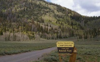
Richfield, Utah
Tasha Equestrian
Overview
Tasha Equestrian Campground is located in central Utah, just 4 miles north of beautiful Fish Lake at an elevation of 9,000 feet....
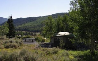
Richfield, Utah
Frying Pan
Overview
Frying Pan Campground is located on the Fishlake Scenic Byway in central Utah, just 3 miles north of Fish Lake, at an elevation ...
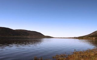
Richfield, Utah
Bowery Creek
Overview
Bowery Creek Campground is located next to Fish Lake in the Fishlake National Forest of central Utah. Visitors enjoy boating, fi...
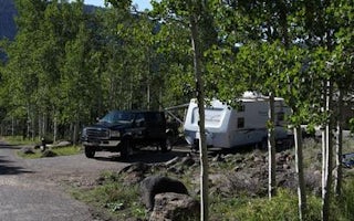
Richfield, Utah
Mackinaw
Overview
Mackinaw Campground is located next to Fish Lake and the Fishlake Scenic Byway in central Utah at an elevation of 9,000 feet. Vi...
Richfield, Utah
Twin Creeks Picnic
Overview
Twin Creeks Picnic Area is is a day-use site located next to Fish Lake, Twin Creeks and the Fishlake Scenic Byway at an elevatio...
Richfield, Utah
Doctor Creek
Overview
Doctor Creek Campground is located next to Fish Lake in the Fishlake National Forest of central Utah. Visitors enjoy fishing, bo...
Unfortunately, we don't have up-to date pricing data for this listing, but you can check pricing through Recreation Gov.
Book NowAdd your business today to reach The Outbound's audience of adventurous travelers.
Community
© 2024 The Outbound Collective - Terms of Use - Privacy Policy


