Port Wing, Wisconsin
Top Spots in and near Port Wing
-
Port Wing, Wisconsin
Explore Twin Falls, WI
3.00.5 miIt’s located on Highway 13 on the outskirts of Port Wing, WI. If you are coming from the west, you’ll see a sign on your right for the park. This will be before you get to the town of Port Wing. If you are coming from the East on Highway 13, you will pass through the town and it’s shortly after ...Read more -
Cornucopia, Wisconsin
Hike to Lost Creek Falls
4.02.5 miThe trailhead has been updated for Lost Creek Falls and can now be found on Trail Drive in Cornucopia. On this well-marked 3-mile trail, there are signs along the trail, new boardwalks, and a larger parking area. This is a very nice trail en route to beautiful falls.Read more -
Cornucopia, Wisconsin
Siskiwit Falls
3.00.35 mi / 7 ft gainSiskiwit Falls is located on the Siskiwit River in Cornucopia. There are a few different drops and slides along the river that can be easily explored. To access the falls (from Bayfield), follow Highway 13 to County Rd C, and take a left on Siskiwit Falls Road. There is a bridge shortly after th...Read more -
Bayfield, Wisconsin
Kayak to the Mainland Sea Caves
5.0GETTING THERE Start your paddle from Meyer’s Beach just off of Highway 13. There is a $5 fee to park in the lot at Meyer’s Beach. At the parking lot there is an area to unload your gear near the stairs that lead to the lake, down which you will need to carry your boat & gear. The area is usua...Read more -
Bayfield, Wisconsin
Hike the Lake Superior Ice Caves
5.01 miBegin at Meyer's Beach in the Apostle Islands National Lakeshore near Cornucopia, WI. There is a parking lot, but get there early in the day to get a spot and make sure to use the bathroom before heading out. There is no opportunity on the ice.Head out onto the frozen lake and follow the shorelin...Read more -
Bayfield, Wisconsin
Meyer's Beach Sea Cave Trail
4.33 mi / 791 ft gainWhile many visitors view the mainland Apostle Island Caves via kayak, this trail provides an alternative view of the caves. The Meyer’s Beach Sea Cave Trail follows 2.3 miles of the Lakeshore Trail, which begins at the Meyer’s Beach parking lot near Cornucopia, Wisconsin. The first 0.7 miles of t...Read more -
Duluth, Minnesota
Photograph Stoney Point Beach on Lake Superior
The AdventureThe work is done. According to The Photographer’s Ephemeris (app.photoephemeris.com) the sun will rise at 7:11 AM. You grab your gear, a hot beverage, and set out for the open road. Scenic 61 follows the shore of Lake Superior all the way from Duluth to Two Harbors, MN. The drive up ...Read more -
Bayfield, Wisconsin
Camp at North Fork Campground
1.0North Fork campground isn't the most sought after campground, but it is a diamond in the rough and a great alternative if Brooklyn Lake Campground and Sugarloaf Campground are full. It is reservable, but they also have an abundance of first come first serve sites available. At 8,600 ft the campgr...Read more -
Washburn, Wisconsin
Houghton Falls
3.01.48 mi / 180 ft gainHoughton Falls State Nature Preserve is a small but mighty park located just north of Washburn, WI. Starting at the trailhead on Houghton Falls Rd, the trail takes you through a heavily forested area filled with hemlock, yew, and birch. About 1/3 mile in, the trail comes across the Echo Dells, a ...Read more -
Two Harbors, Minnesota
Gitchi-Gami from Gooseberry to Split Rock
15.28 mi / 1440 ft gainThe Gitchi-Gami is a paved bike path that will eventually extend from Two Harbors to Grand Marais. As it currently stands (2015), there's a really great segment that starts in Gooseberry Falls State Park and runs all the way to the town of Beaver Bay (total of 16 miles one way). I chose to do a ...Read more -
Two Harbors, Minnesota
Gooseberry Falls
4.6Gooseberry Falls State Park is the first State Park you hit traveling up the North Shore after leaving Duluth. Located 13 miles north of Two Harbors on Highway 61, Gooseberry Falls State Park a quick turn off of the highway which is very well marked with signs. Follow signs for Falls parking. Yo...Read more -
Two Harbors, Minnesota
Snowshoe to Corundum Point at Split Rock Lighthouse State Park
5.8 mi / 240 ft gainAlthough there are dozens of ways to do this trip and I encourage you to explore, I suggest one hike that I think does a good job of introducing this areas to new visitors. If you are planning on snowshoeing like I suggest, try to get a day with a good amount of fresh snow (6+ inches). Packed sno...Read more -
Two Harbors, Minnesota
Hike to the Fifth Falls of the Gooseberry River
3.82 mi / 100 ft gainGooseberry Falls State Park is the first State Park you hit traveling up the North Shore after leaving Duluth. Located 13 miles north of Two Harbors on Highway 61, Gooseberry Falls State Park a quick turn off of the highway which is very well marked with signs. Follow signs for Falls parking. Beg...Read more -
Bayfield, Wisconsin
Kayak to the Sand Island Sea Caves
4.7Sand Island is a part of the Apostle Islands National Lakeshore near Bayfield, Wisconsin. You can (and will want to) explore the sea caves of Sand Island for hours, and this adventure will leave you wanting to explore more of the Apostle Islands National Lakeshore.GETTING THEREYou will start your...Read more -
Bayfield, Wisconsin
Catch a Sunset at Hokneson Fishery
0.16 mi / 11 ft gainBegin at the campground visitor center. Follow the marked paved trail right roughly .08 of a mile. The paved trail ends onto a sandy beach and the abandoned Hokenson Fishery. The trail itself is very short and should take less than 3 minutes to get to.Read more -
Bayfield, Wisconsin
Camp at Little Sand Bay Campground
5.0On a road trip from Kanasas City, MO to explore Lake Superior we stumbled across this amazing campground right on the shore of Lake Superior, Little Sand Bay Campground (34155 State Highway 13, Bayfield, WI 54814). After a long drive, you may want to take a nap :) Once you wake up, check out Mort...Read more
Camping and Lodging in Port Wing
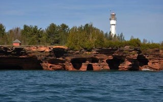
Bayfield, Wisconsin
Apostle Islands National Lakeshore Camping Permits
Overview
The Apostle Islands are Wisconsin's northernmost landscape. Apostle Islands National Lakeshore includes 21 islands and 12 miles ...
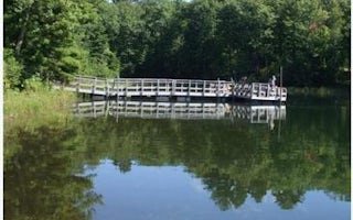
Drummond, Wisconsin
Two Lakes
Overview
Two Lakes Campground is nestled between Lake Owen and Bass Lake. Campsites are spacious and shaded by pine and mixed hardwoods, ...
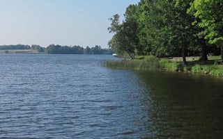
Marengo, Wisconsin
Namekagon
Overview
Namekagon campground is a family-friendly campground that runs alongside its namesake lake, at the headwaters of the Namekagon R...
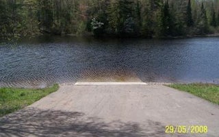
Marengo, Wisconsin
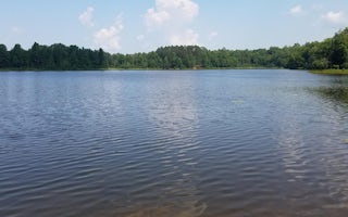
Lake Three
Overview
We apologize, this campground is currently closed.
Recreation
The lake is home to musky, bass and pan fish and offers an ideal s...
Marengo, Wisconsin
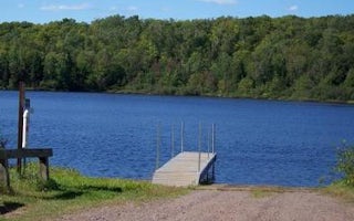
Beaver Lake
Overview
Beaver Lake Campground is a small, secluded, family-friendly campground located on the shores of its namesake lake. The waterfro...
Marengo, Wisconsin
Mineral Lake
Overview
We apologize, this campground is currently closed. Recreation
Boating, swimming and fishing are popular activities among visito...


