Eagle Rock, Virginia
Top Spots in and near Eagle Rock
-
Ripplemead, Virginia
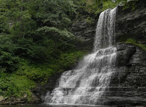
Cascade Falls
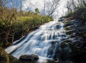
4.93.81 mi / 732 ft gainThe 66' Cascade Falls located in Giles Count is arguably one of the most beautiful waterfalls in Virginia. This classic hike is 4.0 miles and gains 800' in elevation. Located in Pembroke, Virginia, access the trail head by taking Cascade Drive (VA-623) off of US-460 and drive 3.3 miles to the p...Read more -
Hillsboro, West Virginia
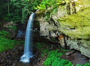
Hike the Falls of Hills Creek, Monongahela NF
5.01.8 mi / 300 ft gainFrom the parking lot, the paved handicap-accessible trail switchbacks to a view of the upper falls (20'). The falls are a bit hard to see from the viewpoint, so it's best to continue down the trail. At the upper falls the trail changes to wooden stairs that descend gradually down. You will cross...Read more -
Hillsboro, West Virginia
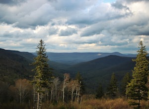
Williams River Overlook
This scenic overlook is along the Highland Scenic Highway. The highway runs through the Monongahela National Forest. The overlook has an amazing view and is a great area to explore. There are two trails that lead off from the overlook and they have a gorgeous spruce forests.Read more -
Newport, Virginia
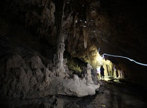
Hike through the New River Cave
4.72 mi / 332 ft gainAfter reaching the parking area, cross the road and continue up the trail for about 0.3 miles. At the kiosk, make sure to register in order to indicate that you are going into the cave. After passing the kiosk and some rocky portions of the trail, you will approach the cave entrance. The cave goe...Read more -
James River Heritage Trail, Virginia
Run on the Seven Rails Trail
3 mi / 117 ft gainEasily accessible from the Percival's Island Natural Area parking lot, the James River Heritage Trail and adjoining Seven Rails Trail are an easy escape from downtown Lynchburg. From the parking lot, follow the trail signs toward Percival's Island, which will almost immediately take you across a...Read more -
Marlinton, West Virginia
Cranberry Wilderness North South Loop Trail
17.1 mi / 1617 ft gainThe Cranberry Wilderness is lesser known, but if you're looking for a rugged escape, this is it. Be mindful of your water intake, as there are a few stretches upwards of 6-8 miles where there is no access to fresh water. Those areas are well-known in most of the hiking blogs/guides (I'd recommend...Read more -
Meadows Lane, Virginia
Camp near Crabtree Meadows in GWNF
5.0As stated, the campsites are free. They do not require reservations or permits and are on a first come, first served basis. Regardless of which direction you're coming from, you will be traveling on Crabtree Falls Highway until reaching Meadows Lane. This is a gravel access road that requires 4WD...Read more -
Raphine, Virginia
Hike to Saint Mary's Falls
4.84.4 mi / 300 ft gainSaint Mary's Wilderness is one of Virginia's largest designated wilderness areas and is an old iron ore mining area. There are two ways to get to Saint Mary's Falls and this Blue Ridge adventure will start you off at the parking area off Saint Mary's Road. Once on Saint Mary's Road, you will dr...Read more -
Raphine, Virginia
Saint Mary's Wilderness
4.56.03 mi / 538 ft gainSaint Mary's Wilderness is an out-and-back trail that takes you by a waterfall located near Vesuvius, Virginia.Read more -
Marlinton, West Virginia
Camp at Day Run Campground
5.0Located in West Virginia’s Monongahela National Forest about half way between Snowshoe and the Cranberry Glades makes this campground an ideal place to set up a base camp while you explore the surrounding area. It is located about five miles from Highland Scenic Highway (HW150), which makes it ju...Read more -
Tyro, Virginia
Spy Rock via Cash Hollow
4.95.71 mi / 1191 ft gainThe hike is part of the George Washington National Forest, and can easily be combined with nearby Crabtree Falls (300ft cascading waterfall with a hike to the top). The entire trip is 5.7 miles, and there are nice campsites at the base of the summit (no water source) if you want to add on this pr...Read more -
Tyro, Virginia
The Priest via Shoe Creek Trail
4.43.01 mi / 843 ft gainStarting at the Upper Crabtree Falls Parking area, continue up the "road" on Shoe Creek Trail for half a mile until you come to the intersection of the Appalachian Trail. That will be the steepest part of the hike. Look for two rocks on either side of the trail with white blazes on them. Take a l...Read more -
Rustburg, Virginia
Explore the Hydaway Outdoor Recreation Center
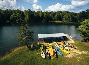
4.3If you love everything outdoors, the Hydaway Outdoor Recreation Center is the place for you! You can do almost any activity you can think of here. If you aren't affiliated with Liberty University, you can't rent their equipment, but you can bring you own to use. The main attraction is the lake wh...Read more -
Blacksburg, Virginia
Float New River
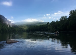
5.0Starting at the "falls" below the New River Junction you can enjoy a three day float trip down to Bluff City near Pearisburg. [Tangent Outfitters in Pembroke can rent you kayaks and shuttle you to the start point and pick you up at the end point if you don't have 2 vehicles to leave] Trip can be ...Read more -
Tyro, Virginia
Crabtree Falls
4.53.05 mi / 1161 ft gainThis is an approximately 3 mile roundtrip hike. It will usually take anywhere from 1-2 hours to get up, depending on your experience and who you have with you, and about an hour down. As you come off of route 56, you will come up to the trailhead where there is a large parking area with restroom...Read more -
Marlinton, West Virginia
Red Spruce Knob
5.01.91 mi / 348 ft gainTo reach Red Spruce Knob trailhead from Marlinton, West Virginia, take HW 219N for about 7 miles then turn left onto HW150. Follow HW150 for about 5 miles, and the parking lot and trailhead will be on the left side of the road. The Red Spruce Knob trail is easy to follow and is well marked with b...Read more

