Vershire, Vermont
Top Spots in and near Vershire
-
Lincoln, New Hampshire
Osceola Mountain via Greeley Pond
4.06.8 mi / 2677 ft gainStart out at the Greeley Pond trailhead off of the Kancamagus Highway. After 1.3 miles the trail splits--bear right to get onto the Mt. Osceola Trail. Continue 1.5 miles to the summit. This summit hike offers a different kind of reward. Views are limited from the peak of Mt. Osceoloa, which allow...Read more -
Stowe, Vermont
Mt. Mansfield via the Long Trail
5.05.27 mi / 2743 ft gainThere are several options to reach the summit of Mount Mansfield. The Toll Road (which, appropriately, has a toll to use it), the Laura Cowles trail, the Sunset Ridge trail, Haselton Trail, the Hellbrook Trail… The most popular trail from the east side of the mountain, however, is the section o...Read more -
Castleton, Vermont
Hike around Taconic Mountains Ramble State Park
Taconic Mountains Ramble State Park is a unique collection of hiking trails and walking paths that meander more than 204 acres of fields, forests, gorges, cliffs, and gardens. The best way to explore these enchanting trails is to pack a picnic and lace up your hiking boots for a full-day ramble. ...Read more -
Jericho, Vermont
Americana and Mobbs Hill Loop
4.02.83 mi / 515 ft gainAmericana and Mobbs Hill Loop is a loop trail that is moderately difficult located near Jericho, Vermont.Read more -
Cambridge, Vermont
Sterling Pond Trail
5.02.28 mi / 876 ft gainSterling Pond trail begins across the street from a parking area on Route 108, about 3 miles south of Smugglers' Notch Resort. Keep in mind that the road is closed to vehicles once the snow falls, so if you want to hike this area in the winter, you'll have to park about 40 minutes away and hike ...Read more -
Cambridge, Vermont
Spruce Peak and Sterling Pond Loop
5.03.38 mi / 1204 ft gainIf you're in New England during September or early October, a drive up north into Vermont is an absolute must for prime fall foliage. I-89 brings you through the state from I-93, and is in itself a beautifully scenic drive. Stowe, Vermont is a small ski resort town located just outside of Mt. Man...Read more -
Jefferson, New Hampshire
Hike the Sugarloaf Trail
3.3 mi / 1099 ft gainThe Sugarloaf Trail begins at the Sugarloaf trailhead on Zealand Road off of US 302. There are two trails that begin at this trailhead--be sure to cross the bridge over the Ammonoosuc and look for the "Sugarloaf Trail" sign. The trail begins following the Ammonoosuc River for a short while before...Read more -
Wallingford, Vermont
Hike the White Rocks Ice Beds Trail
1.6 mi / 180 ft gainThis 1.6 mile round trip hike starts from the Ice Beds parking lot in the Green Mountain National Forest in Vermont. The trailhead is close to the parking lot entrance, following the blue-blazed trail. Be sure to read the signs, as the far trailhead is a hike to the cliffs, not the ice beds. Af...Read more -
Jefferson, New Hampshire
Ski Touring the Pemigewasset Wilderness Traverse
23 mi / 4500 ft gainThe Pemigewasset Wilderness is a 45,000-acre treasure embedded within the spectacular “Whites” of New Hampshire. It’s a remote, less often travelled wilderness than the nearby Presidential Range but no less spectacular. The winter “Pemi Traverse”, a 23 mile tour from Bretton Woods to Lincoln, jum...Read more -
324 State Park Road, Vermont
Hike to Mount Philo
5.01.9 mi / 538 ft gainMount Philo is a great hike year-round with incredible views from the summit. Starting from the bottom, the right hand portion of the loop is ‘paved,’ while the left hand portion is more of a traditional trail hiking experience. Dogs are allowed on this trail, but must be kept on leash. Take caut...Read more -
Waterville Valley, New Hampshire
Sabbaday Falls
4.70.7 mi / 171 ft gainThis awesome waterfall is located right off of the Kancamagus Highway (rt 112) that runs from Lincoln to North Conway, NH. The highway itself is a very scenic drive through the White Mountains that has pull off spots every couple of miles. From I93 take exit 32 for Lincoln. Drive straight throug...Read more -
Jefferson, New Hampshire
Hiking at Pondicherry Wildlife Refuge
4.5As hiking in the White Mountain area goes, this is a pretty easy one. This is a family friendly hike along a rail trail and well maintained forest trails. The main attraction here isn't the difficultly. The main attraction here is the spectacular views and the abundant wildlife.This trail begi...Read more -
Newbury, New Hampshire
Hike to Lake Solitude, NH
4.04.8 mi / 2510 ft gainThe two most popular routes to Lake Solitude are the Newbury Trail and Andrew Brook Trail. The round-trip distance of the hikes are 4.8 miles and 3.8 miles. Both could be described as moderate in terms of difficulty. The Newbury trail is accessed from Lakeview Ave and Andrew Brook Trail can be a...Read more -
Bartlett, New Hampshire
Hike Mt. Carrigain
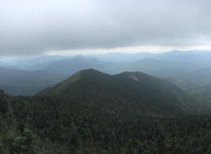
5.010 mi / 3250 ft gainPark on Sawyer River Road at the Signal Ridge Trailhead. Trail starts out as a mild climb and meanders with the Whiteface Brook. When you arrive at the Carrigain Notch Trail junction, turn left. Enjoy three miles of steep uphill along the mountain's edge. When you reach the the apex of Mt. Carrig...Read more -
Hart's Location, New Hampshire
Rappelling at Ripley Falls
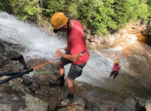
1.5 mi / 0 ft gainThis is a once-in-a-lifetime adventure to rappel down a 100+ waterfall surrounded by beautiful scenes in the midst of the White Mountains. This adventure is organized and facilitated by Northeast Mountaineering who provide gear, guidance, and safety instruction. You will begin your day at the Bu...Read more -
Carroll, New Hampshire
Mount Willard
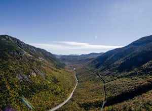
5.03.07 mi / 958 ft gainThis hike begins at the trailhead behind Crawford Depot. The first 1/4 mile of the trail is relatively level. You will cross two small streams before the trail begins to steepen. For much of the trek up to the top of the mountain you will be following an abandoned carriage road. Along the sid...Read more

