Starr, South Carolina
Top Spots in and near Starr
-
Pendleton, South Carolina
Bike the Fant's Grove Trails in the Clemson Experimental Forest
20 mi / 1985 ft gainFant's Grove is part of Clemson University property and is housed inside of the southern end of the Clemson Experimental Forest. The property is managed by Clemson University, and the trail weaves through prescribed burned areas, loblolly pine stands, agriculture fields, wildlife openings and fee...Read more -
Pelzer, South Carolina
Interpretive Jo Peeler Nature Trail
3.70.74 mi / 151 ft gainThere are three loop trail options at this 65-acre park, all beginning at the kiosk. The interpretive Jo Peeler Nature Trail is an easy 0.6 mile tour of the park, while the white trail is rated as a medium length hike, and the blue trail as long. Leashed dogs are permitted at the park.Read more -
Pelzer, South Carolina
Cedar Falls Park Trail
2 mi / 190 ft gainCedar Falls Park Trail is a loop trail that takes you by a waterfall located near Pelzer, South Carolina. The loop is both family friendly and dog friendly (please keep your pup on-leash). There's also a park at the entrance for the kiddos before or after walking/hiking the trail.Read more -
Easley, South Carolina
Doodle Trail
5.07.64 mi / 358 ft gainDoodle Trail is a point-to-point trail that takes you through a nice forest located near Easley, South Carolina.Read more -
Greenville, South Carolina
Lake Conestee Nature Park Loop
2.39 mi / 194 ft gainLake Conestee Nature Park Loop is a family-friendly loop trail located near Greenville, South Carolina. This trail makes for a great stroll and opportunity to do some birdwatching along the route. There are plenty of insects in the warmer months, so you may want to consider packing repellent.Read more -
Comer, Georgia
Explore Watson Mill Covered Bridge
Watson Mill State Park has many different things to offer. The main attraction is the Watson Mill covered bridge. It is the longest covered bridge in Georgia it was built in 1885. The bridge is still driveable today as long as you are in a smaller vehicle I did it in a minivan and had plenty of r...Read more -
Greenville, South Carolina
Hike Swamp Rabbit Trail to Reedy River Falls
4.53 mi / 100 ft gainSwamp Rabbit Trail is a 21 mile-long paved walkway that closely follows the Reedy River in Downtown Greenville. Over a half-a-million people visit the trail each year, but few ever walk the whole thing. What most people don’t know, is that it begins on a different river: the Enoree river and wind...Read more -
Pickens, South Carolina
Hike Glassy Mountain
5.01.3 mi / 200 ft gainThis view never gets old and it is super easy to access. It's also only like half a mile down and then half a mile back up, so if you do watch the sunset, the walk back is easy. The trail is out by Glassy Mountain Church in Pickens, SC and it's accessible year round. The hike is very simple, and ...Read more -
Walhalla, South Carolina
Hike to Issaqueena Falls and Stumphouse Tunnel
4.01.5 mi / 250 ft gainFrom Walhalla South Carolina, follow SC 28 westward 7 miles until you see Stumphouse Tunnel Park on the right-hand side of the road. Take this road halfway down, and park in the parking area on the right. From here, you can travel a short walk to the falls overlook, or, for the more adventurous ...Read more -
Walhalla, South Carolina
Hike to Yellow Branch Falls
5.03 miOnce you have turned into the picnic area off of Highway SC 28, you will see the open and easy parking area. The trail begins at 2 points on the southern end of the parking area. These 2 points form a small loop about 0.2 miles long, with a spur in the middle of the loop onto the main yellow bran...Read more -
Toccoa, Georgia
Explore Toccoa Falls
3.60.2 miPark at the welcome center of Toccoa College.The trailhead is behind the welcome center, starting at the gates to the right of the center. The trail takes you along a creek on a gravel trail. After a short distance, you will reach Toccoa Falls, where the water pours off the rocks from over 180 fe...Read more -
Tamassee, South Carolina
Hike to Lee Falls
4.01.6 miThe Hike: Head out through the middle of the first of three fields, crossing creeks two times as you come to them. At the end of the last field, the trail enters the woods. Hike through the woods for 0.3 mile and take the left fork, crossing a creek , and head toward the larger branch of Tamassee...Read more -
Long Creek, South Carolina
Hike to the Brasstown Falls
4.50.5 miThese waterfalls are absolutely beautiful during the summer greenery and fall foliage, but open to access year around.Driving Directions: From Westminister, follow US 76 West for 11.8 miles and turn left onto Brasstown Road. Follow this road 4.1 miles to FS 751. (The pavement ends in 2.6 miles.) ...Read more -
Salem, South Carolina
Camp on Lake Jocassee
4.7To avoid the regret of cutting your trip too short, go ahead and book a campsite. Come as a walk-in or reserve your site. Either way, you will have to check in at the Park Office. Upon check-in, you will receive your map and general information. Check-in time for camping is 2PM. The only publi...Read more -
Pickens, South Carolina
Paddle on Lake Oolenoy
5.0Part of Table Rock State Park, Lake Oolenoy is a 67-acre lake providing private boat access for kayaks, canoes, or small boats with electric trolling motors.To get to the boat ramp, when traveling on scenic Highway 11, turn Sah Ka Na Ga View Road on the opposite side of the road as the Table Rock...Read more -
Sunset, South Carolina
Hike to Twin Falls, SC
5.01 mi / 0 ft gainOnce you get to the destination there should be a small parking area. At the end of this parking area you will see the start of the Twin Falls trail that will be mostly a flat walk. Follow this trail approximately 0.5 miles to the falls. You will know you are in the right place if the creek is r...Read more
Top Activities
Camping and Lodging in Starr

Anderson, South Carolina
Singing Pines
Overview
Singing Pines Recreation Area consists of 42 acres. The site presently offers day-use and boat-launching facilities consisting...
Starr, South Carolina
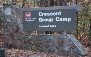
Crescent
Overview
Crescent Group Campground is a 41 acre site located on a narrow peninsula with gentle slopes and a scattered tree cover of pine...
Hartwell, Georgia
Big Oaks
Overview
Big Oaks Recreation Area is a 12 acre gently sloping site with good grass cover and scattered pine and hardwood trees throughou...
Hartwell, Georgia
Watsadler
Overview
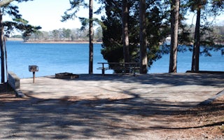
Watsadler Campground is a 36 acre site consisting of a relatively dense cover of pine and mixed hardwoods. The area is ope...
Anderson, South Carolina
Springfield
Overview
Springfield Campground is one of Hartwell’s most popular camping destinations consisting of 60 acres of primarily Virginia pi...
Hartwell, Georgia
Elrod Ferry
Overview
Elrod Ferry Recreation Area is a 39 acre site situated on a gently sloping point that overlooks the lake near Hartwell Dam. ...


