Clearwater, Oregon
Top Spots in and near Clearwater
-
Clearwater, Oregon
Toketee Falls
4.60.79 mi / 98 ft gainToketee Falls is one of the most famous waterfalls in all of Oregon, renowned for the graceful columnar basalt formation framing the two-stepped falls. The North Umpqua River has carved a sinuous gorge out of the lava flow, resulting in a waterfall of 113 feet in height - a 28 foot upper tier whi...Read more -
Idleyld Park, Oregon
Watson Falls
4.30.54 mi / 515 ft gainWatson Falls hurtles over a cathedral amphitheater wall of basalt, crashing into a long talus slope covered in moss and vine maple. At 272 feet, Watson Falls is the 3rd tallest waterfall in Oregon. We actually stumbled upon Watson Falls driving back from Toketee Falls. The parking area is about ...Read more -
Douglas County, Oregon
Umpqua Hot Springs
3.70.52 mi / 108 ft gainWhen you arrive at the hot springs you'll see a bathroom and large dumpster in a small gravel parking lot. From the parking lot you'll see a bridge which leads to the trail up to the springs. Its a 0.25 mile walk up to seven different pools, sitting 150ft. above the North Umpqua River. All the ho...Read more -
Idleyld Park, Oregon
Whitehorse Falls
3.0In June of 2015, I visited as many remote waterfall locations in Oregon as I could find. Whitehorse Falls, located along the Clearwater River in Douglas County, was one of those on my list. It's a small waterfall that is just off highway 138 (about 4.5 miles east of Toketee Falls) in Central Oreg...Read more -
Diamond Lake, Oregon
Clearwater Falls
4.30.15 mi / 7 ft gainThis has to be one of the most overlooked waterfalls in Oregon. It doesn't get a lot of publicity, and it's tucked away in south-central Oregon. As such, many people don't pay it much attention. That's too bad. Clearwater Falls can be found just off Highway 138, near mile marker 69. Clearwater F...Read more -
Douglas County, Oregon
Muir Creek Falls
5.01.08 mi / 135 ft gainMuir Creek Falls Trail is an out-and-back trail that takes you by a waterfall located near Crater Lake, Oregon.Read more -
Douglas County, Oregon
Mt. Bailey and Hemlock Butte Cabin
11.09 mi / 3192 ft gainThe trail starts at 5200 feet and climbs through the forest for 1.6 miles to an opening with a great view off diamond lake and the beautiful and very recognizable Mt. Thielsen. There are several small outcropping here that make a perfect spot to stop and get out the backpacking stove for some mou...Read more -
Crescent, Oregon
Base of Mt. Thielsen via Mt. Thielsen Trail
4.77.26 mi / 1926 ft gainThe Trail begins at Mt. Thielsen Trailhead/Sno Park and takes you up through a vast forest of pines. As you ascend, Diamond Lake will slowly start to peak through. Continue straight at mile marker 1.6 and keep an eye out for Mt. Thielsen ahead. Just before entering Mount Thielsen Wilderness aroun...Read more -
Crescent, Oregon
Mt. Thielsen Summit
2.88.88 mi / 3291 ft gainIt may look quite intimidating from the base and surrounding areas but this hike/climb to the summit is quite straightforward and the standard route is non-technical. That being said, there are areas with some significant exposure with 2200 foot drops on its north and east faces that will definit...Read more -
Tiller, Oregon
South Umpqua Falls
If you are early enough, you can park at the designated day use parking area, which is where the bathroom is. There are picnic benches there along with a path to the top of the falls. If you want to be where the real action is, take the dirt trail down to the bottom of the falls which is less tha...Read more -
Lane County, Oregon
Summit Diamond Peak
9 mi / 3600 ft gainAt 8,743 feet, Diamond Peak is almost as tall as the other iconic volcanoes of the Oregon Cascades, but sees just a fraction of the people. Outside the range of casual Portland day hikes and hard to see from the highway and from other peaks, Diamond Peak and the spectacular wilderness surrounding...Read more -
Douglas County, Oregon
Hike to Susan Creek Falls
4.01.9 mi / 434 ft gainThis hike starts at the main parking lot about a mile away from the falls. The falls are accessed via a very easy, well graded trail developed and maintained by the Oregon BLM.The hike through the forest and pine trees make it for a fantastic and fairy tale-like hike. When you arrive at Susan Cre...Read more -
Prospect, Oregon
Explore the Rogue River Gorge
5.0This 500 ft. long gorge carved out of an old lava tube sits right along highway 62 near Crater Lake. The original road that brought travelers to the National Park passed right next to the gorge but it now remains hidden from view of the current highway. The area isn't large but has a nice parking...Read more -
CRATER LAKE, Oregon
Take a Boat Tour of Crater Lake & Hike to the Top of Wizard Island
4.0Wizard Island is located in the middle of Crater Lake National Park. In order to get out to there you have to book a tour through the commercial concierge. Tickets were fairly pricey, but included a full boat tour of Crater Lake, plus 3 hours on the island itself. Half the tour is before you reac...Read more -
Klamath County, Oregon
The Rim at Crater Lake NP
4.330.99 mi / 4124 ft gainWhy Go? Avoid the crowds in summer and have the entire 33 mile long rim and 21 square miles of beautiful Crater Lake to yourself. Sunrises and sunsets that will take your breath away; stars and a milky way you can get lost in for days. Expect solitude and beautiful scenery, nothing less. The 360 ...Read more -
CRATER LAKE, Oregon
Photograph Crater Lake
4.9Crater is a short 20min drive up Highway 62 off of the 97. We were chasing sunset and caught the last glimmers of twilight. Just driving around the west rim is amazing. Pictures did absolutely no justice to this place, you have to see it with your own eyes...it's MASSIVE!!! Every small pull-off/p...Read more
Top Activities
Camping and Lodging in Clearwater
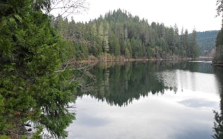
Douglas County, Oregon
Toketee Group Site
Overview
The North Umpqua Wild and Scenic River pauses at Toketee reservoir providing a secure home for a wide variety of wildlife. Here ...
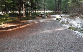
Douglas County, Oregon
Toketee Lake Campground
Overview
The North Umpqua Wild and Scenic River pauses at Toketee Lake providing a secure home for a wide variety of wildlife. Here beave...
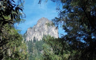
Douglas County, Oregon
Eagle Rock Campground
Overview
Nestled along the bank of the Wild and Scenic North Umpqua River, Eagle Rock Campground offers an excellent setting for the perf...
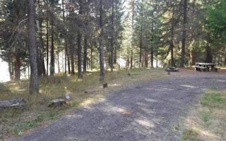
Douglas County, Oregon
Bunker Hill Campground
Overview
This campground clings to the northwest shore of Lemolo Lake beneath the heavily wooded Bunker Hill. Bald eagles often soar abov...
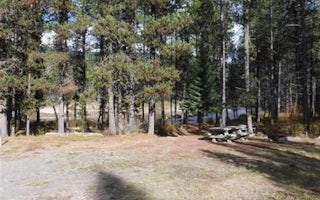
Douglas County, Oregon
East Lemolo Campground
Overview
East Lemolo is on the banks of Lemolo Lake, the highest reservoir on the North Umpqua River at an elevation of 4,150 feet.Recrea...
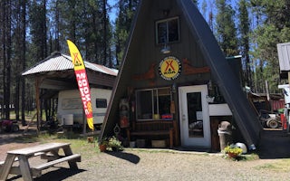
Douglas County, Oregon
Lemolo Lake / Crater Lake North KOA Holiday
Located in the eastern portion of the Umqua National Forest, the property is located on a 540-acre boating and fishing lake with beautifu...


