Applegate, Oregon
Top Spots in and near Applegate
-
Ashland, Oregon
Summit Mt. Ashland
5.05 mi / 1550 ft gainSituated in Southern Oregon right near the California border lies the Siskiyou Mountain Range's tallest peak, Mount Ashland. Mount Ashland is a very popular area for many recreational activities, one of the most popular activities is skiing. The ski area was opened up in 1963 and has changed hand...Read more -
Ashland, Oregon
Hike and Climb Pilot Rock
8 mi / 1000 ft gainPilot Rock is one of the most prominent features in the Cascade-Siskiyou National Monument and is visible from over 40 miles away in the Shasta Valley of northern California and the Rogue Valley of Southern Oregon.Similar to Devil’s Tower in Wyoming, though much smaller in stature, Pilot Rock is ...Read more -
Josephine County, Oregon
Raft or Kayak the Wild & Scenic Rogue River
4.8The Wild and Scenic Section of the Rogue River is a hidden secret in the Pacific Northwest. This virtually untouched 34-mile section boasts some of the most pristine and secluded scenery in Oregon. Bald eagles, osprey, and black bears are frequently (if not always) spotted along the way. This bea...Read more -
Del Norte County, California
Backpack to Raspberry Lake
1.012 mi / 1800 ft gainIf you wish to experience the beauty of the Siskiyou Wilderness and avoid the crowds associated with The Devil’s Punchbowl, then consider a visit to Raspberry Lake. Beginning at the Young’s Valley Trailhead (Coordinates: 41.889919, -123.654755), this hike is a great option for those seeking wide...Read more -
Ashland, Oregon
Hike to Hobart Bluff
2.5 mi / 200 ft gainHobart Bluff is part of the Western Cascades, a range of weathered volcanic mountains that are much older than the High Cascades that most people think of today, the range of Shasta, Rainier, and Hood. These mountains are shorter as a result of the work of time and usually have summits wrapped in...Read more -
Crescent City, California
Devil's Punchbowl, Six Rivers National Forest
4.08.33 mi / 1660 ft gainLocated in extreme Northern California, the Siskiyou Mountains are the largest sub-range of the Klamath Mountain range and among the most rugged. The Siskiyou Wilderness, designated in 1984, encompasses three national forests: Siskiyou, Klamath and Six Rivers for a total of 182,802 acres. Because...Read more -
Jackson County, Oregon
Backpack to Devil's Peak and the Seven Lakes Basin
3.013.7 mi / 3050 ft gainStarting at at elevation of 5250 feet, the trail climbs steadily from the trailhead for approximately 3.3 miles to pass at 6900 feet. From here you will come to a junction where going right will lead to Devils Peak and the PCT and going left (straight) will take down into the basin. If you starte...Read more -
Fort Jones, California
Sky High Lakes in the Marble Mountains
5.011.88 mi / 2070 ft gainThe Marble Mountains are part of the Klamaths, a biologically and geologically diverse range of peaks and ridges often overshadowed by its western neighbors in the Cascades. The Marble Rim is the signature feature of this subrange, a white wall of rock that glimmers in the sun. The nearby Sky Hig...Read more -
Prospect, Oregon
Mill Creek Falls & Barr Creek Falls
5.01.54 mi / 315 ft gainMill Creek Falls is a lesser-known gem in Southern Oregon. At 173 ft it is one of the tallest in the area, and Barr Creek Falls, plunging 240 ft, is less than a quarter mile further down the trail. The viewpoints can be accessed year-round though flows often fluctuate and spring/winter may best f...Read more -
Klamath Falls, Oregon
Hike to the Summit of Mt. McLoughlin
5.09 mi / 3900 ft gainThis is not an easy hike, but every step is more than worth it. Unlike Mount Thielsen to the north, this summit requires no scrambling/climbing; it's just a long, steep hike. Mount McLoughlin (named for John McLoughlin of Hudson's Bay Company and Oregon Trail fame) is a lava cone on top of a comp...Read more -
Prospect, Oregon
Explore Pearsony Falls
0.5 miPearsony falls, located in the Oregon State Park known as Prospect State Scenic Viewpoint, is about 15 feet tall and cascades picturesquely in two sections underneath a green canopy and between mossy rocks. The falls flow year round, though water levels vary with the season. A trip to Pearsony Fa...Read more -
Agness, Oregon
Fly Fish the Rogue River at the Mermaid Riffle
The Steelhead run on the Rogue River is famous the world over and for good reason. Like anywhere, local guides are the gatekeepers to the right spot and should be contacted accordingly. Steelhead run December through March and Chinook April through Fall, with Coho making an appearance in the lat...Read more -
Agness, Oregon
Stand Up Paddleboard the Mermaid Riffle on the Rogue River
The Rogue River is famous the world over for rafting and for its Steelhead runs, possessing a dramatic undeveloped canyon untouched by road and man, and being one of the Original 7 Wild & Scenic Rivers designed by Congress. And not only is it fantastic for rafting but entire sections are perf...Read more
Top Activities
Camping and Lodging in Applegate
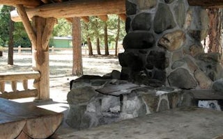
Jacksonville, Oregon
Mckee Bridge Community Kitchen
Overview
Situated along the rocky banks of the Applegate River, the McKee Bridge Community Kitchen is a fantastic day-use picnic shelter ...
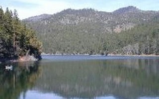
Jacksonville, Oregon
Squaw Lakes
Overview
Squaw Lakes Campground is nestled in the deep shade of a mixed-conifer forest on the banks of Squaw and Little Squaw Lakes. The ...
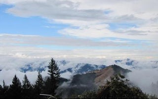
Applegate, Oregon
Squaw Peak Lookout
Overview
Squaw Peak Lookout was constructed in 1942. It is an L-4 style cabin, and is on the National Historic Site Registry. The lookou...
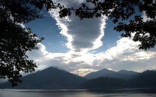
Jacksonville, Oregon
Hart Tish Park At Applegate Lake
Overview
Located in southwest Oregon in the Rogue River-Siskiyou National Forest, Hart-Tish Park is surrounded by a variety of landscapes...
Josephine County, Oregon
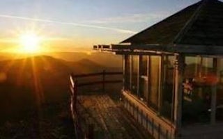
Bolan Mountain Lookout
Overview
Bolan Mountain Lookout is surrounded by glass windows on all sides, providing visitors with an unparalleled view of the sheer dr...
Cave Junction, Oregon
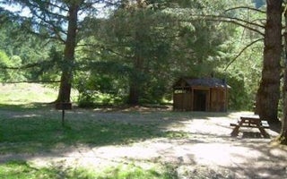
Chinquapin Group Campground
Overview
The Chinquapin Group Campground is located at the former site of the Camp Oregon Caves Civilian Conservation Corps (CCC) camp. D...


