Vandalia, Ohio
Top Spots in and near Vandalia
-
Xenia, Ohio
Disc Golf at Sol Arnovitz Park
This course has some tough points, especially with some water hazards, but for the most part is very forgiving. In many places you can retrieve any discs you lose to the creek, and there aren't any areas of dense thicket or tall grasses that are prone to hide discs so well. Most of the holes are ...Read more -
Yellow Springs, Ohio
Clifton Gorge
4.02.5 mi / 118 ft gainThe entirety of this hike is within the Clifton Gorge State Nature Preserve, a protected park with strict restrictions on off-trail travel with pets prohibited. Starting at the parking lot off of Jackson St, follow the trail northwest along the narrows of Clifton Gorge. Here, the river has carve...Read more -
Cedarville, Ohio
Hike to Cedar Cliff Falls
4.42.6 mi / 250 ft gainStarting from the Indian Mound Reserve parking lot, follow the private drive back until the signs indicate to follow the trail through the woods to the right, about 1/4 mile. Make sure you stay right of the painted yellow line on the road, trespassers on the private land surrounding the park are ...Read more -
Cedarville, Ohio
Hike the Gorge Trail at Indian Mounds
5.0Cedarville, Ohio is known for its expansive farmland, but in the Indian Mounds Park you'll find several unique features, such as the cavern located on the Gorge Trail! This cave is formed out of the side of a cliff and is perfect for easy exploration and climbing. When the water is low enough yo...Read more -
Saint Paris, Ohio
Camp at Kiser Lake
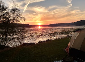
5.0This pet-friendly park has some great sites for lakeside camping, all on the east-end of the lake, giving campers a great view of the sunset. The sites are near a 'field' of lily pads, and the frog calls that emanate from the area make for a relaxing sound to sleep to. There are few trees lakes...Read more -
Springfield, Ohio
Hike the Stone's Throw Trail
4.00.8 miThis 0.4 trail is tiny but mighty! It is hidden up the hill from the CJ Brown Reservoir Visitor Center, and leads down a small wooded path to a less accessed part of the lake. This is a common spot for birdwatching, and a favorite place for Springfield's elusive Great Blue Herons. Follow the p...Read more -
Springfield, Ohio
Stroll along the Dam at the CJ Brown Reservoir
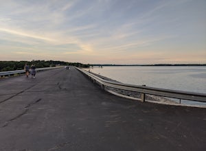
3.01.2 miThis walk is safe, open, flat and perfect for getting some exercise with a view! The dam is 1.2 miles round trip, and open for a variety of activities - walking, jogging, biking, skateboarding, and rollerblading! At the far end of the dam is a long set of stairs leading to the lower parking lot...Read more -
Springfield, Ohio
Swim at Buck Creek SP
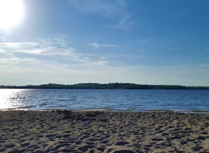
2.5Officially opened in 1975, Buck Creek State Park is home to a 2,120 acre lake with 1,896 acres of land consisting of forests, meadows, a beach, and two dams. On a warm summer day, this beach is the place to be! Plenty of free parking and plenty of space to spread out. It is the only beach in Spri...Read more -
Waynesville, Ohio
Fossil Hunt at Caesar Creek
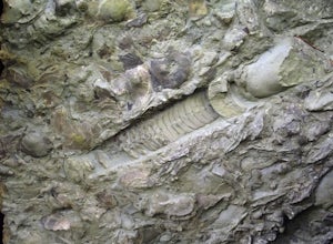
4.7The location of the fossil hunt is within the emergency spillway of the Caesar Creek Dam. Once there, simply look at the ground and at any rocks in the vicinity. It won't take long to find a variety of Ordovician fossils; Trilobites (Ohio's State Fossil), Horn Coral, Gastropods, Brachiopods, and ...Read more -
Waynesville, Ohio
Hike to Horseshoe Falls
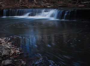
4.02.2 mi / 200 ft gainStarting from the Flat Fork Ridge Recreation Area parking lot near the dam in Caesar Creek State Park, take the trail to the right of the parking lot if you're looking towards the lake. You will hike through the woods for a short period, then emerge onto the emergency spillway from the dam which ...Read more -
Morrow, Ohio
Camp at Morgan's Riverside Campground
5.0The camping spots at Morgan's are right along the Little Miami River, making it a peaceful and beautiful place to camp. There are more than 50 sites to camp at. (Note: not all camp sites are along the water.) The campsites vary in size. There are sites for 2 and sites for 20. There are a decent a...Read more -
West Liberty, Ohio
Explore Ohio Caverns
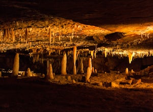
4.81 mi / 80 ft gainOhio Caverns is a locally owned private establishment with guided tours through the cave system that lies beneath the rolling farmland of Central Western Ohio. The caves were formed by the dissolution of the Devonian limestone bedrock below, giving way to some of the most phenomenal cave features...Read more -
Richmond, Indiana
Bike or Run on the Cardinal Greenway
62 miThe Cardinal Greenway has a number of access points within the city of Richmond. The furthest southern access point is off of Test Road just east of the intersection with Abington Pike. There is ample parking here and will allow you to enjoy a short section along the Whitewater River that include...Read more -
Bellefontaine, Ohio
Visit Campbell Hill
0.1 mi / 10 ft gainOne of the easiest of the 50 State Highpoints in the United States to visit, Campbell Hill sits just outside Bellefountaine (pronounced Bell-fountain), Ohio. Sitting on the grounds of the Hi-Point Career Center, Campbell Hill is open to visitors virtually everyday of the year during daylight hour...Read more -
Loveland, Ohio
Loveland Nature Trail
5.00.83 mi / 39 ft gainLoveland Nature Trail is a loop trail where you may see beautiful wildflowers located near Loveland, Ohio.Read more -
Sharonville, Ohio
Hike the Sharon Woods Gorge Trail
1.8 mi / 50 ft gainSharon Woods Metro Park is located just northeast of Cincinnati in Hamilton County. To visit this park it is $3 for a day permit for residents of Hamilton County or $5 for a day permit for non-residents. When you enter the park, take the first left on the road before you cross a bridge over the ...Read more

