Las Cruces, New Mexico
Top Spots in and near Las Cruces
-
El Paso, Texas
Hike the Agave Loop Trail
1.9 mi / 370 ft gainStart your hike at the West Cottonwood trail parking lot. The ascent on the trail is not too difficult. First the trail will take you to the top of the Sneed Cory with good views of the State Park. After that, continue up the mountainside, which has with lots of sotols and agaves as well as many ...Read more -
El Paso, Texas
Hike the Tom Mays Trail
2.6 mi / 502 ft gainHike this trail from the entrance of the State Park all the way to the parking lot of the Schaeffer Shuffle Trail. There are good views of the Franklin Mountains and lots of cacti and wildflowers to enjoy. This trail intersects with the Aztec Cave Trail and the Mundy Gap Trail.Read more -
El Paso, Texas
Hike the Maze-Cardiac Hill trail
5 mi / 639 ft gainThis hike starts just off the Tin Mines trail. It is a moderate hike and has some very good views of the Franklin Mountains and their surroundings. During the summer many beautiful wildflowers can be seen. In the spring cacti can be seen in bloom. Bikers do also use this trail so yield to them w...Read more -
El Paso, Texas
Hike the El Paso Tin Mine Trail
6.6 mi / 1023 ft gainStarted our hike from Chuck Heinrich park and entered the State Park. Hike along the Old Tin Mine Road to the junction of Scenic Road trail. There are many species of cacti and desert plants along the trail. Hiked up the side of the mountain to the site of the old tin mines. The climb is somewh...Read more -
El Paso, Texas
Lazy Cow Trail
7.15 mi / 420 ft gainIt is a fairly open trail with no shade. This trail is best hiked during the cooler part of the year. The trail is sandy with rocky spots along the way. Bikers also use this trail so be careful . The trail is ~7 miles round trip. The trail connects to other trail within the system. I have hiked t...Read more -
County Road A005, New Mexico
Hike to Cox Peak and Mount Riley
5 mi / 1500 ft gainDrove from El Paso to cox Peak this morning. About 45 miles from El Paso. The roads to the mountains are in good condition. Did not hike up the mountain but hiked around the base and enjoyed the views and the cacti. There is not a trail to the top of the mountains and scrambling up the mountain s...Read more -
El Paso, Texas
Granola Bowl Loop Trail
0.66 mi / 167 ft gainThis trail can be hiked at different times of the year. In the spring there are several species in bloom and in the summer wildflowers. There are good views of the Franklin Mountains and West El Paso.Read more -
El Paso, Texas
Hike the Mayberry Trail
1.8 mi / 127 ft gainThis is a great trail to be able to hike year-round. Great place to see wildlife and wildflowers in the spring and summer. Also a great place to see many species of cacti. This trail connects to the numerous trails in Lost Dog system and has great views of the Franklin Mountains.Read more -
El Paso, Texas
South Franklin Mountain from Woodrow Bean Transmountain Drive
3.4 mi / 1 ft gainThis trail is closed for restoration. Please visit the Texas.gov/state-parks website for updates. South Franklin Mountain from Woodrow Bean Transmountain Drive is an out and back hike where you may see beautiful wild flowers located near El Paso, TX.Read more -
El Paso, Texas
Hike Ron Coleman Short Trail
5.01.4 mi / 557 ft gainRon Coleman Short Trail is a 1.4 mile out and back hike where you may see beautiful wild flowers located near Fort Bliss, TX.Read more -
El Paso, Texas
Hike Ron Coleman Trail
1.3 mi / 606 ft gainRon Coleman Trail is a 1.3 mile out and back hike that takes you past scenic views located near Fort Bliss, TX.Read more -
El Paso, Texas
Hike the Vertigo Ridge Trail
1.1 mi / 265 ft gainStart your hike from the Stanton Street parking area. The trail starts a little steep at first but then levels out. There are several connections to other trails. There is a good view of a small canyon and also a cave. The cave is not accessible since it is on the side of a canyon. In the spring...Read more -
El Paso, Texas
Hike Franklin Mountains Ridgeline Hike
5.010.3 mi / 3946 ft gainNote that this trail is only recommended for very experienced or expert hikers. There are some short sections that require rock climbing and there are steep cliffs. Significant upper body strength is needed. If you decide to do the full trail, bring lots of water and food for hydration and energy...Read more -
Sunland Park, New Mexico
Hike Mount Cristo Rey Trail
4.6 mi / 649 ft gainThe trails winds its way up the mountain with several stopping places with crosses and other religious artifacts. On top of the mountain is a very large statue of Christ. This hike provides good views of the Franklin Mountains, El Paso, and Mexico. It is best to hike this trail with a group to be...Read more -
1700 McKinley Avenue, Texas
Hike the Ranger Peak and Directissimo Trails
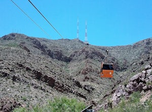
5.02.6 mi / 1230 ft gainTake the Aerial Tramway up to the top. The ride up is short but scenic. Once on the platform, hike the Ranger Peak Trail which affords you good views of the El Paso area and the Franklin Mountains. Return to the parking lot below via the Directissimo trail, which is a rather steep and difficult t...Read more -
White Sands NM, New Mexico
Dune Life Nature Trail
1.8 miStarted the hike at the Dune Life Nature trail parking area. Two rangers took us all on the trail . We walked up and down the dunes and some flat areas. We started out at sunset and the views of the sunset were beautiful. 30 minutes later we walked in the dark with light of the moon. The sand was...Read more

