Montana
Looking for the best hiking in Montana? We've got you covered with the top trails, trips, hiking, backpacking, camping and more around Montana. The detailed guides, photos, and reviews are all submitted by the Outbound community.
Top Hiking Spots in and near Montana
-
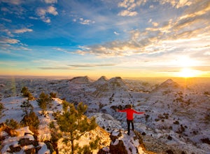
Terry Badlands, Montana
Exploring Terry Badlands
5.0Terry, Montana is a quaint little Southeastern Montana town of about 600 with great food and friendly people. Just 20 minutes down the road you'll find yourself on top of a bluff in the "Terry Badlands" with endless views in every direction. To get there leave Terry heading north on Highway 253 ...Read more -
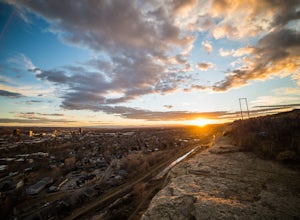
Billings, Montana
Explore The Rimrocks
5.0The Rimrocks (also known as the "Rims") are geological rimrock sandstone formations that outcrop in Billings, Montana. Eighty million years ago the Billings metro area was the shore of the Western Interior Seaway, a sea that went from the present-day Gulf of Mexico to the Arctic North. Sediment a...Read more -
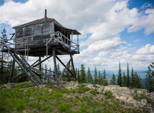
Libby, Montana
Hike to Kenelty Mountain Lookout
10.1 mi / 3502 ft gainStarting from Kalispell, take Hwy 2 west towards Libby. Follow the highway for 62.5 miles until mile marker 57 and turn right in 0.3 miles on to a cut across road for 0.3 miles. Take a left on to Road 763 and follow this road for 3.4 miles and take a right on to an unnamed road for 1.8 miles and ...Read more -
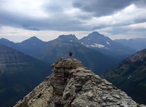
Glacier County, Montana
Pitamakan Pass
15.36 mi / 3064 ft gainThis gripping, 16 mile round trail reveals adventure at every turn. Nestled behind Pray Lake in Glacier National Park, the Pitamakan Pass hike will begin at the North Shore Trailhead. To access this trailhead, a fifteen dollar fee may be payed to cross Pray Lake by boat. If your pocket book is ru...Read more -
West Glacier, Montana
Backpack to Lincoln Lake
16.75 mi / 3747 ft gainIt's a 1600 ft slow increase in elevation. You can walk around the loose rocks going around the lake for an additional 2 miles of hiking. There is a back-country campground at the base of the glacier-fed lake and an amazing waterfall at the opposite end of the of the campground. To camp overnig...Read more -
Glacier County, Montana
Triple Divide Pass Trail to Red Eagle Lake
29.22 mi / 5499 ft gainA couple of notes to keep in mind before you start... this is a loop that takes you to a different part of the park so you will either need two vehicles (one for the pickup spot and one to take you to the trailhead) or you will need to hitchhike back to you drop off vehicle. Also you will need to...Read more -
Florence, Montana
Backpack the Sweeney Creek Trail
14 mi / 2600 ft gainThe hike into Duffy Lake was approximately 7 miles with ~2600' gain. The first mile or two is fairly steep, then it will wiggle up and down the mountain until it drops down into the drainage to the lake. You can hike to Holloway Lake too if the trail isn't completely covered in snow. Late spring ...Read more -
Kalispell, Montana
Backpack to Black Lake
7 mi / 1500 ft gainBegin at Camp Misery (elev. 5,717 ft). This is a total misname by the way! It should be titled Camp On The Way To Awesomeness! Anyway, head .6 miles on Trail 8 to the intersection of trail. From here turn right on Trail 68 and hike .7 miles until the intersection where you turn right on Trail 7 f...Read more -
Swiftcurrent, Montana
Glacier's North Circle Route (North East Section)
9.7 miPlanning & Preparations As amazing as this trek is, it's certainly not without its challenges, and the first one you will run into is obtaining a backcountry permit for camping. As it absolutely should, backcountry camping is very regulated. Essentially, you request permits and multiple da...Read more -
West Glacier, Montana
Hike to the Mt. Brown Lookout
5.0The trail is accessible (though sometimes covered in snow) year-round because the trailhead lies in the lower elevation area of the park. It begins at the Sperry Trailhead, located directly across the street from the lake McDonald Lodge. Follow the Sperry Trail for 1.6 miles until you reach the M...Read more -
Anaconda, Montana
Hike to Fourmile Basin Lakes
Distance: 8 miles round-tripTime: 4 hoursDifficulty: Easy to ModerateTrailhead: 46.135170, -113.207803From MT-1, follow the signs for Trail 44 along Twin Lakes Creek Road until it ends. The trail begins at the end of the road.The area is largely second-growth forest, having been cut several times...Read more -
Sun River, Montana
Hike the First Peoples Buffalo Jump Loop
5.03 mi / 400 ft gainWhile the trail doesn't offer the typical scenery of a Montana hike, the views are spectacular. At the top of the jump, you're at one of the highest points of the basin, allowing you to take in the full magnitude of the surrounding mountains, which include the Big Belt, Little Belt and Highwood R...Read more -
Glacier County, Montana
Hike to Two Medicine Pass
7.9 mi / 2350 ft gainStarting at the South Shore trailhead on Two Medicine Lake (parking available), you'll follow the lake through alternating forest and meadows and eventually cross a small suspension bridge. Afterwards the trail forks. Take the "Two Medicine Pass" trail on the left rather than the Twin Falls/Upp...Read more -
Hamilton, Montana
Hike to Mill Creek Falls
4.56 mi / 650 ft gainThe trailhead is easily visible from the parking area and ascends into a narrow canyon surrounded by dense forest. Mill Creek is not much more than a trickle at the beginning, but slowly gets larger and follows the trail the entire hike. About a half mile in, cross the log bridge over Mill Creek....Read more -
Livingston, Montana
Summit Arrow Peak
2.4 mi / 3600 ft gainStarting in Livingston, MT, take Hwy 89 for 16 miles and take a left on Mill Creek Road. A junction with Road 540 will be reached. At this junction, continue on Mill Creek Road for another 8 miles until a large rock gully on the left is present and a wooden fence is on the right. The route is not...Read more -
Ousel Falls Road, Montana
Short Hike to Ousel Falls
5.01.6 mi / 250 ft gainThe trailhead is easy to find, and has a vault toilet and a decently sized parking lot. The trail leaves from right next to the toilets, and is very easy to follow. Follow a couple easy switchbacks down the hillside, cross the memorial bridge and stop to take in the beautiful scenery before follo...Read more

