Montana
Looking for the best hiking in Montana? We've got you covered with the top trails, trips, hiking, backpacking, camping and more around Montana. The detailed guides, photos, and reviews are all submitted by the Outbound community.
Top Hiking Spots in and near Montana
-
Gallatin Gateway, Montana
Hike to Emerald and Heather Lake
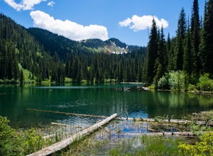
5.010.9 mi / 2000 ft gainOnce in Bozeman, Take 19th Ave. south to Hyalite Canyon Rd. Turn left and continue past Hyalite Reservoir; when the road splits, take the left fork toward Palisade Falls. Continue past Palisade Falls to the end of the road. The trailhead is immediately ahead of you. This hike is around 11 miles t...Read more -
Victor, Montana
Hike to Bear Creek Falls
5.03 mi / 400 ft gainThe trailhead is well established with a small campground and bathroom facilities.The hike begins in dense forest and slowly climbs over Bear Creek through a canyon. You get your typical (but always beautiful!) Bitterroot scenery: jagged rocky mountains towering over you on each side.At 1.5 miles...Read more -
Browning, Montana
Hike Dragon's Tail Ridge
3.53 mi / 1800 ft gainStarting from Logan's Pass, make your way along the boardwalk that leads to the Hidden Lake Overlook. Depending on the previous winter, there may be quite a bit of snow covering large portions of the boardwalk and trail that leads to Dragon's Tail, so it is suggested that you take any necessary p...Read more -
Heron, Montana
Ross Creek Cedars Loop
5.00.87 mi / 151 ft gainThe Ross Creek Cedar area is a really cool area in Northwest Montana that houses some monstrous Western Red Cedar Trees (some of which have a diameter of over 12 feet and over 500 years old!). The grove is one of the few in the area that still has some really beautiful old-growth forest. Due to i...Read more -
Wilsall, Montana
Summit Hardscrabble Peak
5.04 mi / 1900 ft gainLocated in the Bridger Mountain Range, Hardscrabble Peak offers a scenic hike just outside of Bozeman, MT. The Peak sits just north of the more popular Sacagawea Peak and from atop grants views over the Gallatin Valley as well as surrounding mountain ranges such as the Big Belts, Crazies, Tabacco...Read more -
Hamilton, Montana
Hike Blodgett Canyon Overlook
4.73 mi / 400 ft gainThe drive up forest service road 735 can be a little sketchy. Caution is advised during winter months or if the road is wet or muddy. The road dead ends at the Canyon Creek/Blodgett Overlook trailhead. There is ample parking space and an outhouse. Begin on the Canyon Creek trail and hang a rig...Read more -
Browning, Montana
Reynolds Mountain
4.511 mi / 2500 ft gainReynolds Mountain stands high above the Logan Pass Visitors Center. Because of it's easy location, be prepared to get caught in the heavy rush of tourists on the way up. Though most will not be going to Reynolds Mountain, you will still need to "wade" through heavy tourism to reach the trail he...Read more -
Big Sky, Montana
Summit Beehive Peak
5 miBeehive Basin has it all, a mini playground for outdoorsmen. My first visit was during the winter one year ago. We hoped to ski The Fourth of July Couloir, but conditions were not ideal and we left thinking about all the possible ski routes.I’ve been up numerous times since, running and climbing....Read more -
Browning, Montana
Swiftcurrent Lookout
16.68 mi / 4491 ft gainTake this beautiful hike up Swiftcurrent Mountain to the Fire Lookout (8436 ft). The hike is 7.1 miles one-way from from the Swiftcurrent Inn parking lot trailhead. The elevation gain is 2,307 feet. The First 3 miles or so are a flat hike where you'll pass by several famous lakes and gain only ...Read more -
West Glacier, Montana
Camp at Bowman Lake
5.026.85 mi / 3005 ft gainBowman lake is the 3rd largest lake in Glacier National Park and one of the most remote areas accessible by car. The drive out on a dirt road is slow and bumpy but the reward is an area without crowds and lots of adventure potential. The first-come-first-served campground offers 48 sites near t...Read more -
Anaconda, Montana
Backpack the Warren Pass Loop
12 mi / 2000 ft gainOften overlooked due not to its lack of scenery, but rather because of its proximity to both Yellowstone and Glacier National Parks, the Anaconda-Pintler Wilderness in southwest Montana is a haven for hikers and backpackers seeking a true wilderness experience. Established in 1964, the area strad...Read more -
Gallatin Gateway, Montana
Hike to Garnet Mountain Lookout
5.07.7 mi / 2800 ft gainStarting in Bozeman, travel south of Gallatin Gateway about 5 miles on Hwy 191 and turn left on to Storm Castle Creek Road. Follow this road for about 3.5 miles until the road ends. At this point, there is a decent sized parking area. The trail is open year round with ATV access and also snowmobi...Read more -
Troy, Montana
Kootenai Falls and Swinging Bridge
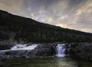
5.01.59 mi / 200 ft gainKootenai Falls is accessed via short dirt trail from the parking lot on Highway Two between Troy and Libby. In the summer the parking lot is often full and even has some vendors selling objects and food. The trail is easy to follow and winds through the forest before descending towards the rive...Read more -
Columbia Falls, Montana
Hike to Apgar Lookout
4.57 mi / 1850 ft gainPrecursor: I completed this hike in November, hence the snow in the photos. Due to a lack of tree coverage, this hike is best suited for a cool summer day, or in the late spring and early autumn. It is doable in the heat of the summer, but be sure to pack plenty of water. This hike begins by tre...Read more -
Bigfork, Montana
Hike to Bond Lake
5.011.6 mi / 2300 ft gainFrom Kalispell, head south towards Swan Lake along Highway 83 until a sign for Bond Creek Trailhead is located on the east side oft the road near mile marker 71. Turning onto Forest Service Road #680 and after 1.5 miles, turning on FS Road #9507, the trailhead will be 2.3 miles after the intersec...Read more -
Glacier County, Montana
Upper Two Medicine Lake
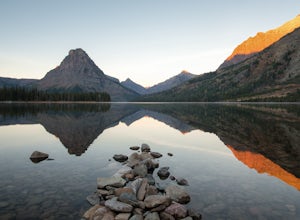
9.67 mi / 719 ft gainI did this trip during the end of autumn, and was pretty much the only person on the entire lake. With it being so serene and so quiet, I had the perfect nature getaway. I made sure to watch an epic sunrise on Two Medicine Lake, then spend the day taking my time to the upper lake and back, with a...Read more

