Elliston, Montana
Top Spots in and near Elliston
-
Helena, Montana
Continental Divide Trail: MacDonald Pass to Priest Pass
5.010.8 mi / 2500 ft gainThe CDT trail is a popular trail with thru-hikers, and is considered one of the three Crown Jewels. The Appalachian Trail and the Pacific Crest Trail being the other two. This section of the Continental Divide Trail starts 25-minutes to the West of Helena just off Highway 12 at the CDNST Trailhe...Read more -
Helena, Montana
Prospect Shaft Trail
2.4 mi / 800 ft gainThe Prospect Shaft Trail is a lightly used trail used to reach the summit of Mt Helena. The trail is rated as a 'moderate' trail due to its steep, loose, rocky surface. Due to these characteristics, it's rarely used for mountain biking and primarily used for hiking and trail running. The views a...Read more -
Helena, Montana
1906 Trail
3 mi / 1000 ft gainLocated just outside of Helena, the 1906 Trail starts at the Mt Helena Parking Lot. The path is wide enough to share with hikers, trail runners, or mountain bikers. Note: this is an uphill-only trail for mountain biking. It's a very popular trail due to its wide trail and awesome views from the t...Read more -
Helena, Montana
Rodney Ridge Trail
2.6 mi / 300 ft gainWith it's easy access from Rodney Street, Rodney Ridge Trail is a locals favorite. The trail heads up the ridge and provides fantastic views of Helena below. The trail is rated as moderate, and is used primarily for mountain biking and hiking. Dogs are allowed, so, you'll most like encounter a 4...Read more -
Helena, Montana
Mount Ascension
3 mi / 950 ft gainMount Ascension is a popular trail in Helena. It's used for hiking, trail running, and mountain biking. It can be accessed year-round, but can get icy and slippery during the winter. The path for Mount Ascension is a network of trails that that can be done as an out-and-back, or a lollipop trail...Read more -
Deer Lodge, Montana
Summit Mount Powell
11.6 mi / 4730 ft gainFrom Interstate 90, exit at Racetrack #195. Continue west for one mile and turn north at a T intersection. Follow the road for about 0.75 mi. to Quinlan Rd. and continue west with a dogleg south for 3.5 mi. Take a sharp right to the north east to a Y and take the left fork. After about 0.07 mi., ...Read more -
Lincoln, Montana
Hike the Continental Divide Trail via Roger Pass
2.33 mi / 665 ft gainAfter driving over Rogers Pass more times than I can count, we finally made it a point to stop and check out the Continental Divide Trail No. 440 -- glad we did. If you've driven the pass, you've seen the trail head about 66 miles west of Great Falls -- the wooden stairs off the right side of th...Read more -
Helena, Montana
Four Wheel Drive and then Hike to Historic Mann Gulch
2.4 mi / 1535 ft gainIn 1949, a fire started in a remote area of the Gates of the Mountains wilderness, a gulch east of the Upper Missouri River. Fifteen smokejumpers were dropped in to fight it. Thirteen died. The United States Forest Service drew lessons from the tragedy of the Mann Gulch fire by designing new trai...Read more -
Anaconda, Montana
Photograph the Falls at Lost Creek State Park
5.0Drive along the park road until the road loops back near the campground. Park in any available space. From here, the falls are a short, 200 yard walk down a paved trail. Be sure to wear slip resistant shoes that you don't mind getting wet.After photographing the falls, be sure to follow the trail...Read more -
Lincoln, Montana
Pick Huckleberries at Reservoir Lake
If you live anywhere near the Pacific Northwest, you've likely heard of huckleberries -- if you haven't, what are you doing with your life? These juicy little gems are worth every once it takes to pluck them from the bush. While there are plenty of places to pick huckleberries in Northwestern Mon...Read more -
Wolf Creek, Montana
Fly Fish the Missouri River from Holter Dam to Cascade.
5.0Due to the cold water being released from the bottom of Holter Lake, it creates excellent habitat for trout. The section of the Missouri River from Holter Dam to Cascade, MT is the main area for trout fishing, and has excellent access to the river. This section of river runs through the valley w...Read more -
Lewis and Clark County, Montana
Rock Climb and Explore Hellgate Gulch
Known as one of the most serene climbing areas in Montana, as well as some of the best sport climbing in the state, if you're a climber, Hellgate Gulch is worth the visit. Within 30 miles of Helena, you'll be climbing on limestone's funky pockets. There are plenty of climbing options, and most of...Read more -
Helena, Montana
Explore Refrigerator Canyon
0.5 mi / 100 ft gainThe Refrigerator Canyon Trail is a scenic trail that leads into the Gates of the Mountains Wilderness. While this trail goes back for up to 16 miles, for this adventure, we will focus on the first half-mile of the trail. The first half-mile of Refrigerator Canyon Trail is the most scenic and uniq...Read more -
Butte, Montana
Hike Maud S. Canyon Loop
4 mi / 994 ft gainMaud S is a great moderately traveled trail that weaves you through dry grassland, forests, and provides you with beautiful mountain views totaling 994 ft of elevation gain. You will find people hiking, running hills, mountain biking, and walking their dogs on this trail. After completing the ste...Read more -
Anaconda, Montana
Ski or Snowboard Discovery Mountain
Discovery Ski Area is an alpine ski area in the small town of Anaconda, Montana. With over 2,200 acres of skiing and over 8,000 feet of elevation at the summit, you can find an adventure to fit any skill level. After entering Anaconda take the Pintler Veterans Memorial Scenic Hwy south towards G...Read more -
Anaconda, Montana
Hike to Fourmile Basin Lakes
Distance: 8 miles round-tripTime: 4 hoursDifficulty: Easy to ModerateTrailhead: 46.135170, -113.207803From MT-1, follow the signs for Trail 44 along Twin Lakes Creek Road until it ends. The trail begins at the end of the road.The area is largely second-growth forest, having been cut several times...Read more
Top Activities
Camping and Lodging in Elliston
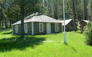
Helena, Montana
Moose Creek Cabin
Overview
Moose Creek Cabin is situated in an grassy clearing surrounded by conifer forest in the Tenmile Creek drainage west of Helena, M...
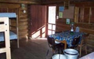
Elliston, Montana
Kading Cabin
Overview
Kading Cabin is located 16 miles south of Elliston, Montana in Helena National Forest. This site has served the Forest Service s...
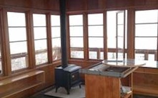
Lewis and Clark County, Montana
Granite Butte Lookout
Overview
The Granite Butte Lookout is located at 7,587 feet above sea level atop the Continental Divide of North America. The 15' by 15'...

Helena, Montana
Helena North KOA Journey
The Helena North KOA sits in the shadow of Mount Helena in the capital of Montana, halfway between Yellowstone and Glacier National Parks...
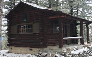
Montana City, Montana
Strawberry Cabin
Overview
Explore a magnificent recreation and wildlife resource at the doorstep of Montana's Capital City. From prairie to alpine, mayfli...
Goldcreek, Montana
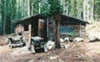
Doney Cabin
Overview
DUE TO EARTHQUAKE DAMAGE THIS CABIN IS NO LONGER FOR RENT AND IS OFF THE SYSTEM.
Recreation
Facilities
Natural FeaturesNearby...


