Malad City, Idaho
Top Spots in and near Malad City
-
Saint Charles, Idaho
Hike to Bloomington Lake
4.80.5 miBloomington Lake is deep in the mountains West of a small town called Bloomington. The road from the town to Bloomington Lake is a narrow dirt road. It takes about 35 minutes to take this road and most cars should be able to handle it. There's plenty of parking at the trailhead and some bathrooms...Read more -
Richmond, Utah
Hike Mt. Magog
5.05 mi / 1702 ft gainMt. Magog is one of the most visually striking mountains in the Bear River range. With its very rocky peak being visible from Tony Grove, it is often photographed, but rarely ever hiked. It is rarely hiked because there is not actually an official trail that goes to the summit. This makes the hik...Read more -
Richmond, Utah
Backpack to White Pine Lake, Logan
4.57.6 mi / 1344 ft gainYou will start from the Tony Grove Lake parking lot and start hiking northeast on the White Pine Lake trailhead. The trail is roughly 3.8 miles to the lake through beautiful Quaking Aspens and Pines. The first 2.5 miles are fairly easy with a slight incline. You will then reach the top of a ridge...Read more -
Logan, Utah
Hike to Saddleback Mountain Reflectors
2.6 mi / 2302 ft gainHead east on the road going into Green Canyon, and just before the road turns Northeast, you will see a short dirt road continuing up towards the mountain next to a small power station. You can park anywhere along here. The trailhead is at the top of this road. The trail is hard to spot, but you ...Read more -
Logan, Utah
Hike to the Wind Caves, UT
4.53.7 mi / 1000 ft gainAs you drive up Logan Canyon, you'll see the trailhead on the left side of the road, just after Guinavah-Malibu Campground. It's a fairly steep hike, but also very well maintained. The Wind Caves are probably the most popular hike in Northern Utah and for a good reason. As you can see in the pict...Read more -
Logan, Utah
Hike the Crimson Trail
4.5From the start of Logan Canyon, it's a 4.3-mile drive up the canyon. Pull over at the Guinavah-Malibu campground (between mile marker 466 and 457). Enter the campground and drive to the east, over the Logan River bridge. The trailhead starts between campsites 29 and 30. Beginning at an elevation ...Read more -
Wellsville, Utah
Box Elder Peak
4.37.57 mi / 3986 ft gainFrom the Rattlesnake Trailhead (about a mile northeast of the Sherwood Hills Resort on U.S. 89) to the peak is just under 4.5 miles. The hike is great exercise, as it's relatively steep. The steep angle provides for stunning views along the entire trail, making this one of the most picturesque hi...Read more
Top Activities
Camping and Lodging in Malad City
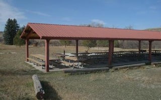
Malad City, Idaho
Third Creek Group Site
Overview
Third Creek Group Campground is located just 12 miles northeast of Malad, Idaho, on the Weston Highway near Deep Creek Reservoir...
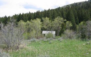
Downey, Idaho
Malad Summit Guard Station
Overview
Malad Summit Guard Station is located 14 miles north of Malad, Idaho on Malad Pass just off I-15. The rustic one-room cabin is i...
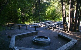
Downey, Idaho
Malad Summit Campground
Overview
Malad Summit Campground is situated next to Mill Creek, just 14 miles north of Malad, Idaho, at an elevation of 6,100 feet. Visi...
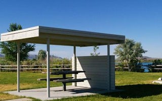
Holbrook, Idaho
Curlew Campground
Overview
Curlew Campground is located just seven miles north of Snowville, Utah, and fewer than 10 miles south of Holbrook, Idaho. The ca...
Preston, Idaho
Albert Moser
Overview
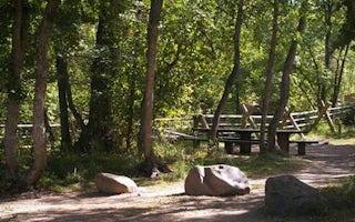
Albert Moser Campground is situated on the banks of the Cub River about nine miles from Preston, Idaho. Built by the Civilian Co...
Preston, Idaho
Cub River Guard Station
Overview
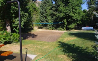
Cub River Guard Station was established in 1907, and the first cabin was built in 1909 about a mile from the current site. This ...


