Red Cliff, Colorado
Top Spots in and near Red Cliff
-
Kremmling, Colorado
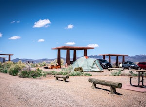
Camp at Wolford Mountain Reservoir
If a nice relaxing adventure is what you seek, this is the place for you. There aren't a lot of super scenic, adrenaline pumping hikes at this campground, but there are well established campsites with beautiful sunrise and sunset views. If you're a photographer, the midnight sky on a moonless nig...Read more -
Glenwood Springs, Colorado
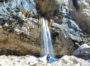
Spouting Rock via Hanging Lakes Trail
4.42.85 mi / 1529 ft gainTo get to Spouting Rock you need to take the same trailhead as Hanging Lake. I made the hike in the offseason when there was still ice on the trail and using crampons were imperative. The hike to Hanging Lake is rather steep and while it's only about 1.2 miles long it takes about an hour. Once yo...Read more -
Glenwood Springs, Colorado
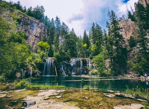
Hanging Lake
4.73.06 mi / 1168 ft gainHanging Lake is a beautifully unique natural wonder. Surrounded by dramatic, pine tree lined cliffs, a unique community of hanging plants thrive beside waterfalls cascading in to this glimmering turquoise pool of water. If this isn’t enough to entice you- the trail leading up to the lake is rathe...Read more -
Idaho Springs, Colorado
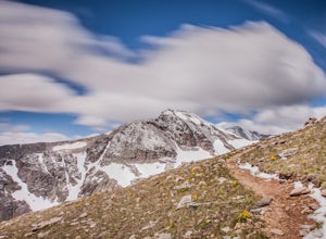
Hiking James Peak (13,294')
8.3 mi / 3000 ft gainJames Peak is one of 76 13,000'+ peaks in Colorado's front range. On your way up to the peak you will pass St. Mary's Glacier. It is not an actual glacier yet a permeant snow field that is popular among skiers and snowboarders year round. St. Mary's Glaicer is a very popular destination (though m...Read more -
Carbondale, Colorado
Camp at Prince Creek
3.0From Colorado State Highway 82, turn south onto Highway 133 (toward Carbondale). Continue south past the Carbondale Main Street roundabout. After two miles, turn East onto Prince Creek Road. Follow this four miles to where the pavement ends. After passing through a cattle gate, BLM land lines the...Read more -
Carbondale, Colorado
Mountain Bike Prince Creek
Turn south off Colorado State Highway 82 onto Highway 133 toward Carbondale. Continue south past the Carbondale Main Street roundabout. After two miles, turn East onto Prince Creek Road. Follow this four miles to where the pavement ends. This is the best place to park to start biking or running.F...Read more -
Buena Vista, Colorado
Hike Davis Meadow
5.08.6 mi / 800 ft gainThis is a great hike that is very close to Buena Vista, CO. This trail is on the east side of town and is accessible in the spring. The hardest part of the hike is locating the trail-head. It is located in the northern part of Four Mile Canyon and is in San Isabel National forest. Starting in Bue...Read more -
Idaho Springs, Colorado
Hike St. Mary's Glacier
4.32 mi / 467 ft gainJust West of Idaho Springs on I-70 take the St. Mary's Alice Exit. Take a right and stay on the main road and follow the signs for about 8 miles (watch on the right side of the road for a surprise pink pig). There are two parking lots for the trailhead. The larger one is South of the trail and a ...Read more -
Buena Vista, Colorado
Hike Mt. Harvard
14 mi / 4600 ft gainStart your hike at the North Cottonwood Creek Trailhead. The trail begins at the end of the parking lot. You'll cross a bridge and meander along the creek, eventually reaching another bridge crossing at about 1.5 miles.After this bridge, you'll reach a trail junction. Be sure to go right (towards...Read more -
Buena Vista, Colorado
Backpacking to Kroenke Lake
9 mi / 2750 ft gainStarting at the North Cottonwood trailhead just outside of Buena Vista, Colorado. This hike will take you 4.5 miles to the lake with about 2750 feet of elevation gain. The hike is mostly mellow and you'll likely see hikers heading up to Horn Fork basin to hike Mt. Harvard and Columbia. Campsites ...Read more -
Hartsel, Colorado
Ice Fishing Antero Reservoir
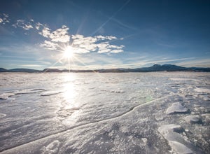
The Antero Reservoir was the first dam built on the South Platte River. The reservoir is best known for its large rainbow trout and rainbow x cutthroat hybrid trout. It's also home to brown trout, snake river cutthroat trout, cutthroat trout, brook trout, and splake.The earth filled Antero Dam wa...Read more -
Carbondale, Colorado
Trail Run Mushroom Rock and Red Hill
5.03 miMushroom Rock sits high above Colorado Highway 82 overlooking the town of Carbondale. With huge views up the Crystal and Roaring Fork River Valleys, terrain that inspires more desert-Utah than Rocky-Mountain-Colorado, this recreation area feels like a getaway even when it is minutes from Main Str...Read more -
Nederland, Colorado
Hike Rollins Pass to Devils Thumb
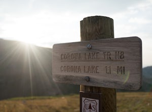
2.1 mi / 622 ft gainCorona Lake is an easy, short hike if you're pressed for time. It's scenic, secluded, and will put you in a great spot to hike to Devils Thumb the next day. There are two ways to reach Devils Thumb. This is considered the "easier" route because of the "lack of elevation gain." The sun and wind re...Read more -
Bailey, Colorado
Payne Creek Trail via Brookside McCurdy Trailhead
4.517.98 mi / 3773 ft gainDay 1: Park at the Payne Creek/Brookside Trailhead (8,040 ft.) right outside Bailey. You'll go on the trail for about a mile before the trail parts to Craig Meadows or Craig Park. If you start this in the nighttime, it's best to camp before you part ways on the trail as it's a little more spaciou...Read more -
Idaho Springs, Colorado
Hike Chief Mountain, CO
4.54 mi / 1100 ft gainSitting at 11,709’, Chief Mountain is not one of Colorado’s highest peaks, but the views from this mountain are spectacular nonetheless and rival the views of any 14er I’ve climbed. This mountain sits along Squaw Pass Road so you get the luxury of a high trailhead for this peak.To get there, foll...Read more -
Aspen, Colorado
Backpack to Copper Lake
10 miLooking for a wildflower hike, we decided on Copper Lake in the Maroon Bells Wilderness as a place to base camp for 4 nights. It is 5 miles from the Trailhead, which is off Gothic Road above Crested Butte (2WD Accessible).Copper Lake is this beautiful alpine lake, situated right at treeline, with...Read more

