Powderhorn, Colorado
Top Spots in and near Powderhorn
-
Gunnison, Colorado
Hike the Dillon Pinnacles Trail
4 mi / 300 ft gainThe Dillon Pinnacles are a geologic phenomenon of southern Colorado. Volcanic eruptions formed the breccia rock into towering spires above the Sapinero Basin of Blue Mesa Reservoir. This packed dirt trail starts at about 7500 feet and climbs to a max elevation of 7800 feet. The four mile out-and-...Read more -
Lake City, Colorado
Uncompahgre Peak (14,309')
5.07.3 mi / 2881 ft gainAt 14,309 feet, the summit of Uncompahgre Peak is the highest point in the entire San Juan range, but getting to it requires only good hiking skills, good physical shape, and a four-wheel-drive, high-clearance vehicle to get to the trailhead. From Lake City, head west along the Alpine Loop about...Read more -
Lake City, Colorado
Capture Fall Foliage and Whitmore Falls on Engineer Pass
5.0Just outside of the small community of Lake City, Colorado is Engineer Pass, a dirt road that has amazing views and opportunities to hike, take pictures, and maybe even explore an abandoned mining town. Four wheel drive or all wheel drive is preferable, but the road can definitely be driven by a ...Read more -
Lake City, Colorado
Backpack to Wetterhorn Basin
13 mi / 3000 ft gainThis trip is for the lover of solitude and the appreciator of the unscathed backcountry. Wetterhorn Basin is in the heart of the beautiful San Juan Mountain range in Southwestern Colorado.With a 4WD high clearance vehicle start at the West Cimarron Trailhead at 10,750 feet (38.1117N -107.5533W),...Read more -
Lake City, Colorado
Explore Nellie Creek Falls
5.00.8 mi / 300 ft gainNellie Creek Falls is a beautiful little falls, up County Road 23. The waterfall is surrounded by a forest of aspens leading up the valley. To get to the falls take the northern route of the Alpine Loop from Lake City towards Engineer Pass. In about 5 miles you come to Nellie Creek Road on the ri...Read more -
Gunnison, Colorado
Camp at Hartman Rocks
3.0Just 3 miles outside the small south central town of Gunnison, Colorado lies Hartman Rocks recreation area. This 8000 acre open space includes 40 miles of single track trails as well as 33 miles of road. Camping at Hartman Rocks is the perfect way spend a relaxing night, or get an early start to ...Read more -
Gunnison, Colorado
Mountain Biking in Colorado's Hartman Rocks
4.0Drive four miles south of Gunnison, Colorado and you'll find Hartman Rocks. Meet up with your friend at the parking lot at the base and head out with your bikes onto Jack's Trail, a singletrack trail that takes you onto the main routes through BLM land.Kiosks throughout Hartman Rocks have maps wh...Read more -
Lake City, Colorado
Hike Redcloud and Sunshine Peaks
5.012 mi / 4800 ft gainThe easier drive to the Silver Creek / Grizzly Gulch trailhead is reached by traveling south from Lake City and turning right onto County Road 30. Although parts can be rough and the shelf road around the base of Sunshine Peak may cause a tighter grip on the steering wheel, in dry conditions a hi...Read more -
Ouray, Colorado
Backpack to Dragon's Back via Horsethief Trail
5.016 mi / 3520 ft gainThe Uncompahgre Wilderness stretches out through the mountains and forests of southwestern Colorado, with worn trails lingering beside abandoned 19th-century mines and crossing old alpine sheep pastures. Dragon's Back is the unofficial name for Point 12,968', a small but beautiful summit at the b...Read more -
Lake City, Colorado
Cinnamon Pass OHV Trail
5.028.73 mi / 7431 ft gainCinnamon Pass OHV Trail is a loop trail that takes you by a river located near Lake City, Colorado.Read more -
Ouray, Colorado
Drive Engineer Pass
5.0This pass is closed December through May but when opened, does not fall short of views. I drove it on opening weekend and the snow was piled high all around (pictured above) but the views were just as amazing as driving it in late summer. Starting in Silverton, drive east on Colorado 2 through t...Read more -
Ouray, Colorado
Lower Cascade Falls
3.00.5 miLocated within the picturesque town of Ouray, Colorado, Cascade Falls is what most city parks strive to be. This park and amazing waterfall are located on the edge of town along the longer 5+ mile Perimeter Trail and provides a place for picnics, relaxing, and further days hikes through connector...Read more -
Montrose, Colorado
Camp at Black Canyon of the Gunnison's South Rim Campground
5.0The South Rim Campground is located about 6 miles inside Black Canyon of the Gunnison National Park. There are a total of 88 sites, 34 of which are available year-round. Reservations are definitely recommended, but are not required - loop C is first-come, first-served. Loop B fills up first, as i...Read more -
Ridgway, Colorado
Soak at Ouray Hot Springs
4.0There are three different hot springs facilities to choose from in Ouray, notable for its proximity to the San Juan peaks. Orvis Hot Springs has seven pools, each ranging from between 98 and 112 degrees, with nice views to accompany your soak. Wiesbaden Hot Springs has a natural vaporcave, in add...Read more -
Montrose, Colorado
Tomichi Point and Gunnison Point Overlooks
5.02.3 mi / 354 ft gainTo access the South Rim of the Black Canyon of the Gunnison National Park, take US 50 and CO 347 to the south entrance, 15 miles east of Montrose. There is no bridge between the north and south rims of the canyon - make sure you enter from the Montrose side. After passing through the entrance st...Read more -
Montrose, Colorado
Drive the East Portal Road
Want an easier way to get to the bottom of the canyon without the rugged hiking trails? Drive to the bottom via the East Portal Road. Open once the harsh winter breaks, this road switchbacks its way to the bottom at the meeting place of Curecanti National Recreation area and Black Canyon of the G...Read more
Top Activities
Camping and Lodging in Powderhorn
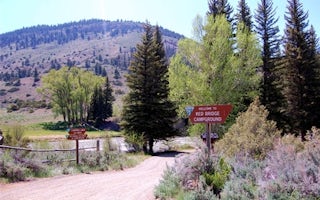
Powderhorn, Colorado
Red Bridge Campground
Red Bridge Campground is a short distance off of the Silver Thread National Scenic Byway. You'll find public fishing access to the Lake F...
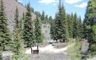
Powderhorn, Colorado
The Gate Campground
This campground is tucked into the center of the geologic formation known as The Gate, a notch in the rocks carved by the Lake Fork of th...
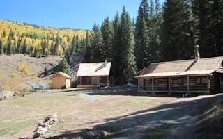
County Road 868
Alpine Ranger Station
Overview
The Alpine Ranger Station is situated on the Alpine Plateau at 9,600 feet, in a beautiful alpine valley surrounded by aspen, spr...
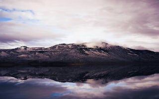
Gunnison, Colorado
Lake Fork Campground
Overview
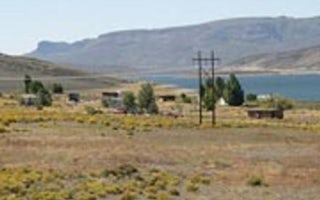
Lake Fork Campground is on the Blue Mesa Reservoir, near the reservoir's dam. It is a part of the historic Curecanti Recreation ...
Gunnison, Colorado
Elk Creek Campground
Overview
Elk Creek Campground is on the north shore of Blue Mesa Reservoir. The lake is Colorado's largest body of water with 96 miles of...
Gunnison, Colorado
East Elk Creek Group Campsite
Overview
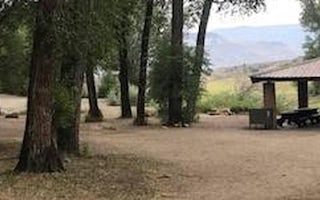
Invite family and friends to East Elk for an active group camping experience surrounded by rugged and stark mountains. The campg...


