Park County, Colorado
Top Spots in and near Park County
-
Pine, Colorado
Little Scraggy Peak Loop
5.012.18 mi / 1621 ft gainLittle Scraggy Peak Loop is a loop trail that takes you past scenic surroundings located near Buffalo Creek, Colorado.Read more -
Guffey, Colorado
Paradise Cove
4.5From Colorado Springs, follow RT 24 to the town of Florissant (34.5 miles). From Florissant, follow Teller County Road 1 south for about 9.2 miles, until a Y fork, and bear right, into County Road 11. Follow County Road 11 for 4.1 miles, until a T intersection, and make a right turn at the inters...Read more -
Divide, Colorado
Hike to Rock Pond
4.04.76 miThis hike begins at the east side of the Visitor's Center parking lot. The Visitor's Center keeps a record of any recent wildlife sightings, so its a good idea to check in the building if your goal is to see some animals. Otherwise, head to the end of the parking lot and take trail #5 down the hi...Read more -
Hartsel, Colorado
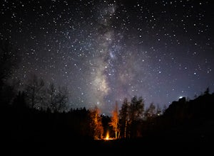
Camp at East Castle Rock Gulch
This is an awesome camp spot for individuals who do not have a 4x4 or AWD and want a secluded getaway! It does require to drive about 3 miles along a dirt road before arriving at the dead end of 188A, but can be easily cleared. From what I could see on the drive in there were only 4 camp spots de...Read more -
Divide, Colorado
Hike to Brook Pond
4.04.74 miThis hike begins at the east side of the Visitor's Center parking lot. The Visitor's Center keeps a record of any recent wildlife sightings, so its a good idea to check in the building if your goal is to see some animals. Otherwise, head to the end of the parking lot and take trail #5 down the hi...Read more -
Chaffee County, Colorado
Off-Trail Hike of Limestone Ridge
4.09 mi / 1000 ft gainFinding a winter or early spring adventure that won't take you deep into dangerous mountain territory, while still providing epic vistas, is a challenge in Colorado. There are a few 10,000' tall ranges that sometimes escape deep snow, which are inviting for a first step into the alpine wonderland...Read more -
Divide, Colorado
Hike to Raspberry Mountain
5.05.2 mi / 900 ft gainTake US-24 west and turn left at traffic light in Divide. Drive south on US-67 for about 4 miles. Turn left to CR-62 right after you pass the entrance to Mueller State park on the right. Drive about a mile on the dirt road and you will see the new trailhead parking lot on the left side.Once you p...Read more -
Woodland Park, Colorado
Red Rocks at Woodland Park
4.31 mi / 100 ft gainIn Woodland Park driving on HWY 24 towards Divide, you will see signs for HWY 67 which is where you'll need to get to. The Road will fork towards the end of town (left being 24 towards Divide, Right being 67). Stay right at the fork onto 67. You will then drive about 2 miles until you see a sign ...Read more -
Buena Vista, Colorado
Backpack the Buffalo Peaks Wilderness Loop
5.011.7 mi / 2000 ft gainStarting at the Rich Creek Campground this wonderful moderate hike forms a loop by connecting the Rich Creek Trail and the Tumble Creek trail. in the Buffalo Peaks wilderness. Flanked by the Collegiate Peaks, in Spring and Summer the area is awash with rushing creeks, lush wet lowlands & deep...Read more -
Buena Vista, Colorado
Hike Davis Meadow
5.08.6 mi / 800 ft gainThis is a great hike that is very close to Buena Vista, CO. This trail is on the east side of town and is accessible in the spring. The hardest part of the hike is locating the trail-head. It is located in the northern part of Four Mile Canyon and is in San Isabel National forest. Starting in Bue...Read more -
Fairplay, Colorado
French Pass Trail
5.06.87 mi / 1736 ft gainFrench Pass Trail is an out-and-back trail where you may see beautiful wildflowers located near Jefferson, Colorado.Read more -
Sedalia, Colorado
Hike Devils Head Fire Lookout
4.72.8 mi / 951 ft gainThis is one of my favorite hikes near Denver and the lookout itself is over 100 years old! On the road to the trailhead there are many spots for camping and other activities.From Sedalia, CO head down Highway 67 for about 10 miles. Turn south onto Rampart Range Rd and continue for about 9.5 miles...Read more -
Divide, Colorado
Summit The Crags
4.67.9 mi / 1379 ft gainAs you drive past Mueller state park (on the right), about 1/4 mile down the road you will see a small wooden sign for "The Crags" You will take a left there and follow the road about 1.5 miles, past the first stop, which is the Raspberry Mountain Trailhead, until you come to a fork in the road a...Read more -
Breckenridge, Colorado
Camp at Boreas Pass
9 mi / 1500 ft gainBoreas pass is a high mountain pass in the Rocky Mountains that sits on the Continental Divide at 11,481'. Forest Service Road 33 goes over the pass and has numerous campsites all along its length, with several near the summit that feature breathtaking views of the Tenmile Range and the Breckenri...Read more -
Breckenridge, Colorado
MTB Boreas Pass
Boreas Pass is a scenic route that lies between Como (north of Fairplay on Hwy 285) and Breckenridge. It is 21 miles of low maintenance, rough gravel road that follows the Continental Divide and summits at 11,481 feet. Other than the altitude, the ride is not difficult, as the grade is not steep ...Read more -
Breckenridge, Colorado
Mount Guyot Snow Climb
5 mi / 2500 ft gainFrom Jefferson follow 35 north to 54 and drive up 54 as far as possible ending a few miles before Georgia pass. Depending on the snowpack and drifts on the unplowed road, you could hike as few as 5 miles round trip or as many as 10. If the snow blocks you from driving past Michigan Creek Campgro...Read more

