Laporte, Colorado
Top Spots in and near Laporte
-
Bellvue, Colorado
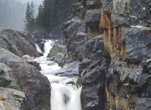
Photograph Poudre Falls
To get to Poudre Falls, simply drive up Poudre Canyon on Highway 14, just north-west of Fort Collins. The drive all of the way up to the falls is a little bit of a jaunt and will take about an hour or so. There are plenty of cool things to see on the way, so have the camera in the passenger seat...Read more -
1046 County Highway 115, Colorado
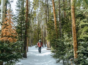
Winter Hike to Calypso Cascades
6.25 mi / 580 ft gainWhile most people go snowshoeing near the Bear Lake or Glacier Gorge area in RMNP, Wild Basin is a much less trafficked option. The entrance station isn't manned in the winter, so you'll get in for free, as well! You can put the Wild Basin Trailhead into your GPS, but you'll have to park at the w...Read more -
Allenspark, Colorado
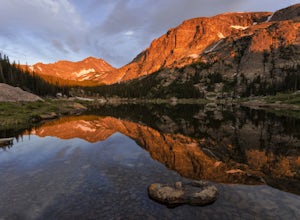
Hike to Pear Lake
5.013 mi / 2112 ft gainPear lake is a beautiful alpine lake in the southern Wild Basin region of Rocky Mountain National Park. Once used as a reservoir, Pear Lake has been restored to its natural state and lies in scenic basin below some of the most isolated mountains in the park. The trail to Pear Lake passes through ...Read more -
Allenspark, Colorado
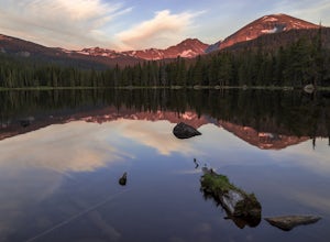
Hike to Finch Lake
3.08.96 miThere are several ways to reach finch lake but this will cover the route from the Finch Lake Trailhead in the wild basin area of Rocky Mountain National Park. You can also loop it with other trails in the area or begin at the Allenspark Trailhead, which is technically outside the park and a bit e...Read more -
Allenspark, Colorado
Ouzel & Ogallala Peaks
17.18 mi / 4403 ft gainBegin at the Wild Basin Trailhead in southeastern Rocky Mountain National Park near the town of Allenspark. Plan to start before sunrise if attempting this trek as a day trip in order to avoid afternoon thunderstorms above the treeline. This trip can easily be made into a backpacking experience b...Read more -
Allenspark, Colorado
Hike to Ouzel Falls
4.05.22 mi / 870 ft gainLocated right outside of Rocky Mountain National Park, this hike is perfect for anyone looking to do a little exploring without the cost of a park fee. The drive through the Rocky Mountains to the trailhead is an added bonus. This hike is great because it has multiple attractions all along the wa...Read more -
Allenspark, Colorado
Backpack to Bluebird Lake
4.314 mi / 2500 ft gainStarting at the Wild Basin trailhead on the south side of Rocky Mountain National Park, hike through a wet forest towards upper and lower Copeland Falls, located 0.45 miles from the trailhead. From here, continue on the main trail along the North Fork of the Saint Vrain River to Calypso Cascades,...Read more -
Allenspark, Colorado
Hike to Thunder Lake
12 mi / 2275 ft gainStarting at the often-busy Wild Basin TH, the trail passes through dense forests as it follows the North Fork of the Saint Vrain River through the southernmost section of Rocky Mountain National Park. The trail passes alongside the small Copeland Falls before continuing west towards Calypso Casca...Read more -
Lyons, Colorado
Hike Meadow Mountain
4.07.7 mi / 2832 ft gainFrom the trailhead, follow the trail through the woods until you reach a meadow with a steep slope. Some portions of this slope reach an angle of 30 degrees and may feature slight avalanche danger in the winter. However, the trail is used enough that such conditions would make themselves known ...Read more -
Bellvue, Colorado
Snowshoe Sawmill Creek Trail
7 mi / 1660 ft gainTo reach the Sawmill Creek Trailhead you have to park at the Blue Lake Trailhead parking lot located across from Long Draw Road (Rd 156) Turn-off. Once you park here you'll see a big sign for the Blue Lake Trail but you'll have to continue following the road up (Southwest) for about 100 yards unt...Read more -
Boulder, Colorado
Hike the Eagle Sage Loop
4.33.75 mi / 205 ft gainThis is a great trail if you are in the Boulder area and want something fairly easy or quick. This 3.75 loop can be hiked in about an hour and a half since it is fairly flat. The elevation gain is minimal. You start out at the Eagle Trailhead located west of the Boulder Reservoir.Start out at the...Read more -
Estes Park, Colorado
Mt. Ida via Milner Pass
5.09.28 mi / 2112 ft gainThe hike to Mt. Ida offers some of the most stunning views of Rocky Mountain National Park. How to get there: From the east, take Trail Ridge Road all the way to the west side of the park. You will pass Alpine Visitor Center and the road sharply turns south at Medicine Bow Curve. The trailhead...Read more -
Estes Park, Colorado
Backpack Alpine Terrain to Haynach Lakes
17 miBegin at the Milner Pass Trailhead off of Trail Ridge Road in Rocky Mountain National Park. Commonly used to summit Mount Ida, this trailhead is often popular with summer hikers. The trail climbs steeply through the trees before revealing open slopes of tundra and fantastic panoramic views. Altho...Read more -
Ward, Colorado
Hike the Ceran St. Vrain Trail
5.04 mi / 1207 ft gainThe Ceran St. Vrain trail north of Jamestown offers the hiker a nice respite from the summer sun as this path runs through dense pine forests. The trail follows the South St. Vrain Creek for most of the way and follows moderate grades throughout. There is no official end to the trail, only that i...Read more -
Cheyenne, Wyoming
Hidden Falls Loop
5.04.32 mi / 469 ft gainDirections: From Laramie, take I-80 east to exit 323 and continue on HWY 210 east for approximately 15 miles. From there the entrance to Curt Gowdy State Park will be clearly marked on the right side of the road. Then drive south for 1.4 miles until you reach a large parking area on the right sid...Read more -
Cheyenne, Wyoming
Lakeside Camping and Mountain Biking
4.0This trail system is somewhat of a hidden gem to mountain bikers south of the Wyoming border. Those who know their way around the best trail systems, though, hail Curt Gowdy as one of the best. If you've got some energy to burn, try the IMBA Epic suggested route, which loops together the 20 miles...Read more

