Black Hawk, Colorado
Top Spots in and near Black Hawk
-
Estes Park, Colorado
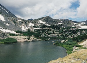
Mt. Ida via Milner Pass
5.09.28 mi / 2112 ft gainThe hike to Mt. Ida offers some of the most stunning views of Rocky Mountain National Park. How to get there: From the east, take Trail Ridge Road all the way to the west side of the park. You will pass Alpine Visitor Center and the road sharply turns south at Medicine Bow Curve. The trailhead...Read more -
Estes Park, Colorado
Backpack Alpine Terrain to Haynach Lakes
17 miBegin at the Milner Pass Trailhead off of Trail Ridge Road in Rocky Mountain National Park. Commonly used to summit Mount Ida, this trailhead is often popular with summer hikers. The trail climbs steeply through the trees before revealing open slopes of tundra and fantastic panoramic views. Altho...Read more -
Sedalia, Colorado
Hike Devils Head Fire Lookout
4.72.8 mi / 951 ft gainThis is one of my favorite hikes near Denver and the lookout itself is over 100 years old! On the road to the trailhead there are many spots for camping and other activities.From Sedalia, CO head down Highway 67 for about 10 miles. Turn south onto Rampart Range Rd and continue for about 9.5 miles...Read more -
Summit County, Colorado
Hike to Crystal Peak
5.08.6 mi / 2482 ft gainOnce you turn off of Colorado hwy 9 onto dirt, your GPS will lead you to a gravel lot. At the end of that lot there's a pretty steep gravel road that heads NNW (GPS coords: 39°25'43.01"N 106° 4'11.30"W | Map Link if you want to plug that into your GPS for parking). From this lot you'll walk up t...Read more -
Breckenridge, Colorado
Hike McCullough Gulch to Upper Blue Reservoir
5.02.8 mi / 910 ft gainThe trail first takes you to Upper Blue Reservoir, about 1.4 miles in. Past this point, it can be somewhat tricky to find the trail, but for experienced hikers, the upper valley holds a number of lakes, a waterfall, and open tundra for exploring. Mountain goat sightings are also common in this ar...Read more -
Estes Park, Colorado
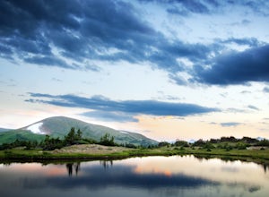
Catch a Sunset Above Milner Pass
This is a great place to be at sunrise or sunset. Bring a camera & tripod and check the weather ahead of time.Take Trail Ridge Road all the way to the top and park at the Alpine Visitor Center. There's a great view from here, but if you're interested in photography I recommend taking the tr...Read more -
Breckenridge, Colorado
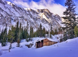
Ski or Snowshoe McCullough Gulch
5.06 mi / 1300 ft gainIf the snow is not coming to you, you go where the snow is. Breckenridge is a good place to start; this beautiful ski area gets more than its fair share of snow, and is full of stunning trails. Why pay big bucks at one of the Nordic centers, when you can access acres and acres of the White River ...Read more -
Breckenridge, Colorado
Winter Hike to Quandary Peak (14,265')
4.67 mi / 3500 ft gainQuandary Peak is a popular winter 14er because of its easy access near Breckenridge, its Class 1 designation, and its low avalanche risk. While the access roads to many 14ers are closed in winter, adding extra mileage to an already grueling hike, Quandary Peak’s access is just off Hwy. 9, and the...Read more -
Jefferson, Colorado
Trek through Granite Pillars on Bison Peak
12.4 mi / 4000 ft gainBison peak sits 2 hours from Denver in the mountains of the Lost Creek Wilderness. To reach the 12,431 ft. summit you'll start in low density ponderosa forest at 8,750 ft on crushed granite trail. Early starts are recommended in the summer months as the trail's high albedo can make for an extreme...Read more -
Silverthorne, Colorado
Hike Cataract Lake and Falls
4.72.1 mi / 200 ft gainMy husband and I heard about this hike while we were at a marriage retreat in nearby Dillon. This is the perfect casual day hike for a couple, small groups, or families with children. While we were there in May, just before the aspens were fully leafed out, it was easy to see that this location w...Read more -
Breckenridge, Colorado
Winter Climb of North Star Mountain
4.08 mi / 2400 ft gainFrom the west parking lot at the top of Hoosier Pass, take the 4x4 road as it climbs through a forest west of the pass. Before long, the trees thin and you'll stay on the road through treeline and reach a gate at just over 12,000 feet.Stay right at the gate and continue on this old mining road as...Read more -
Castle Rock, Colorado
Run the Challenge Hill
5.00.6 mi / 200 ft gainThe Basics: The Challenge Hill, or as I like to call it, the Mini-Incline, is a shrunken version of its big brother to the south in Manitou. However, don't let its relatively small 200 stair count fool you - this hill is a serious workout! Located in Philip S. Miller Park, just one minute off I-2...Read more -
Loveland, Colorado
Climb Green Ridge in the Roosevelt National Forest
9.8 mi / 2400 ft gainGreen Ridge is a fantastic series of summits in the Front Range that make for excellence training hikes, but is often forgotten as it lies outside of the nearby Bobcat Ridge Natural Area and just inside of Roosevelt National Forest. The summit itself at 7,402' is fantastic, featuring a nearly 900...Read more -
Loveland, Colorado
Hike the Valley Loop Trail in the Bobcat Ridge Natural Area
4.4 mi / 500 ft gainThe Valley Loop Trail in the Bobcat Ridge Natural Area begins at the main entrance of the Natural Area, just off W County Road 32 C near Masonville, west of Fort Collins and the Horsetooth Reservoir.To get there take West County Road 38 E west from Fort Collins over and around the Horsetooth Rese...Read more -
Loveland, Colorado
Hike the D.R. Trail in the Bobcat Ridge Natural Area
3.76.2 mi / 1050 ft gainD.R. Trail, named for David Rice Pulliam who donated the land to create the Bobcat Ridge Natural Area, is a 3.1 mile spur off the Valley Loop Trail that climbs roughly 1,000' into Mahoney Park before it intersects with the Powerline and Ginny Trails. To get to the start of the trail, take the Val...Read more -
Loveland, Colorado
Hike the Powerline Trail in the Bobcat Ridge Natural Area
3.8 mi / 1100 ft gainPowerline Trail is a 1.9 mile spur off the Valley Loop Trail in the Bobcat Ridge Natural Area that climbs 1,100 feet from the valley floor to Mahoney Park.To get to the start of the trail, take the Valley Loop Trail .9 miles in the Bobcat Ridge Natural Area from the main entrance of the Natural A...Read more

