Oakhurst, California
Oakhurst, California, known for its top outdoor adventures, offers one of the best trails for hiking - the Lewis Creek Trail. A must-visit, this scenic trail is moderately challenging, making it ideal for both beginners and seasoned hikers. As you traverse the trail, you'll come across two stunning waterfalls - Corlieu and Red Rock. The sight of the cascading water against the backdrop of the Sierra National Forest is truly captivating. The trail also offers views of unique rock formations and lush greenery. If you're lucky, you might even spot some local wildlife. Other outdoor activities in and near Oakhurst include fishing in Bass Lake and exploring the famous Yosemite National Park. So, if you're looking for the best trails and outdoor activities, Oakhurst should definitely be on your list.
Top Spots in and near Oakhurst
-
Yosemite National Park, California
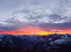
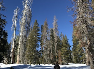
Winter Backpack to Sentinel Dome in Yosemite
5.019.23 mi / 860 ft gainThe goal for our weekend was to do some winter camping in the Yosemite backcountry; we decided on Sentinel Dome as our destination. The trail is a cakewalk during the summer, but winter turns it into a 10 mile uphill grind from the car. Most people opt to head for the ski hut at Glacier Point, bu...Read more -
Yosemite National Park, California
Dewey Point via Badger Pass Ski Area
5.07.36 mi / 761 ft gainTake the one-hour shuttle ride from the Yosemite Lodge to the Yosemite Ski Area, so that you don't have to worry about driving in the snowy conditions, or finding parking. If you don’t own snowshoes, you can easily rent a pair from the rental shop for the day. Current rates are $24.00 for a full ...Read more -
YOSEMITE NATIONAL PARK, California
Dewey Point via McGurk Meadow Trailhead
5.07.51 mi / 300 ft gainBefore you start, be sure to visit the Yosemite Valley Visitor Center and grab an overnight permit. More info on this at nps.gov. This trail meanders through beautiful, dense meadows full of wildlife - watch for bears! When you're not hiking among the wildflowers and babbling brooks, you're enc...Read more -
Wawona, California
Dewey Point Trail
4.95 mi / 315 ft gainThis approximately 5-mile out-and-back trail is a great hike in Yosemite National Park. This trail starts off of Dewey Point's Meadow Trail, but you can also start from the Dewey Point Ridge trail, which you'll pass first when coming up Glacier Point Road. This trail is not dog friendly, but is a...Read more -
Mariposa County, California
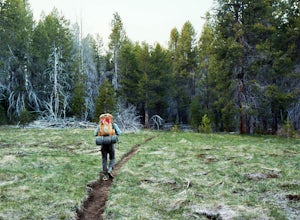
Backpack to Lower Ottoway Lake
32 mi / 2400 ft gainThe hike begins at Mono Meadows trailhead along Glacier Point Road, first descending 2.8 steep miles to Illilouette Creek. Above the Illilouette Junction, take in views of the Valley's granite domes before beginning the post-burn forested slog. The trail covers an additional 10 miles of relativel...Read more -
Shaver Lake, California
Balsam Forebay
4.01.05 mi / 62 ft gainAccess to the forebay starts at the trail head from the parking lot 6,700 ft up, also from the parking lot there is access to two different sets of boulder patches separate from the ones encountered along the hike in. Hike Start the 1 mile out and back hike from the parking lot following the t...Read more -
Mariposa County, California
Hike to Turtleback Dome
1.4 mi / 350 ft gainTurtleback Dome will provide you with views of southern Yosemite and the Valley in a less crowded area. This hike on a service road is relatively easy with a slight elevation gain over the entire 0.7 miles. To get to the Trailhead, take Wawona Road north towards the valley. Use the referenced poi...Read more -
Mariposa County, California
Sentinel Dome and Taft Point Loop
5.05.17 mi / 1076 ft gainSENTINEL DOME & TAFT POINT TRAILHEAD: About an hour drive from Yosemite Valley campgrounds. This trailhead is an intersection of the starting point of the Taft Point trail and Sentinel Dome trail. It is a short walk (and visible) from the parking lot. In doing both trails, it would be an esti...Read more -
Mariposa County, California
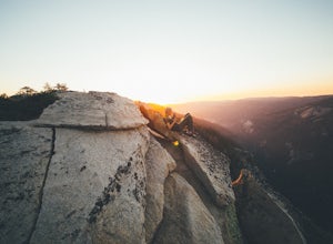
Sentinel Dome Trail
5.02.15 mi / 400 ft gainOne of the most popular places in Yosemite for sunset is Glacier Point, but by walking one mile from the trailhead, the crowds quickly dissipate. Sentinel Dome is great for all ages since the trail is short and not too steep. Park at the Sentinel Dome trailhead, about 3 miles from the end of Glac...Read more -
Mariposa County, California
Hike to Inspiration Point in Yosemite NP
2.4 mi / 900 ft gainInspiration Point is a granite slab located on the mountainside above Tunnel View. Hiking to this scenic point will provide you with the same views you would get from Tunnel View with less people around. Hiking this trail can also take you to different parts of Yosemite if you're so inclined (Bri...Read more -
Mariposa County, California
Dewey Point via Tunnel View
5.09.25 mi / 2979 ft gainDewey Point lies on the western side of the Pohono Trail, across the valley from El Capitan and above Cathedral Rocks. When I was there in September, it was deserted but for a few birds drifting on the thermals above the cliffs. The sunset was stunning. It felt like there was nothing between me a...Read more -
Mariposa County, California
Hike to Artist Point in Yosemite National Park
4.82 mi / 500 ft gainPark at the Tunnel View parking lot. The Pohono Trail, which you fill follow for the first half mile, starts on the left side of Wawona Tunnel. You should notice a small path starting from the parking lot. The trail quickly ascends up a series of switchbacks before reaching a junction. If you...Read more -
Mariposa County, California
Hike from Tunnel View to Glacier Point
5.013 mi / 3000 ft gainBeginning at 4400 feet of elevation in the bottom of Yosemite Valley, this trail will take you up about 3000 feet over 13 miles. You'll finish the hike at Glacier Point and be richly rewarded with one of the most spectacular views of Half Dome in the park.If you are interested in seeing landmarks...Read more -
YOSEMITE NATIONAL PARK, California
Taft Point
4.92.35 mi / 200 ft gainTaft Point is such an amazing and different view of the Yosemite Valley. If you're lucky and you time it right, you'll also experience complete solitude. While driving Glacier Point Road, just a few minutes before arriving at Glacier Point, you'll see a parking lot for the Taft Point Trailhead. ...Read more -
Mariposa County, California
Photograph Yosemite's Tunnel View
4.3Tunnel View sets you up for an iconic view of some of the major highlights of the Yosemite valley including Bridal Veil Falls, El Capitan and Half Dome in the distance. To access the viewpoint, from Northside Dr., turn right onto Wawona Rd. You'll continue on Wawona Rd. up until you see you parki...Read more -
Mariposa County, California
Backpack Yosemite's South Rim
5.018 mi / 2800 ft gainStep 1: Get Wilderness Permit from the Wilderness Office the day before! Permits are free and required. This trail is a Point-to-Point trail so make sure you have a shuttle situation figured out (or you can always hitch hike). The best option is to get dropped off at Tunnel View so that you don'...Read more

