Macdoel, California
The best Trails and Outdoor Activities in Macdoel, California are a must-visit for those who enjoy outdoor adventures. One of the top trails is the Pacific Crest Trail that offers scenic views of the Shasta Valley. This trail is moderately difficult, making it suitable for most hikers. It is also home to various unique rock formations and a river for fishing. The Klamath National Forest, near Macdoel, is another prime location for hiking and camping. The forest is known for its dense pine trees and clear lakes, making it a perfect spot for canoeing and fishing. For bird watchers, the Lower Klamath National Wildlife Refuge is a must-visit. It's home to a variety of bird species, making it a top attraction for wildlife photography. Macdoel offers the best of California's natural beauty, making it a must-visit for outdoor adventures.
Top Spots in and near Macdoel
-
Siskiyou County, California
Climb Mt. Shasta via the Hotlum-Bolam Ridge
10 mi / 7200 ft gainThe Hotlum-Bolam route follows the ridge between the Hotlum and Bolam Glaciers on Shasta's north side. It's an intermediate route that isn't much more technical than the south side routes, except for icy sections and possible late-season open crevasses. For this reason it's a popular alternative ...Read more -
McCloud, California
Mt. Shasta via Clear Creek Route
11.43 mi / 7615 ft gainThe least technical route to the summit of Mt Shasta begins at the Clear Creek Trailhead (elevation 6390 ft). Please note that although this is a less technical route, this is still dangerous and there have been deaths on Mt. Shasta because of falling rock. To start this, you should be a good hik...Read more -
McCloud, California
Gray Butte
3.27 mi / 646 ft gainMount Shasta is an incredible mountain in Northern California that offers a great variety of activities. The Gray Butte trail is one of the more beautiful trails in the area, and it's not too long (2.8mi, ~2h). We arrived at Shasta by late afternoon, so it was a great hike to do when golden hour ...Read more -
McCloud, California
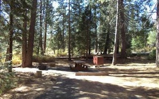
Panther Meadows Campground
5.0The Panther Meadows Campground is located in the timberline on Mt. Shasta. The free campsite has 10 sites with a fire ring and a table. The elevation of the campground is 7,500 ft, making it the highest campground on Mt. Shasta. Summer nights can get pretty cold, so make sure to bring proper atti...Read more -
Siskiyou County, California
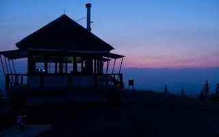
Camp Out at Little Mt. Hoffman Lookout
4.0If you've never stayed in a lookout, you should. It's not a thrilling get your adrenaline type of adventure, but more of a private, secluded, let's enjoy epic views and incredible company type of get away.Little Mt. Hoffman lookout is one of a few remaining historic lookouts that was built in the...Read more -
Siskiyou County, California
Climb Mt. Shasta via Avalanche Gulch
5.011 mi / 7200 ft gainThe Avalanche Gulch route is the second easiest, non-technical route to the summit of Mt. Shasta after the Clear Creek Route, but is by far the most popular. Many people complete this climb in one day from the trailhead, but you also have the opportunity to overnight at Horse Camp (7,950 ft.) or ...Read more -
Mount Shasta, California
Black Butte
5.05 mi / 1608 ft gainBlack Butte is hard to miss from I-5 as it winds past the city of Mount Shasta. This lava dome formed roughly 9,000–10,000 years ago and isn't a cinder cone, though it does look like one. The rock that makes Black Butte was extruded instead of spewed, then broke apart as it cooled. The jumbled re...Read more -
Mount Shasta, California
Winter Summit Black Butte
5 mi / 2000 ft gainNote: February thru early March are great times to climb it for a winter ascent without snowshoes. If there is no snow seen from the south (e.g. on I-5 heading north to Mount Shasta City), don't be too worried. As long as there is snow on the surrounding peaks (e.g. Trinity Alps) around the same ...Read more -
McCloud, California
Middle McCloud Falls
4.82.49 mi / 243 ft gainJust 4 hours north of San Francisco, McCloud Falls offers a quick hike and swimming hole for those looking for something less crowded than Burney Falls. McCloud Falls has 3 tiers, but the middle section offers the best views by far. Getting Here To get here, park at the Fowlers Campground which...Read more -
McCloud, California
McCloud Middle Falls Short Trail
3.00.79 mi / 85 ft gainMcCloud Middle Falls Short Trail is located near McCloud, California. This route makes for an abbreviated version of the longer Middle McCloud Falls adventure which is 2.5 miles roundtrip. The parking area has an established parking lot and a vault toilet. The shorter trail with minimal elevati...Read more -
McCloud, California
Algoma Campground
The Algoma Campsite is a free campsite along the Upper Portion of the McCloud River. It features eight sites and a pit toilet. Unlike the other campgrounds in the area, this site receives very little traffic and has no fee. To get there, take SR 89 east from the McCloud Ranger Station for 13 mi...Read more -
Tulelake, California
Explore the Catacombs at Lava Beds National Mounument
5.0Once you reach the Lava Beds National Monument stop by the visitors center to pay your fees, grab a map, and empty your bladder. From there you will drive your car to each cave entrance.The Catacombs are considered the most difficult and longest cave system at the Monument and is the sixth cave s...Read more -
Tulelake, California
Hike the Schonchin Butte Trail in Lava Beds National Monument
5.01.5 mi / 475 ft gainFrom the entrance booth of Lava Beds National Monument drive south. There will be a left hand turn labeled Schonchin Butte, take it. Drive down a dirt road about a mile to reach Schonchin Butte trailhead parking. It is less than a mile hike to the fire lookout with elevation gain of 475 feet. The...Read more -
Tulelake, California
Spelunking in the Golden Dome Cave, Lava Beds National Monument
5.0Once you reach the Lava Beds National Monument stop by the visitors center to pay your fees, grab a map, and empty your bladder. From there you will drive your car to each cave entrance.Golden Dome Cave is the third cave on the cave loop. The entrance is about 25m from where you park. You will en...Read more -
Tulelake, California
Explore Crystal Ice Cave, Lava Beds National Monument
1 miThis adventure is only accessed through a ranger guided tour by the staff at Lava Beds National Monument. A reservation is needed, go to recreation.gov to make a reservation space is limited. You will meet at the visitor center. The ranger will take you to the cave. Don't try to find the cave...Read more -
Tulelake, California
Descend Into Skull Cave of the Lava Beds National Monument
4.50.1 mi / -328.1 ft gainOnce you reach the Lava Beds National Monument stop by the visitors center to pay your fees, grab a map, and empty your bladder. From there you will drive your car up the road from the visitors center to Skull Cave.The visitors center will give you map and answer any questions you have. From the ...Read more
Top Activities
Camping and Lodging in Macdoel
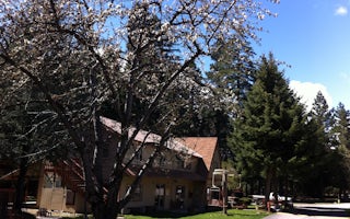
Mount Shasta City KOA Holiday
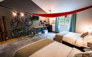
LOGE Mt. Shasta
From $119 / night


