
Dutchman's Creek Trail, Uwharrie NF
Mount Gilead, North Carolina
Details
Distance
11.31 miles
Elevation Gain
1407 ft
Route Type
Loop
Description
Added by Conrad Mcgill
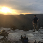
This is a relaxed hike featuring beautiful scenery and fair weather year-round. No matter the activity, Uwharrie National Forest has something for everyone to enjoy!
This hike starts with mellow terrain changes allowing you to get a feel for the trail. For the first 5 miles you will have one or two steep inclines that take a toll on the calf muscles. The remaining 6 miles include a more difficult terrain including a section of the hike called Hallucination Hill, which is named appropriately for its lengthy and incredibly steep incline. You conclude the last few miles enjoying riverside trails and finish off back beside the highway.
Trail Map: http://www.fs.usda.gov/Internet/FSE_DOCUMENTS/stelprdb5378693.pdf
Download the Outbound mobile app
Find adventures and camping on the go, share photos, use GPX tracks, and download maps for offline use.
Get the appFeatures
Dutchman's Creek Trail, Uwharrie NF Reviews

I ended up hiking five miles due to how late I got there, so I had to pitch my tent after nightfall. Other than that, loved the hills and little streams to cross!
5.0
Nice hike through the woods of Uwharrie national forest. Terrain is mostly flat with a few inclines. Under dense tree cover majority of time so if you are looking for a nice scenic overlook or summit this isn’t the hike for you. If you want to camp, there are plenty of nice small camp sites along the loop that are worn down and hard to miss. Trail was very well marked and easy to follow!
4.0
As described by the author, the first five or six miles are pretty easy and then the latter have some butt-kicking potential.The Uwharries are old and worn down mountains so don't expect any crazy climbs or views for that matter. Unless you go in the winter you probably will never be able to see anything in the distance. I did this as part of a thru-hike of the entire you Uwharrie Trail. I started at the North End of the Uwharrie and hiked all the way to the South End and made a figure eight coming back on Dutchmans Creek and then took the Uwharrie Trail the remainder back to the jumping off rock trailhead. It was about 45 miles and I was able to do it in 3 days. There are plenty of campsites and water in a lot of places. This is definitely a good place to test out your gear for a multi-day trip. Since there are lots of old logging roads and road crossings somebody can come save you if you have problems.
4.0
Lots of steep mountains and great campsites! Would recommend for anyone!
5.0
I was really disappointed by the dutchman's creek trail. No spectacular views or anything really exciting.
1.0
Leave No Trace
Always practice Leave No Trace ethics on your adventures and follow local regulations. Please explore responsibly!
Nearby

Drive the Uwharrie Scenic Road

Walk through The Botanical Gardens in Asheville

Paddle Lake Juniper

Sugarloaf Mountain

Forty Acre Rock Loop

Forty Acre Rock and Beaver Pond Loop
Community
Mobile Apps

© 2024 The Outbound Collective - Terms of Use - Privacy Policy