Iron Mine
Book this listing through our partner Recreation Gov
About Iron Mine
Overview
Iron Mine Campground in nestled in the scenic North Fork Drainage off Highway 35, about 18 miles from Tabiona, Utah.The North Fork Drainage lies on the southern slope of the beautiful Uinta Mountains in northeastern Utah. Visitors enjoy fly-fishing and exploring many local trails.
Recreation
Fishing for brook, brown and rainbow trout is a popular activity on the North Fork Duchesne. Hiking, mountain biking, OHV and horseback riding trails are in the area.Facilities
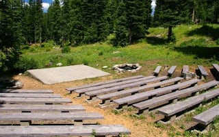
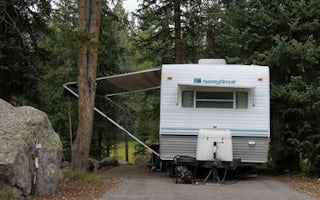
The campground contains single and double sites, and one group site that can accommodate up to 50 people.Sites are equipped with picnic tables and campfire rings. Vault toilets, drinking water and trash collection are provided. Roads and parking spurs are dirt.
Natural Features
The campground is situated in an aspen forest dotted with subalpine fir, lodgepole pine and spruce near the North Fork Duchesne River at an elevation of 7,400 feet. The campground affords beautiful scenic views of the surrounding canyon and summer wildflowers are plentiful.Nearby Attractions
The North Fork Drainage provides access to the Granddaddy Lake region of the High Uintas via Grandview Trail. Numerous sparkling lakes provide great backcountry fishing. Backpacking, hiking and horseback riding are very popular in this breathtaking area.Charges & Cancellations
A $10.00 service fee will apply if you change or cancel your reservation. Late cancellations are subject to additional fees. For full details see NRRS Reservation Policy.Iron Mine Reviews
Have you stayed here? Be the first to leave a review!
Top Spots in or near Hanna
Explore Grandaddy Basin
Hanna, Utah
5.0
Grandaddy Lake is the largest lake in the High Unitas. While Grandaddy Lake can have plenty of hikers, there are over twenty lakes within a two-hour hike within the Grandaddy Basin. Most hikers don’t go beyond Grandaddy lake, making the area a fantastic area to explore and camp. Elevation in the basin ranges from 10,000 - 10,500 feet. This basin is one of the greenest and most beautiful parts o...
Hike Little Deer Creek to Cataract Gorge
Wasatch County, Utah
4.0
4 mi
Little Deer Creek Canyon can be accessed from the Emerald Lake Highway (150) in the Uinta National Forest east of Kamas, Utah. Turn right onto Murdoch Basin Road (Forest Service Road 137) until it splits off to the road to Cataract Gorge (Forest Service Road 027). It is recommended you park here and hike down the Forest Service Road about a quarter mile until you turn right into the gorge. P...
Camp up Murdock Basin Road
Kamas, Utah
4.0
Murdock Basin Road is located about 22 miles up Mirror Lake Highway (UT-150) from Kamas, UT. After turning right onto Murdock Basin Rd, you'll cross a bridge over the Provo River and then it's onto the dirt road. Sites are scattered on the left and right (I suggest the left side spots) with plenty to choose from. The road is washboard but not too rough and certainly passable without the need of...
Camp at Pyramid Lake in Murdock Basin of Utah's Uinta Mountains
Hanna, Utah
Grab a fishing pole, hammock, or book. Pyramid Lake is the perfect setting to kick back and relax in Murdock Basin of Utah's Uinta Mountains!
Pyramid Lake is at an elevation of 9,700 feet with a 1,000-foot tall mountain directly to the west of the lake. Due to this steep face butting up to the edge of the lake, the sun drops behind the mountain early, but it stays light long into the evening. ...
Camp at Shallow Lake Meadow
Kamas, UtahLocated 1.5 hours from Salt Lake Cityand just 1 hour from Park City this mountain meadow is a great placeto take your next adventure! Getting there was a piece of cake, theroad is mainly paved then turns to lava...I mean gravel for the lastmile. Along the road are several already established camping spotswith fire pits for those wanting to spend the night. You can spendyour day taking photos or...
Backcountry Ski Mt. Watson in the Uinta Mountains
Kamas, UtahMt. Watson is a beauty. It is one of the tallest peaks directly outside of the High Uintas Wilderness area and has a stunning East face that is very steep and littered with cliff bands. Many people hike around Mt. Watson in the summer, when the Mirror Lake Highway is open and the trailhead is easily accessed. In the winter, however, Mt. Watson is deep in the wilderness. The Mirror Lake Highway ...
Camping and Lodging in Hanna
Hanna, Utah
Hades
Overview
Hades Campground is nestled in the scenic North Fork Drainage off Highway 35, about 17 miles from Tabiona, Utah. The North Fork ...
Hanna, Utah
Aspen (Ut)
Overview
Aspen Campground is nestled in the scenic North Fork Drainage just off Highway 35, about 13 miles from Tabiona, Utah.The North F...
Hanna, Utah
Upper Stillwater
Overview
Upper Stillwater Campground is located below its namesake reservoir in the Rock Creek Drainage on the southern slope of the beau...
Kamas, Utah
Soapstone
Overview
Soapstone Campground is located on the beautiful Mirror Lake Scenic Byway in the Uinta Mountains of northeastern Utah at an elev...
Kamas, Utah
Wolf Creek (Ut)
Overview
Wolf Creek Campground is located on the summit of scenic Wolf Creek Highway at an elevation of 9,400 feet. Visitors enjoy hiking...
Kamas, Utah
Lost Creek Campground
Overview
Lost Creek Campground is located just off the Mirror Lake Scenic Byway on the shores of Lost Lake at an elevation of 9,900 feet....
Unfortunately, we don't have up-to date pricing data for this listing, but you can check pricing through Recreation Gov.
Book NowAdd your business today to reach The Outbound's audience of adventurous travelers.
Community
© 2024 The Outbound Collective - Terms of Use - Privacy Policy


