
Castle Peak and Conundrum Peak
Aspen, Colorado
Details
Distance
12.71 miles
Elevation Gain
5125 ft
Route Type
Out-and-Back
Description
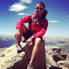
Added by Jeff Richards
Hike one of Colorado's most beautiful mountain ranges with a chance to get to the top of two 14ers in one day, Castle Peak and Conundrum Peak. As an added bonus, there's free camping for the night before/after!
There are many different places to start the trek up to Castle and Conundrum. The first step, however, is always go to the end of Castle Creek Road just outside of Aspen, CO. When the paved road ends, there is parking available right off the road for those who don't wish to drive further. However, if you drive up Forest Road 102 (rough 2WD) for a half mile or so there is more parking with designated camping. For those with a high clearance 4WD vehicle, this road continues all the way up around 13,000 feet, and there are numerous camping spots along the way.
For those without a car capable of tackling this rough road, the parking lot at the end of Castle Creek Road may be the best bet. This is where I started and I do not regret it. From this parking lot, simply start walking up Forest Road 102. The road is rough for cars but a breeze for feet. It is not too steep and is impossible to get lost on, and provides some amazing views of the peaks around the area as you weave in and out of the forest.
After walking up this road for around 3 miles, there will be a "junction" at around 11,200 feet. You will see that to the left the 102 turns into Pearl Pass Road, which looks like a broken axel waiting to happen. Don't pay any mind to Pearl Pass, and instead just walk straight on, staying on 102. The road does get steeper after this point, especially once you get above tree line, but it is nothing too tough, and with a steady pace and a few breaks it will go by quickly.
Finally, after roughly 5 miles of walking (no real hiking yet really), you will see the end of the road. You will also see what looks like a wall of a slope. In spring and summer until late July or August, this wall will be snow covered. You may think the trail wraps around this "wall", but nope, that wall is your trail. In the snow this section can be a bit dicey, but I was able to do it without an axe, crampons, or mountaineering boots. All it takes is a little time and careful footing, which shouldn't be too hard to find, as there will almost certainly be boot trails up the snow. If there isn't snow, then it is just steep talus and boulders, and again just takes time and careful footing.
Once to the top of this snow section, the trail up the the Castle ridge can be seen directly to the left. Make your way over to this and get ready for a fun time. This trail leading up to the ridge is almost ridiculously steep, and covered in loose rock, so it definitely can be a challenge. The plus side to this is that its very short, under a quarter mile. Once up this slope, you will gain the ridge and things can get a bit trickier. Throughout the ridge there is a very broken trail, which can be easy to lose at some points. Simply keep your eyes open, be ready for a few very easy scrambling moves, and watch for the loose and slick rock all around, and this ridge will be no problem. However, if exposure is not your thing, this may be a bit of a challenge.
After scrambling/hiking around the ridge for about 15-20 minutes you will reach a high point looking directly at Castle Peak. From this point simply drop down about 50 feet, and then make the final 250 foot push to the top. This last section is very steep but is over much quicker than one might think.
From the top, the route to Conundrum is obvious. Simply follow the trail/ridge down to the saddle and then back up to Conundrum. Along the way there are a few rocky outcroppings to avoid, but everything is class 2, although it will still be loose. Once on Conundrum you will see there are two summits. The true summit is a bit further north and requires dropping down into a notch and climbing back up another 50 feet or so. It is easy, but can kind of be a mood dampener at this point in the hike.
To get back down, simply follow the ridge back up and over Castle and then back down, or, if you have the gear (crampons, Ice axe, a strong stomach) there is a couloir-like route down from the low point of the saddle which will connect up to the main trail down at the "wall" area. This way is shorter, but can, like mentioned, require gear if snow is still around. Regardless, you will end back up on the road and then have a long, but easy, decent down to the car.
Download the Outbound mobile app
Find adventures and camping on the go, share photos, use GPX tracks, and download maps for offline use.
Get the appFeatures
Castle Peak and Conundrum Peak Reviews

Definitely recommend this one. We only had time for castle and not conundrum but it was great.
5.0
I had an absolute blast on this hike/climb, but didn't have the super long approach as I have a jeep and camped along the creek. The climb is great with enough exposure if you stay along Castle's ridge to keep your heart rate up, but also easy to avoid. My party decided to descend into the basin from the low point in the saddle between Castle and Conundrum and we regretted it all the way back to the main trail. Lots of people do this, but it is just steep, nasty, loose scree! Back over Castle is definitely better!
Leave No Trace
Always practice Leave No Trace ethics on your adventures and follow local regulations. Please explore responsibly!
Nearby

Backpack Cathedral Lake

Hike or Snowshoe Castle Creek

Conundrum Hot Springs via Conundrum Creek

Backpack to Copper Lake

Weller Lake Trail

Camp Difficult Campground, Aspen
Community
Mobile Apps

© 2024 The Outbound Collective - Terms of Use - Privacy Policy