
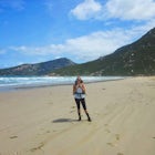
Backpack Mitchell River
Iguana Creek, Victoria
Details
Distance
23.6 miles
Elevation Gain
4986.9 ft
Route Type
Out-and-Back
Description
Added by Katie Kessel
This two day hike is a true hidden gem. The Mitchell River offers a serene warm temperate rainforest hike in Gippsland with stunning views of the river from both clifftops and from the waters edge. The landscape changes through the hike, starting in a lush forest environment and continuing through rough, rocky outcrops and mossy green trails.
The thing I loved the most about this hike is how isolated it was. It may have been the time of year, but in the spring I saw no one else on the trail for two days, though I did see snakes, monitors, kangaroos, wallabies, wombats, and many birds. Given it was springtime, the forest was full of wildflowers. A majority of the beginning of the trail up to the first lookout was fairly overgrown, but as a lot of the bushes had flowers I came out smelling great!
There are two notable places to fill your water along the way, including the creek you wade across after Billy Goat Bend and Mitchell River once you reach Angusvale (or Rock Creek, which is also on the river).
This trail is an out-and-back, which is great since you can see the views from both sides. It felt like a different hike on the second day. Since the beginning/ending of the hike is a family-friendly 2.5km circuit where you can see a bluff lookout and the Den of Nargun, I recommend starting to the left, to the Den of Nargun, and ending with the Bluff Lookout.
Follow the signs from the carpark to the Den of Nargun (just past the picnic area). The Den of Nargun is a gorgeous waterfall spilling over a cave that is of great importance to the Aboriginal community. If you're lucky, you can see water dragons on the outskirts of the pool of water.
From the den, follow the signs to Mitchell River, which you'll likely be able to hear before you can see. Here, you'll have to cross the creek. Look out for the trail on the other side for where to cross, as it gets tricky if you head too far downstream before crossing.
The trail starts winding its way along the river, heading in and out of the forest. Along the path, I stumbled upon lots of kangaroos, wallabies, a monitor, and wombats. Here, the trail is more lush, offering more shade and greener scenery than you get down the track. Keep your eyes peeled for a cool cave to your left that seemed to go fairly deep into the hill.
The trail starts to work its way up a hill slowly, peaking at Billy Goat Bend. As you approach the bend, the trees are a little more sparse along the trail and you get some fantastic views of the river and the beautiful red exposed rock you'll find yourself on soon enough.
At Billy Goat Bend, follow the trail along the cliffs, where you can really take in the view. The trail starts to head down from here, so I took the opportunity to grab some water and food before heading on.
The trail continues down until you reach a creek, which you can either wade across (it's not deep) or you can jump onto the sandbar in the middle and make your way through the bushes up to the path on the right. It's a little rough to get through with a pack, but manageable.
From here, the trail continues onto Mitchell Track, a 4x4 road that goes through the park for a little over 1km, then back onto the trail. The trail here is gorgeous, as the track has headed back uphill and looks over the river. The trail here can get a bit narrow, but the view is worth it!
Since a lot of this rocky area is exposed to the sun, just make sure to keep a lookout for snakes.
The rocks slowly give way to forest, which turns from a dirt trail into a moss-carpeted track. This part of the trail felt quite surreal, with the trees giving way into small grassy alcoves in the trees filled with wildflowers. It was stunning.
Follow the trail along the river until you reach Rock Creek, a dried up creek that follows parallel to the river, heading upstream until you reach Rock Creek camping area. If you prefer to camp alone, you can pitch your tent here. The campsite is secluded from the drive-in camping further ahead though it is still fairly secluded (depending on the time of year, there were hardly any people there when I went in spring). If you wish to keep going, follow the track along the river (not up the hill, I made this mistake and added a few kms to my trip) until you reach Angusvale.
Angusvale sits at a bend in the Mitchell River and offers many camping spots. Though it is drive in, as I mentioned previously it is relatively secluded. There are spots here to swim and the water is quite clear (in comparison to some of the other rivers in Victoria). Kangaroos graze all over the campground and I heard a few wombats once I was in my tent.
The next day, hike out the same way you came, finishing with the gorgeous view at the Bluff Lookout near the carpark.
Download the Outbound mobile app
Find adventures and camping on the go, share photos, use GPX tracks, and download maps for offline use.
Get the appFeatures
Backpack Mitchell River Reviews
A beautiful, wild hike with so much variation and stunning views. Definitely at least head in for the day if you're in the area!
5.0
Leave No Trace
Always practice Leave No Trace ethics on your adventures and follow local regulations. Please explore responsibly!
Nearby

Summit Mt. Feathertop

Backpack from Mt Baw Baw to Mushroom Rocks

Backpack Mt Bogong

Hike Mount Buffalo
Community
Mobile Apps

© 2024 The Outbound Collective - Terms of Use - Privacy Policy